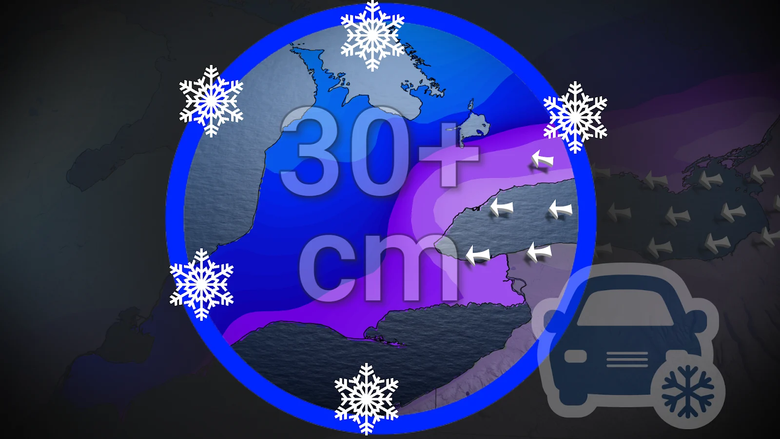
Intense snowfall rates, 10-30+ cm hitting southern Ontario
A significant winter storm nudges its way into southern Ontario on Sunday. With hefty snowfall totals, avoid travel if possible
A winter storm coming from the United States will affect southern Ontario with a slug of heavy snow across the region on Sunday.
Heavy snowfall and high wind gusts will lead to near-whiteout conditions at times. Folks across the area are advised to stay home and avoid unnecessary travel during the height of the storm.
DON’T MISS: 200 million impacted by major ice, snow in generational storm
Major storm brings heavy snow, cancelled flights
A generational winter storm unfolding south of the border will spread heavy snowfall across southern Ontario on Sunday.

Winter storm warnings have been extended from Coubourg to Burlington, while snowfall warnings go from Windsor to Ottawa. The peak of the snowfall is expected to arrive around mid-day, but will likely affect your morning commute.
So far, at least 500 flights have been cancelled from Toronto Pearson, Ottawa and Montreal airports.
Wind gusts close to 60 km/h are forecast through Sunday evening, creating widespread blowing snow, especially in open areas and near Lake Ontario.

Temperatures in the -10s to -20s will make this a fluffy, fast-accumulating snow that plows will struggle to keep up with. Snow-covered roads combined with heavy snowfall rates and gusty winds will make travel treacherous through Sunday and Sunday night.
Lake enhancement will likely increase totals for some
Easterly winds off Lake Ontario will likely enhance snowfall rates, leading to especially poor visibility and additional accumulations.

The placement of this band remains uncertain as it depends on the precise wind direction. The greatest risk zone stretches from Hamilton to Oakville, up to Toronto, and through Pickering.
Communities caught beneath this enhancement zone will see the heaviest snowfall totals along with whiteout conditions.
RELATED: The Great Lakes’ winter superpower is fading, polar vortex punches through

Widespread snowfall totals of 20-30+ cm are expected throughout the Greater Toronto Area and the Golden Horseshoe, affecting the QEW, 401, 404, and 407 corridors.

Areas north of the 407, including London and Barrie, are in line for 10-20 cm of accumulation from this event.
Folks across eastern Ontario will see a widespread 10-25 cm of snowfall, with around 15 cm forecast for the Ottawa area.
Stay with The Weather Network for all the latest on conditions across Ontario.