Large hail and tornadoes: Severe weather day takes shape on the Prairies
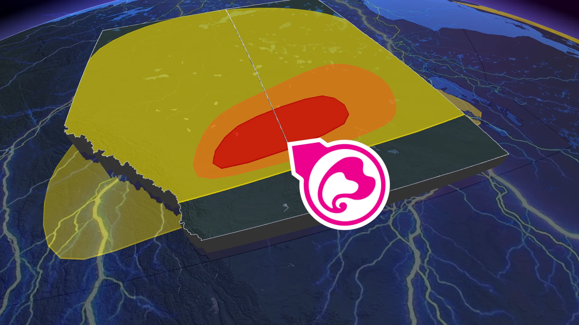
Wednesday will bring much-needed rainfall to the Prairies, but it also sets the stage for severe weather in parts of southern Alberta and Saskatchewan. These areas face a favourable environment for severe thunderstorms, with potential development of supercells and a risk of one or two tornadoes. Residents should stay alert to weather updates and potential warnings
A severe weather setup is unfolding across the Prairies, with southern Alberta and Saskatchewan at particular risk into Thursday morning.
Wednesday's conditions are favourable for severe thunderstorms, with the potential for large hail, damaging wind gusts, and the development of supercells. There is also a risk of one or two tornadoes.
DON'T MISS: Get the latest wildfire news and safety tips to help you stay safe
The large storm system will also bring desperately needed rain north into the fire zones of Saskatchewan and Manitoba. The rain is expected to persist into late Friday, and will provide essential relief to wildfire-affected regions.
It'll be important to remain weather-aware, and stay up-to-date on all of the latest watches and warnings as conditions change.
Wednesday: Severe storm threat, but with desperately needed rainfall for the wildfire zones
An unstable atmosphere is expected to develop Wednesday as a large upper-level low from the north interacts with a warm ridge of high pressure in the south.
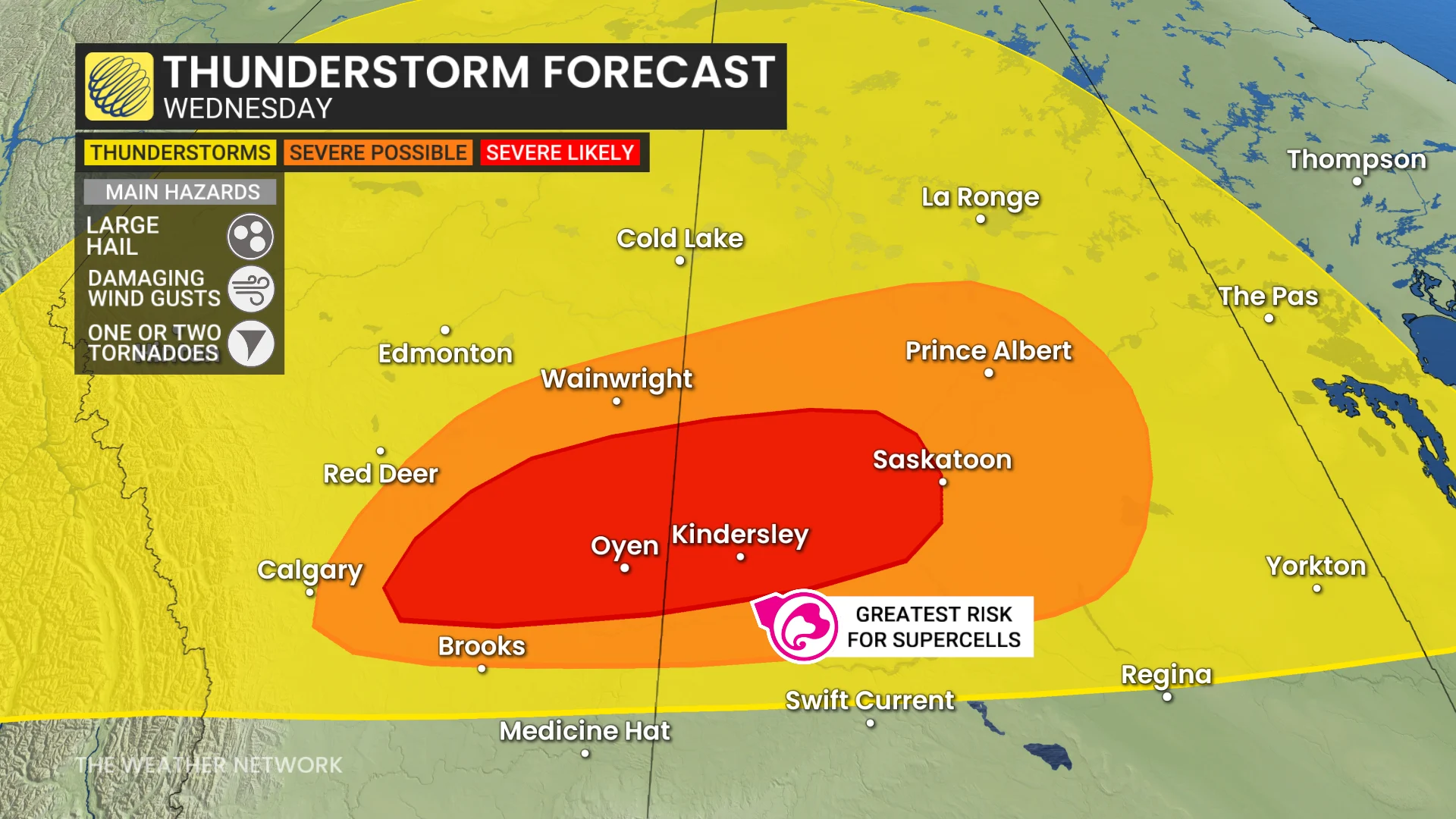
Isolated thunderstorms are forecast Wednesday afternoon across northern and central Alberta and Saskatchewan, with a focus on areas from east of Calgary to Saskatoon for potential severe storms by early evening.
Supercells may form in Alberta and track eastward into Saskatchewan, bringing risks of large hail (3-5 cm, or loonie to golf ball size), and possibly one or two tornadoes. Damaging wind gusts of 90-110 km/h could also accompany maturing storms.
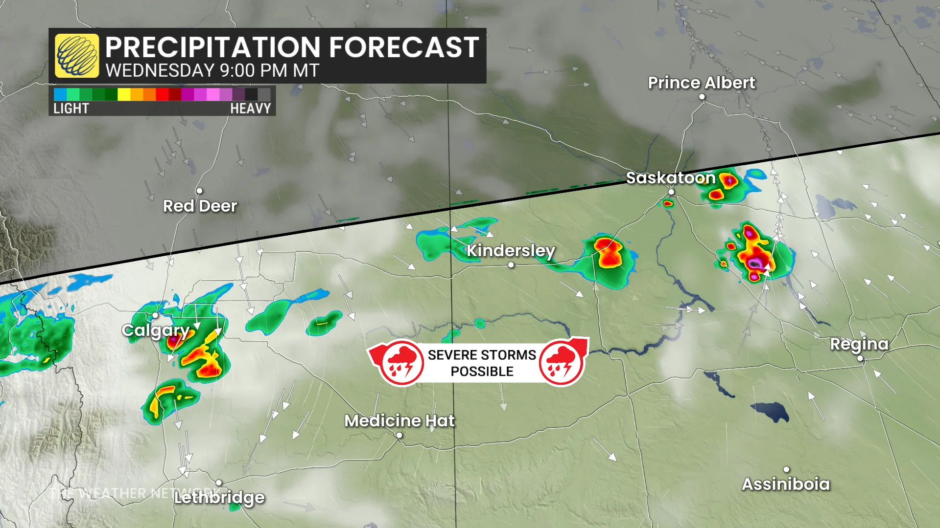
Overnight, this system is expected to bring persistent rain into wildfire-affected areas of Saskatchewan and Manitoba, offering much-needed relief through Friday, when as much as 30-80 mm could fall.
DON'T MISS: 2025 is Canada's second-worst wildfire season on record for area burned
However, southern and central Saskatchewan could see isolated strong storms overnight, with the potential for additional large hail and heavy rain as the system tracks eastward.

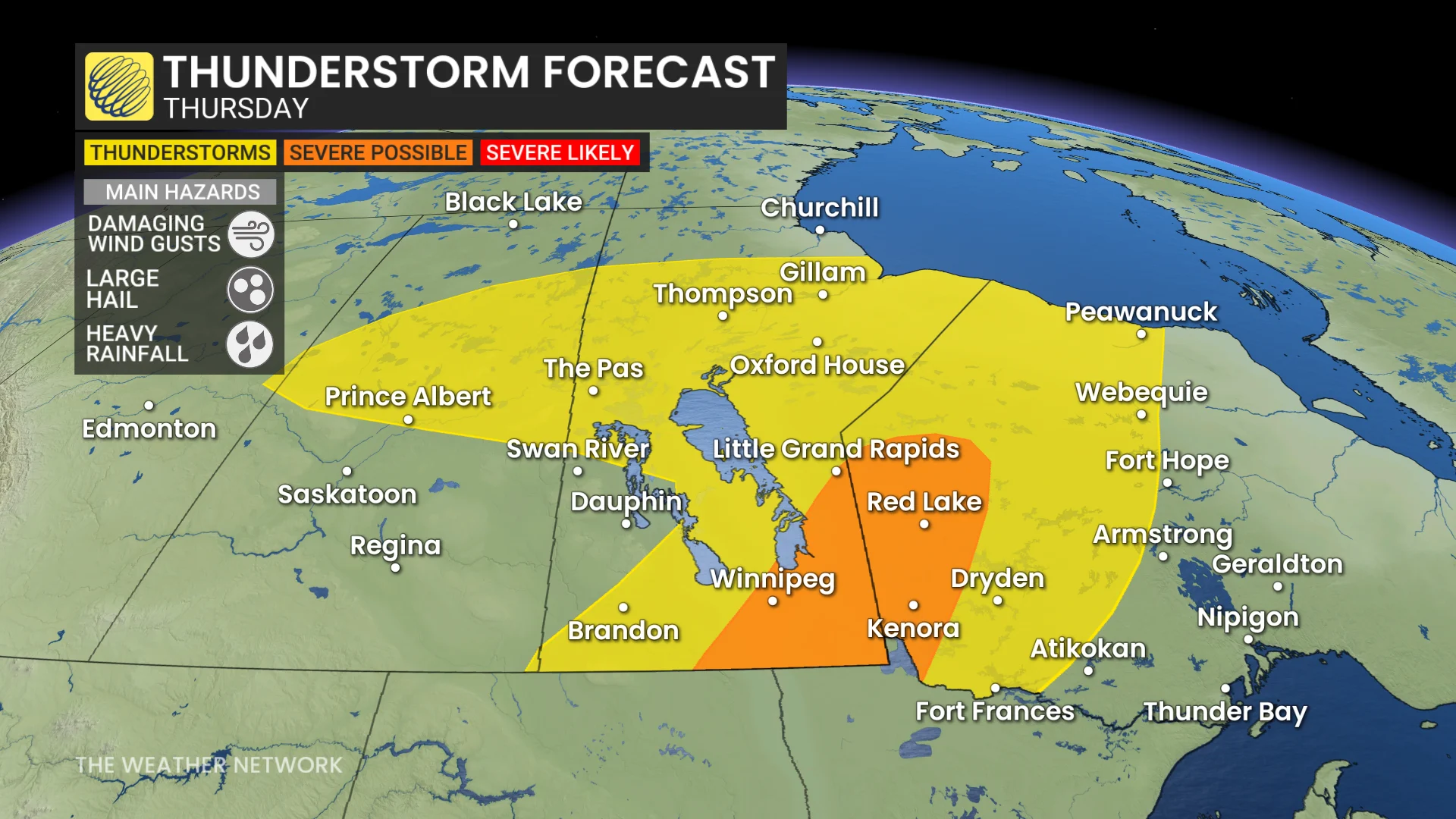
Thursday: Storm risk shifts east, Alberta significantly cools
By Thursday, the storm system will shift eastward, bringing a significant cooldown to Alberta, with daytime highs falling below 17°C.
SEE ALSO: Canada’s rain gauge runs dry, cities top weeks without rain
In southern Manitoba and northwestern Ontario, high thunderstorm energy will build through the afternoon. The system’s advancing cold front is expected to trigger potentially severe storms by late afternoon into the evening.
There is some uncertainty where thunderstorms will trigger, but a potent environment is present for large hail and damaging winds storms near the Winnipeg area and east.
Beyond, temperatures will be changeable through the weekend. Northern areas will be cooler than normal, but the southern Prairies will end up warmer than normal with a couple rounds of warmer weather surging north of the U.S. border. Warmer-than-normal temperatures will dominate next week.
Be sure to check back for the latest updates across the Prairies