Flood and tornado risk: Stay alert to Ontario's severe thunderstorms Wednesday
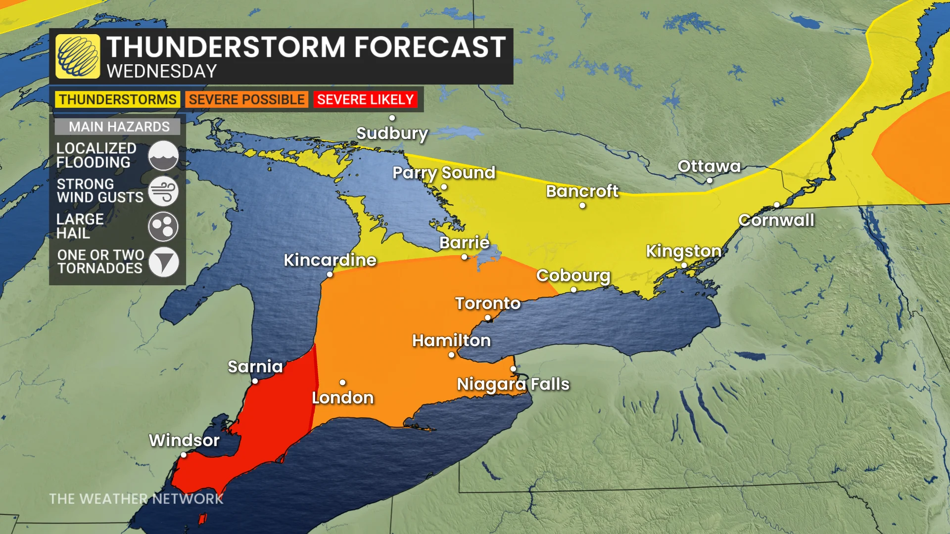
Southern Ontario faces a severe weather threat on Wednesday, with elevated risks of localized flooding and the potential for one or two tornadoes in southwestern areas. Residents are encouraged to stay alert and monitor for updates throughout the day
Southern Ontario should brace for a heightened risk of severe storms on Wednesday, with the potential for active weather widespread across the region.
The rising temperatures will contribute to conditions favourable for severe thunderstorms. The primary concerns include strong winds, hail, heavy rainfall, and the possibility of localized flooding.
DON'T MISS: Toronto's 270-day heat streak drought is about to end
Also, there is a risk of a tornado or two in southwestern Ontario.
Pay close attention to watches and warnings in your area as severe thunderstorms bubble up on Wednesday.
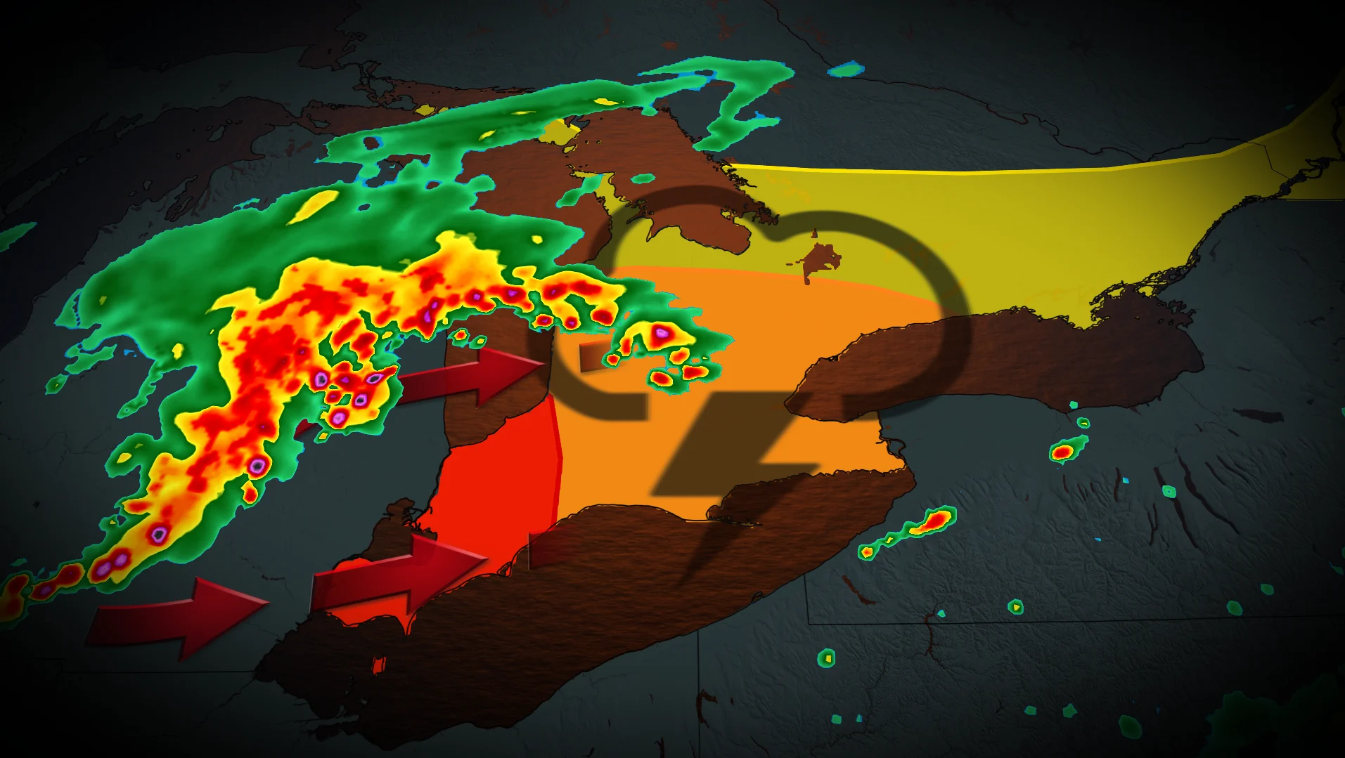
Wednesday: Severe thunderstorm threat stretches across southern Ontario
Southern Ontario faces an enhanced risk of thunderstorms on Wednesday as a low pressure system advances from the U.S. Midwest.
Areas from southwestern Ontario to the Greater Toronto Area (GTA) are poised to see the strongest storm potential, with activity spreading from Michigan and Ohio into the province.
Forecast models suggest two distinct rounds of storms:
First round - 2-4 p.m.: Storms are expected to emerge along a warm front from east of Lake Huron through Kitchener-Waterloo and into the GTA during the afternoon.
Heavy moisture and the potential for successive storm cells raise concerns of localized flooding in these regions.

Second round - 8-10 p.m.: A cold front will push into southwestern Ontario by evening, with its timing critical to storm strength.
An earlier arrival could produce stronger storms, while a delayed approach may limit storm intensity. Threats include strong wind gusts, heavy rainfall, large hail (up to the size of loonies), and a slight risk of isolated tornadoes.
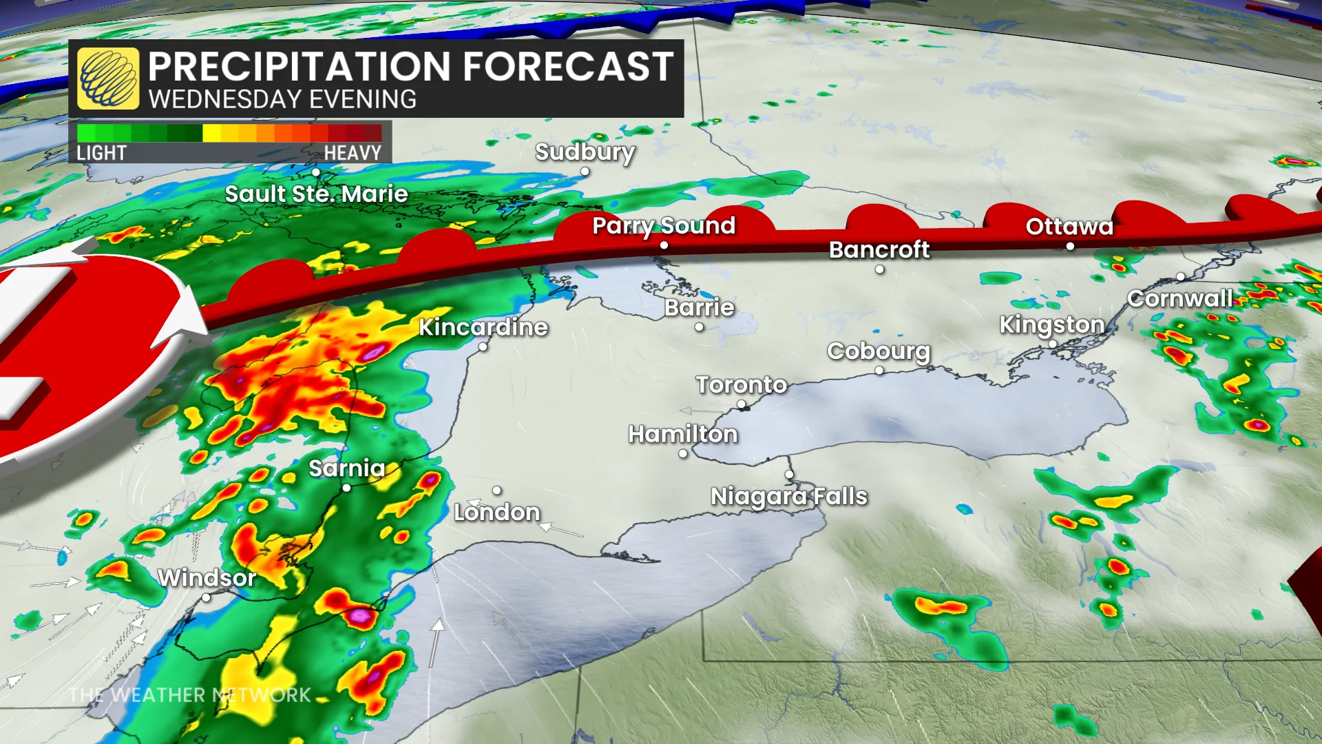
This cold front is forecast to move towards the GTA late Wednesday night into early Thursday, bringing the possibility of thunder and lightning.
Residents are advised to monitor local updates often, as conditions could prompt weather alerts and warnings.
WATCH: What today's storm risk could bring to southern Ontario
Did you know? Ontario has had only one tornado confirmation so far this year on May 16, west of Woodstock, Ont.. For reference, in 2024, six tornadoes had already been confirmed by this date. This makes this the slowest tornado start since 2021 in the province.
Stay with The Weather Network for all the latest on conditions across Ontario.