Cool, dreary pattern locks in for mid-July in Alberta, hefty rain totals ahead
After a cool and wet start to the week across southern Alberta, more rain is on the way
It may be mid-July, but southern Alberta remains stuck in a pattern of cool and wet conditions, with another round of rain and below-seasonal temperatures expected later this week.
PHOTOS: Supercell hits Calgary area with hail, torrential rains
Stay updated for evolving forecasts and any watches or warnings issued in the days ahead.
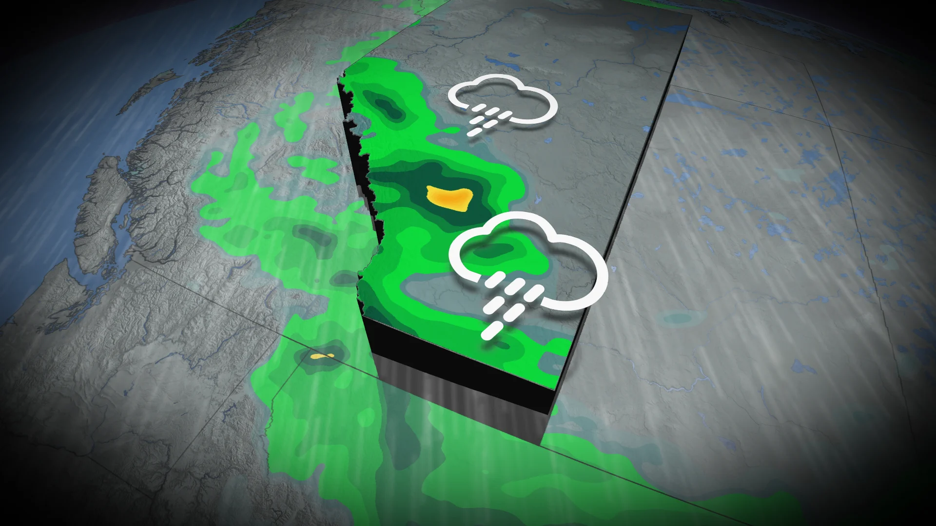
Renewed rain chances start Thursday
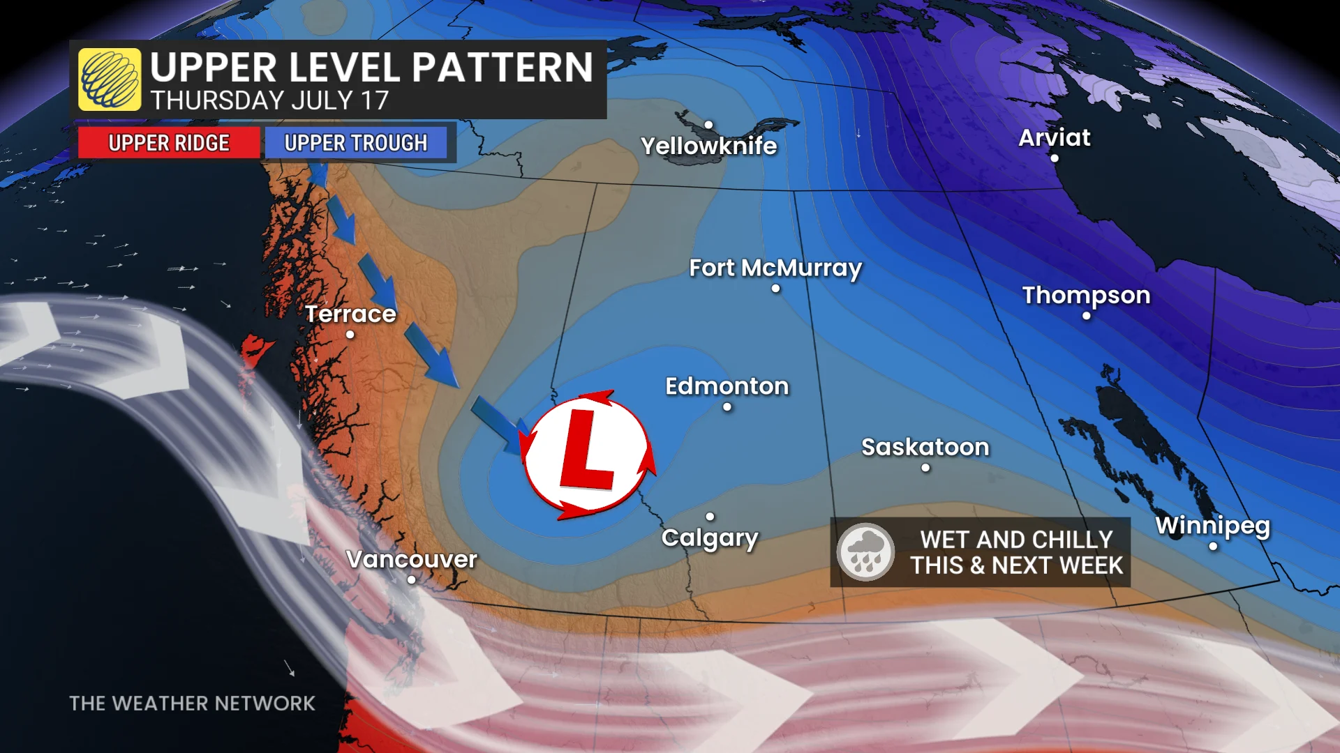
A persistent northeasterly flow will drive a low pressure system southward, settling over the Rockies by Thursday.
Widespread rainfall is forecast from Red Deer to Calgary, with totals between 30–50 mm or more by the time the system exits.
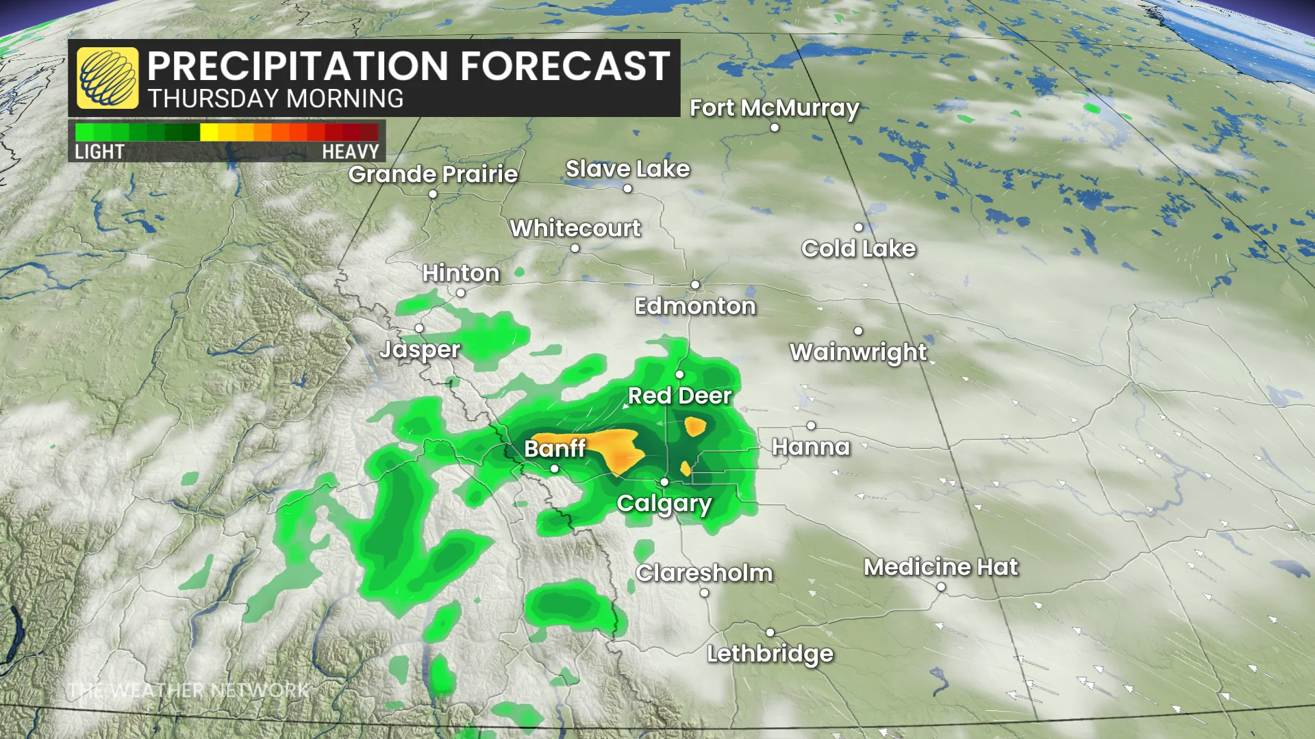
Upsloping flow near the foothills could enhance rainfall amounts locally.
Temperatures are expected to stay cooler than average under thick cloud cover and rain, as well, with daytime highs near 15°C—well below the seasonal norm of 23°C.
The unsettled weather is likely to linger, with some additional rain and sub-20°C highs into early next week, as well.
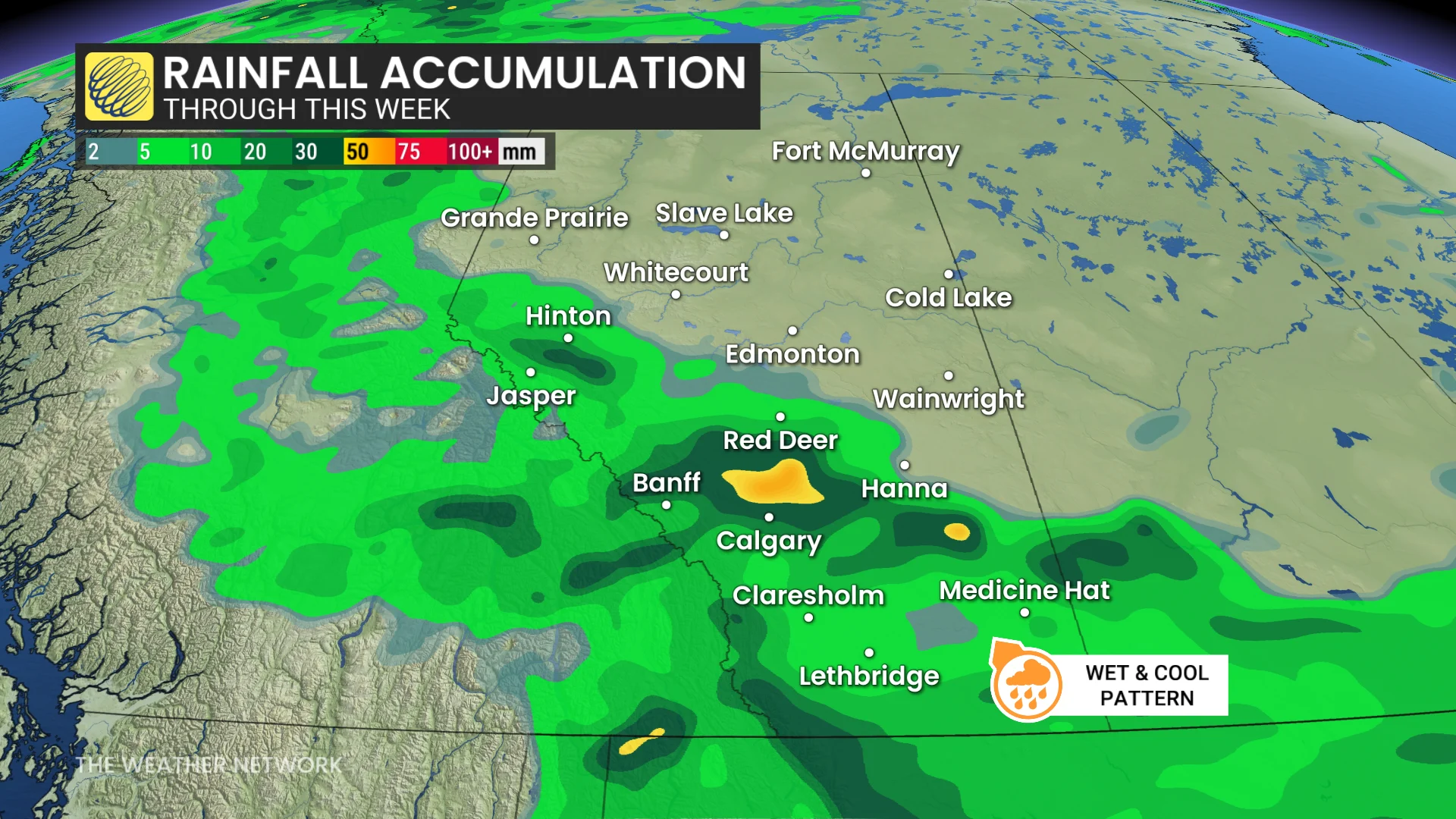
Wet pattern to provide drought relief
This wet pattern may provide much-needed drought relief, but residents should stay updated on rainfall warnings or localized flooding risks if heavy amounts persist.
MUST SEE: La Niña could return in a quick burst this fall and winter
Keep an umbrella handy and plan for cooler-than-normal summer weather over the coming days.
WATCH: How storm chasers in Canada got into the action-packed job
Stay with The Weather Network for all the latest on conditions across Alberta.