Tornado warnings issued in Saskatchewan and Manitoba
The threat for severe weather which started on Wednesday, will shift into eastern Saskatchewan and western Manitoba on Thursday
7:06 p.m. CST - Severe thunderstorms prompted a tornado warning in southern Saskatchewan on Thursday evening.
Environment and Climate Change Canada issued a tornado warning for the following areas in southern Saskatchewan:
R.M. of Antler including Redvers Antler and Wauchope
"This is a dangerous and potentially life-threatening situation. Take cover immediately, if threatening weather approaches," ECCC said in its warning.
The agency added: "Go indoors to a room on the lowest floor, away from outside walls and windows, such as a basement, bathroom, stairwell or interior closet. Leave mobile homes, vehicles, tents, trailers and other temporary or free-standing shelter, and move to a strong building if you can. As a last resort, lie in a low spot and protect your head from flying debris.”
The original article with the full forecast for the Prairies continues below.
Alberta will a catch break from the heat, humidity on Thursday but could see more foul weather in the northern section of the province once again.
Wednesday was quite stormy in the northern half of Alberta, prompting severe thunderstorm and tornado warnings, as well as watches. A tornado was reported by storm chasers, with a visible funnel cloud captured in photos and videos--between Lodgepole and Drayton Valley, Alta.--but there hasn't been an official confirmation, yet.
MUST SEE: Don't make this deadly mistake when waiting out a storm
The risk of severe storms will reappear in northern Alberta Thursday while also moving into parts of Saskatchewan and Manitoba, bringing the chance of large hail, strong winds and heavy downpours.
Be sure to monitor local weather alerts and incoming conditions throughout the day.
Storm threat shifts, pushes into Saskatchewan, Manitoba on Thursday
The same cold front to trigger Wednesday's storms will makes its way east into Saskatchewan and Manitoba on Thursday, triggering another risk of thunderstorms; although there is still some uncertainty as to how strong the storms will be and their locations.
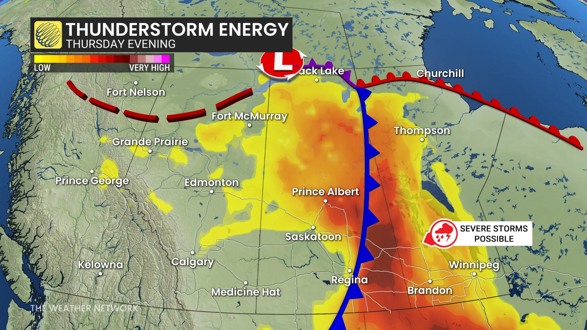
Thunderstorm energy over the Prairies will still be high, though, so we will see a risk of severe storms developing along the Saskatchewan-Manitoba border in the late-afternoon to evening hours.
There will be a widespread risk for severe thunderstorms across the northern Prairies. Forecasters will be watching the Brandon, Man., region for severe weather by the early evenin, potentially moving east into Winnipeg in the overnight period.
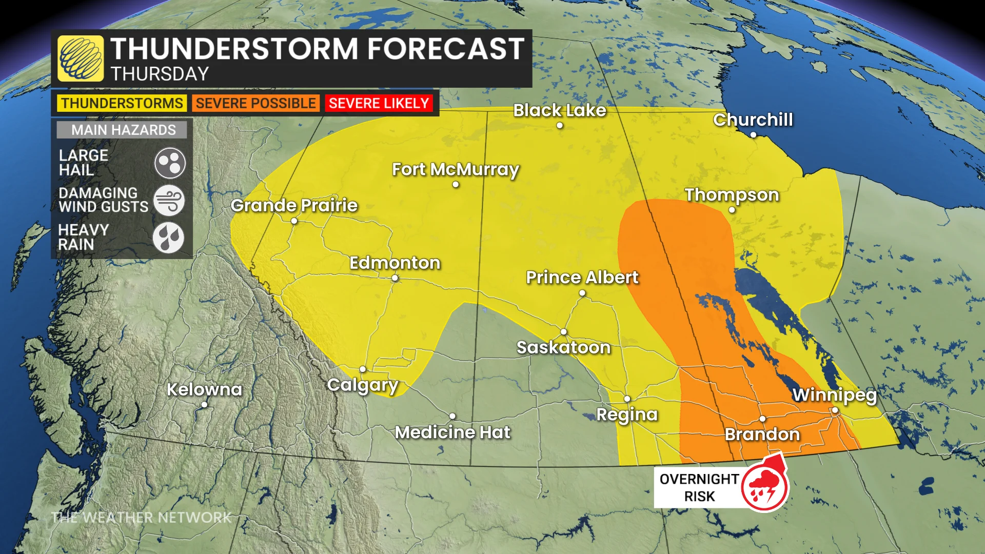
We could once again see some large hail, between 3-5 cm in diameter, and damaging winds between 90-110 km/h with any severe storms that pop up.
With a short window on Thursday where we’ll see a threat of a Tornado, but the risk is still pretty low.
As the week wraps up, the Prairie provinces are anticipated to get some relief from both the heat and the storms, with cooler air coming in by Friday.
In the meantime, residents are urged to remain weather-aware. Those in high-risk areas should pay attention to alerts, particularly in the late afternoon and evening.
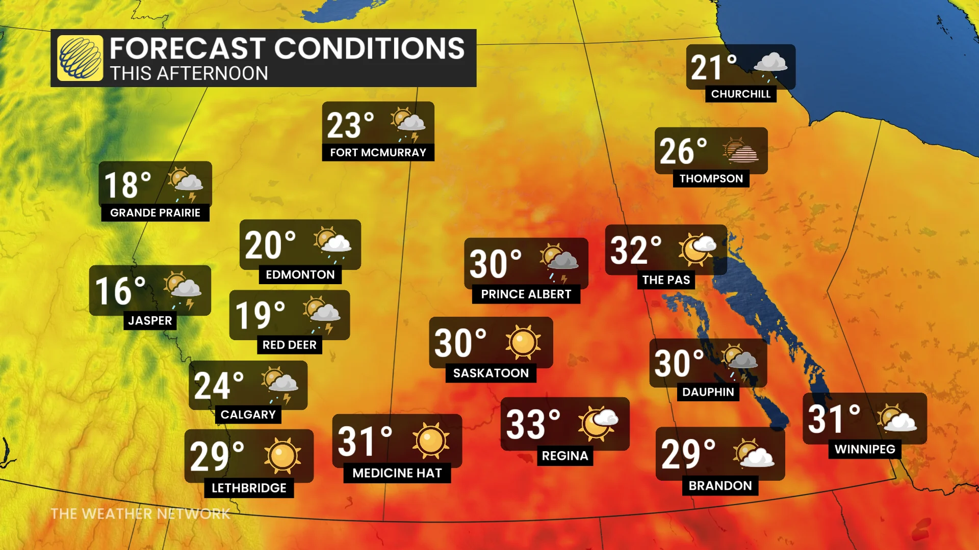
Conditions will be very hot and muggy in southern Saskatchewan and Manitoba, with Winnipeg feeling like 43 on Friday.
WATCH BELOW: Storm chasers spot tornado in Alberta on Wednesday
Thumbnail courtesy of Iona, taken in Prince Albert, Sask.
Stay with The Weather Network for more information and updates on your weather across the Prairies.