Colder than December? Ontario’s late-May chill turns heads
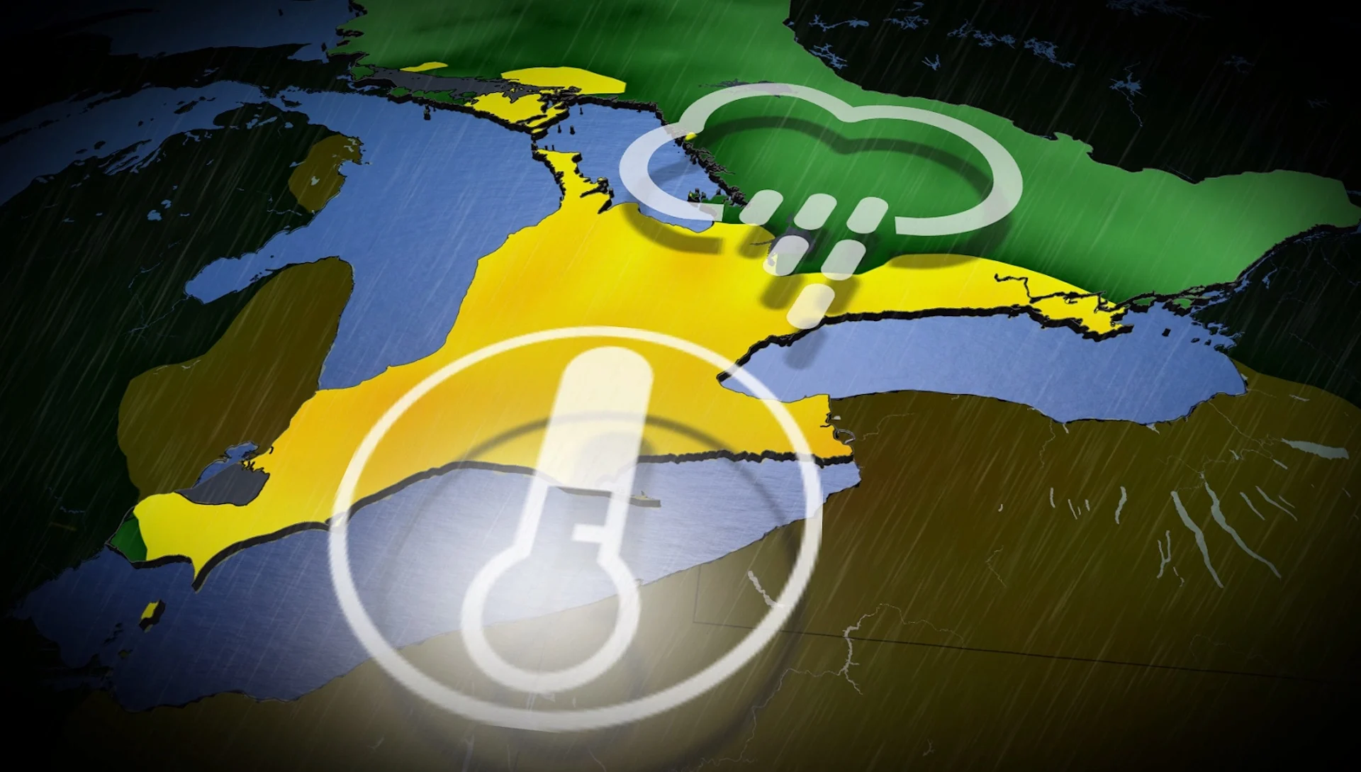
Temperatures plummet this week in Ontario, putting us colder than the daytime highs we saw in late December. As well, with the cold comes widespread rain and very gusty conditions
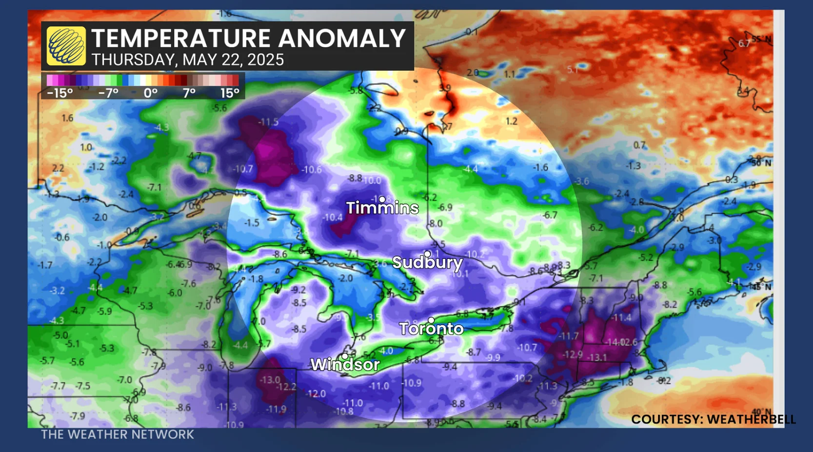
Five months after the holidays, parts of Ontario are going to run colder than late December.
A stubborn May cooldown means several cities are forecast to see daytime highs below what they experienced during the final days of 2024.
DON’T MISS: The pyrotechnic science behind Victoria Day firework displays
A low-pressure is expected to track into the lower Great Lakes region and stall, cycling showers as far as northern Ontario and southern Quebec. With this slow-moving system, Ontario can expect days of cloudy skies and rainfall–– in addition to the chilly temperatures.
The much cooler-than-seasonal temperatures will dominate through the weekend.
Ontario forced into a temperature and rainy rut
High pressure situated in Northern Canada and a stubborn upper trough in the U.S. will join forces to create a significant, late-May temperature rut that will take days to climb out of.
The jet stream, which normally keeps systems moving from west to east, will dive well south--leaving an upper trough detached from the main upper-level winds.
DON'T MISS: Kenora firefighters stay on standby as wildfires blaze in northwest Ontario
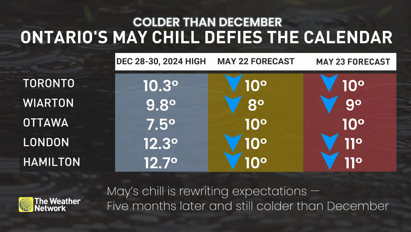
Here are some forecast highs for this week when compared to daytime values seen at the end of December 2024.
Toronto (Pearson airport)
Wednesday: 11°C | Thursday: 10°C | Friday: 10°C
Dec. 29, 2024: 10.3°C
March had nine days warmer than 11°C
Wiarton
Thursday and Friday: 8-9°C
Dec. 28, 2024: 9.8°C
Ottawa
Thursday and Friday: 10°C
Struggling to break into double digits
London
Thursday and Friday: 10–11°C
Colder than Dec. 28 (12.3°C) and Dec. 29 (11.1°C)
Hamilton
Forecast: Three straight days below 12°C
December highs: 12.7°C (Dec. 28), 10.4°C (Dec. 29)
Did you Know? Highs in the 8°C to 9°C range are typical of late-March weather in the Greater Toronto Area (GTA).
To make matters worse...but some silver linings
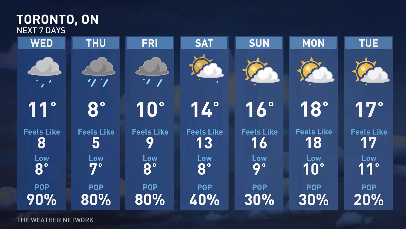
To add insult to injury, the surface low will bring us periods of rainfall this week.
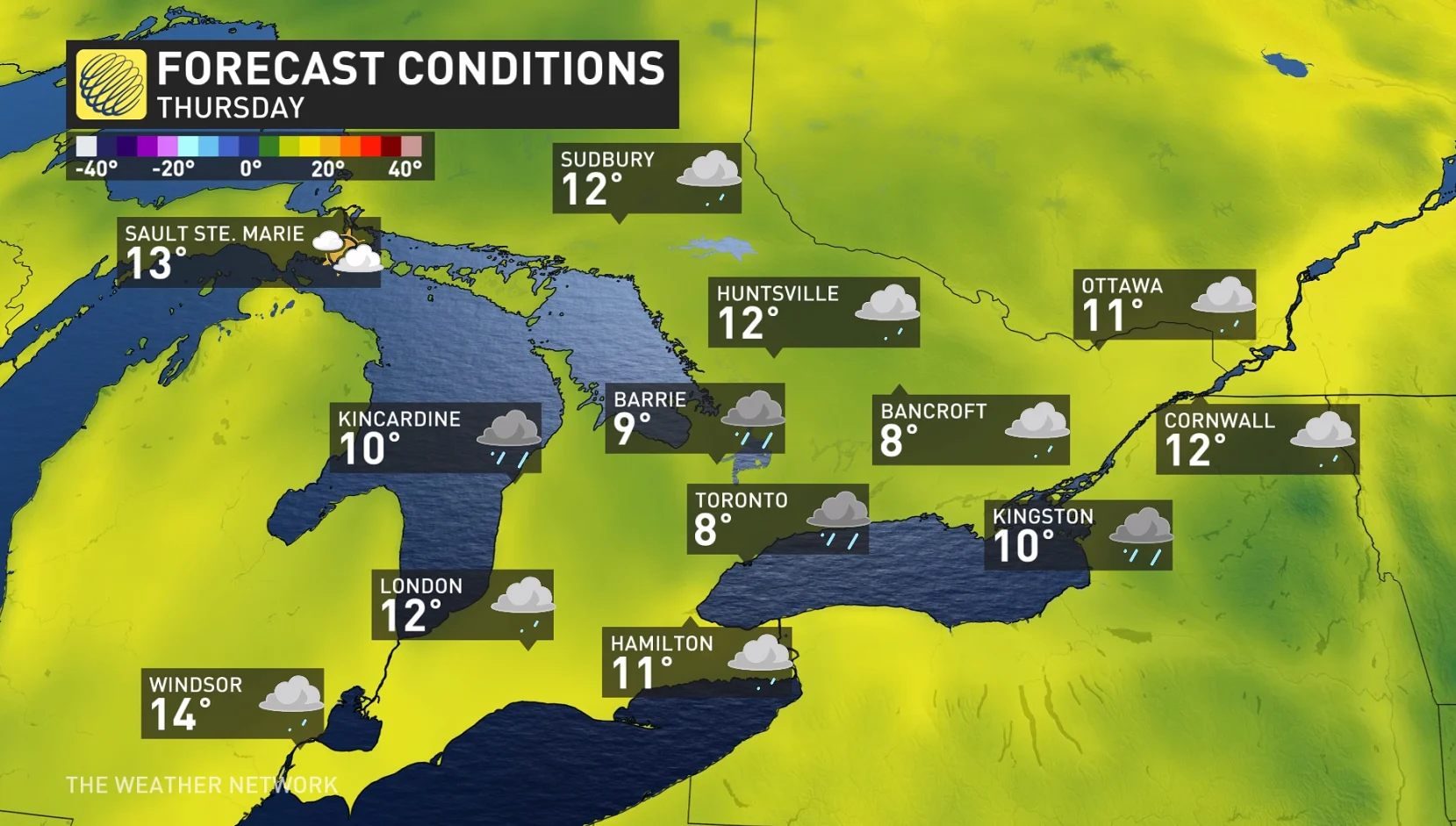
The first impulse of rainfall arrives Wednesday, with steady rates pushing across the region in the afternoon and evening. Heavy showers persist well into Thursday, extending north to cottage country and beyond, with widespread precipitation spilling into Friday, as well.
By Saturday, close to 40 mm of rainfall is forecast to fall all across the GTA and a wide swath of southern Ontario. It’s a lot of rain, and about the same amount the region received in all of May 2020 (40 mm) and May 2022 (47 mm).
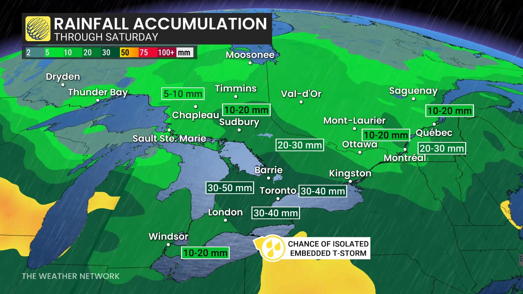
Regions near Lake Erie have the highest chance of reporting some embedded thunderstorms over the next couple of days.
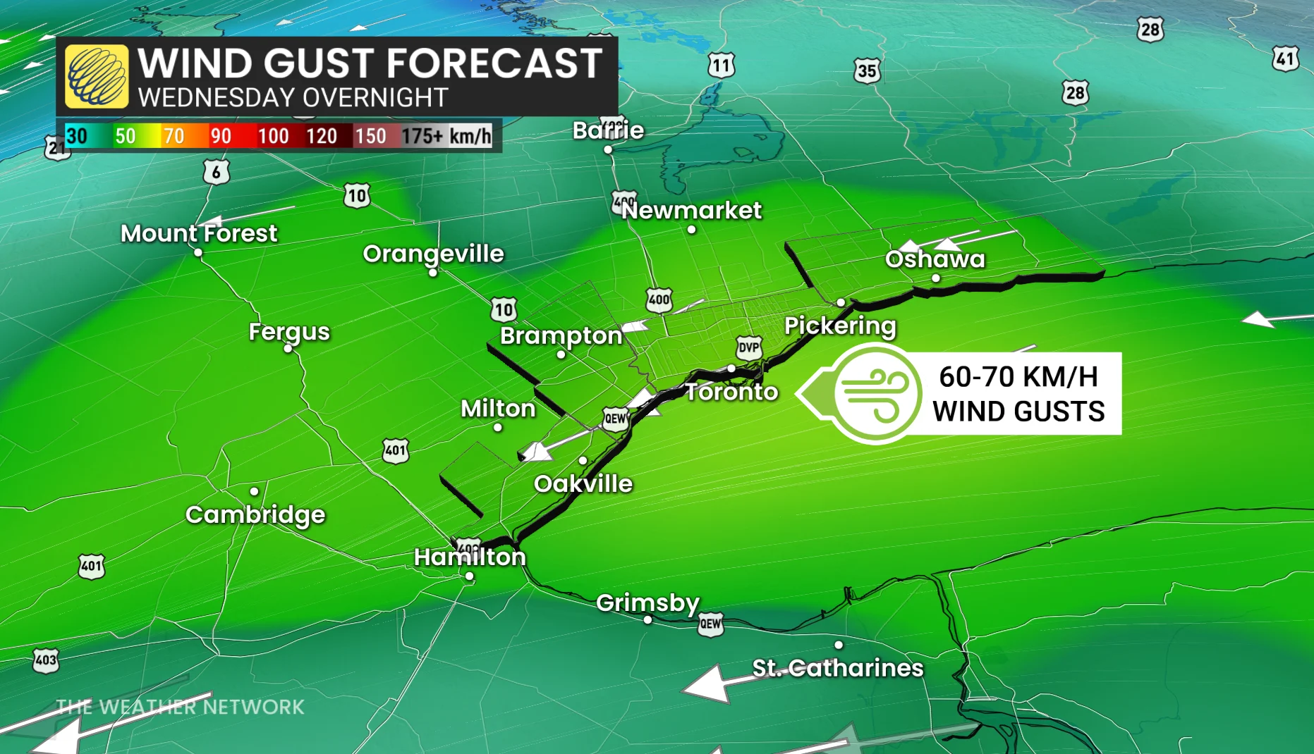
By Wednesday evening, sustained winds along the west end of Lake Ontario are between 30-40 km/h, with gusts of 60-70 km/h possible through early Thursday.
And, for those residing in the GTA, the pesky, easterly wind will further keep temperatures on the cool side in Toronto and other communities adjacent to Lake Ontario. Water temperatures right now are only at 10°C or 11°C.
The situation does come with some silver linings, however. The biggest pro is the steady rain will essentially mean a non-existent drought situation heading into summer. You have to go back to May 2021 to find the last significant drought across southern Ontario at this time of year.
Temperatures should slowly recover next week--trending closer to seasonal as we approach the first of June, but changeable conditions are still expected during the first week of next month.
A stretch of warmer-than-normal temperatures are expected as we get deeper into June.
WATCH: Violent storms stretch from Minneapolis to Ontario, Beyoncé concert delayed
Stay with The Weather Network for more information and updates on your weather across Ontario.
Thumbnail image courtesy: Unsplash