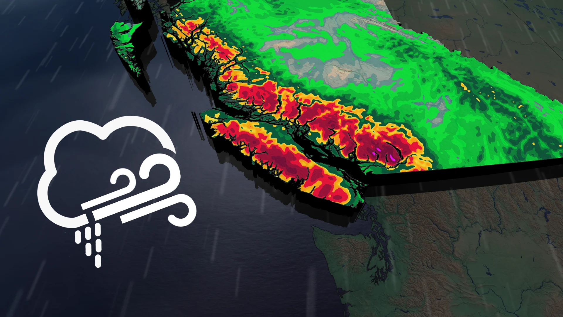
Powerful winds and waves whip into B.C.'s South Coast, warnings issued
Stay alert: Two consecutive storms deliver a prolonged period of heavy rain and strong winds to B.C.'s South Coast
An active weather pattern is set to persist for B.C.'s South Coast over the next two weeks, as a series of systems make their way across the region.
The next system will impact the region on Thursday, bringing widespread rain and strong winds throughout the day. Soaking rainfall and gusty conditions will dominate, posing potential weather-related impacts with travel or outages.
DON'T MISS: Canada’s November features extended fall, but winter lurks on the sidelines
Coastal flood statements were also issued for sections of Vancouver Island, where strong winds and high waves during high tide could create hazardous conditions.
Stay prepared and monitor local forecasts for updates.
Thursday-Friday: Coastal flooding, outages and ferry delays possible over B.C.'s South Coast
Consecutive storm systems are set to bring heavy rain and strong winds to B.C.'s South Coast over the next 24 hours.
Another stormy system will intensify Thursday afternoon and evening, delivering gusts of 70-90 km/h alongside heavy rain. The strongest winds are expected along the coasts and straits, particularly impacting Comox, Campbell River, and Powell River. Wind warnings are in effect.
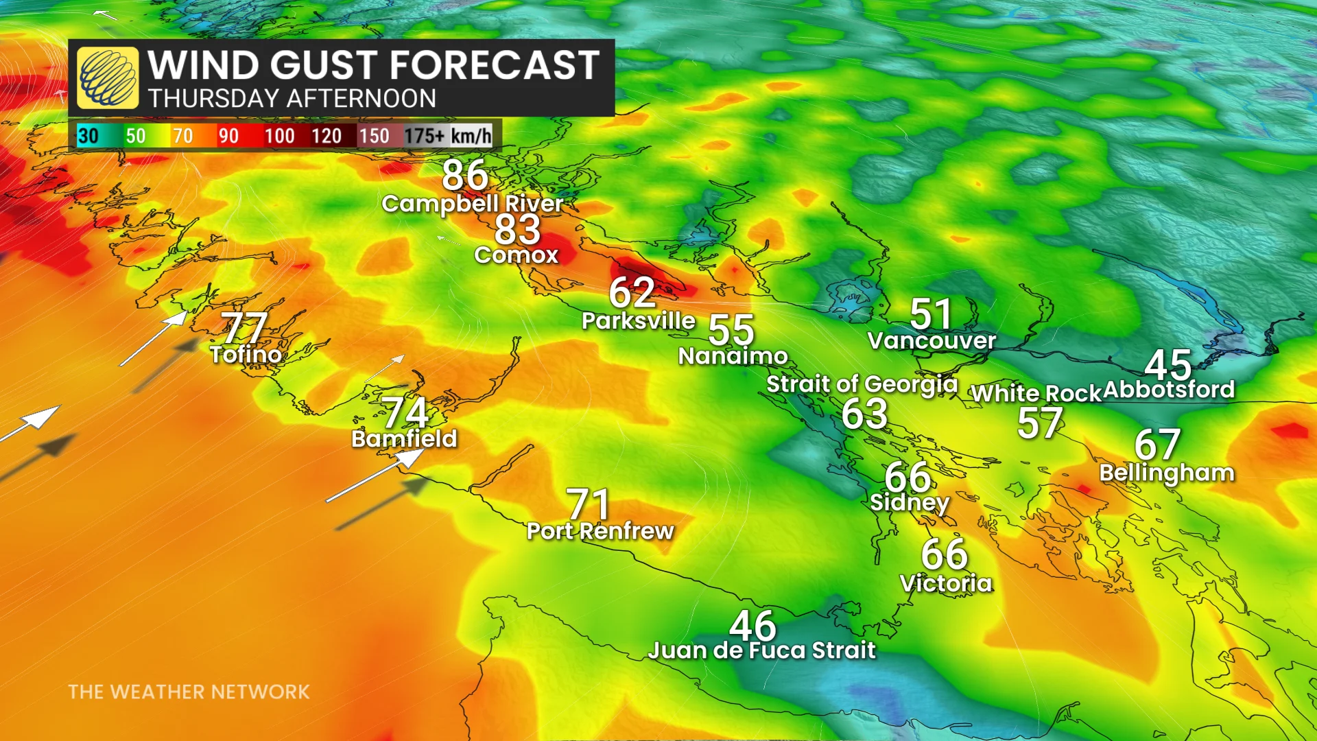
Coastal flood statements are in effect for parts of Vancouver Island, including West and North Vancouver Island, Greater Victoria, the Southern Gulf Islands, and the Campbell River area. High tides, combined with incoming strong winds and waves, could lead to hazardous conditions Wednesday afternoon and again Thursday afternoon.
"The timing of the peak southeast winds with high tide will result in potential storm surge with water level higher than the highest astronomical tide," says Environment and Climate Change Canada (ECCC) in the statement. "Minor coastal flooding is likely along exposed shorelines, especially in the low-lying areas."

Roads and walkways may also become difficult to navigate due to flooding and or debris, such as driftwood and rocks, ECCC adds.
SEE ALSO: Look up! Taurid fireballs and the Perigee Supermoon shine in November
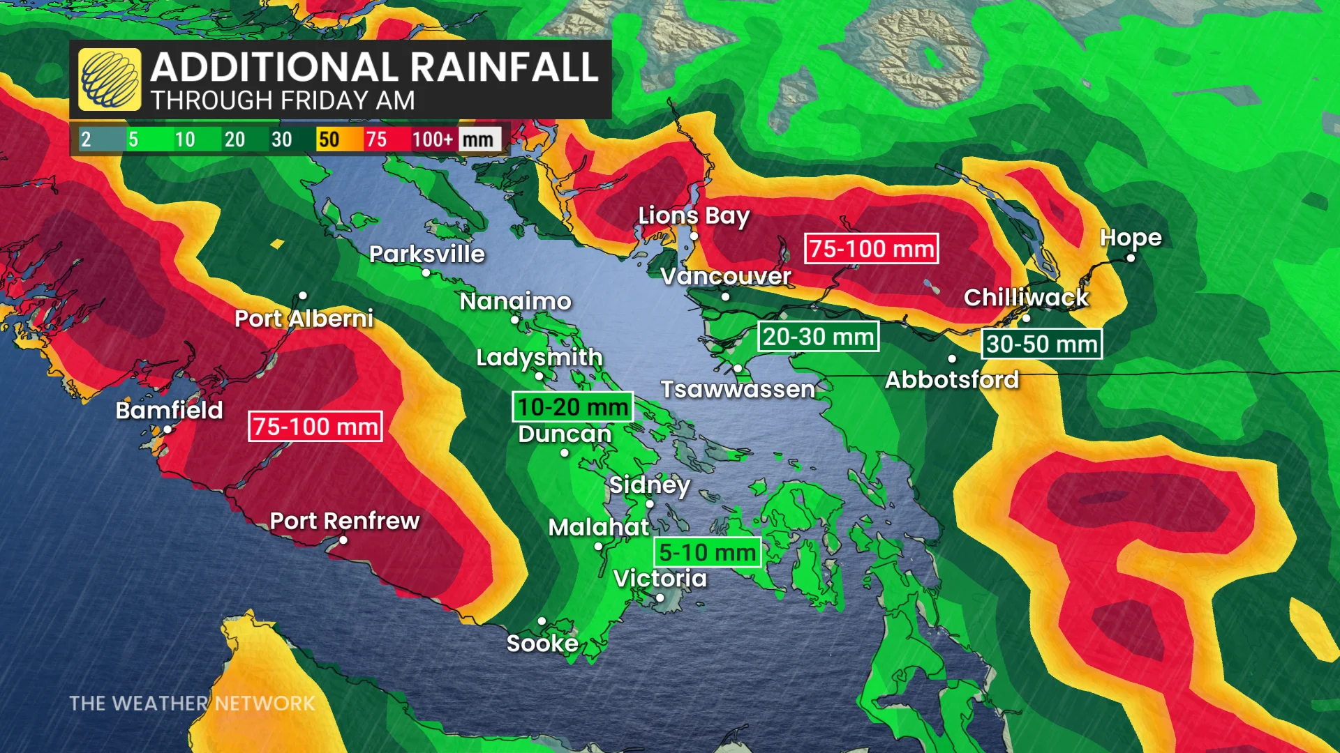
Rainfall totals could reach 50-100+ mm for the North Shore and western Vancouver Island. Potential impacts over the next few days include localized power outages, ferry delays or cancellations, and flooding in vulnerable areas.
Stay updated with local advisories and plan for disruptions as these storms move through.
This weekend will offer a brief break with a couple of dry days expected across the region. However, the active weather pattern is set to return next week, bringing above-normal precipitation totals extending through mid-November.
Temperatures over the next two weeks are forecast to remain near seasonal, leaning slightly on the milder side for many areas.
WATCH: An abrupt flip to winter looms for Canada this November
Be sure to check back for the latest weather updates across B.C.