Canada’s weather map looks broken: Arctic heat meets southern chill

This week, the heart of Canada’s polar region will be milder than cities like Toronto, Hamilton, Ottawa, and Sault Ste. Marie, Ont.
An upside-down temperature pattern is unfolding across Canada, flipping seasonal expectations on their head.
While much of the Arctic basks in spring-like warmth, Ontario is gripped by an unseasonable chill developing this week.
DON’T MISS: The threat of earthquakes is very real in Canada: Are you prepared?
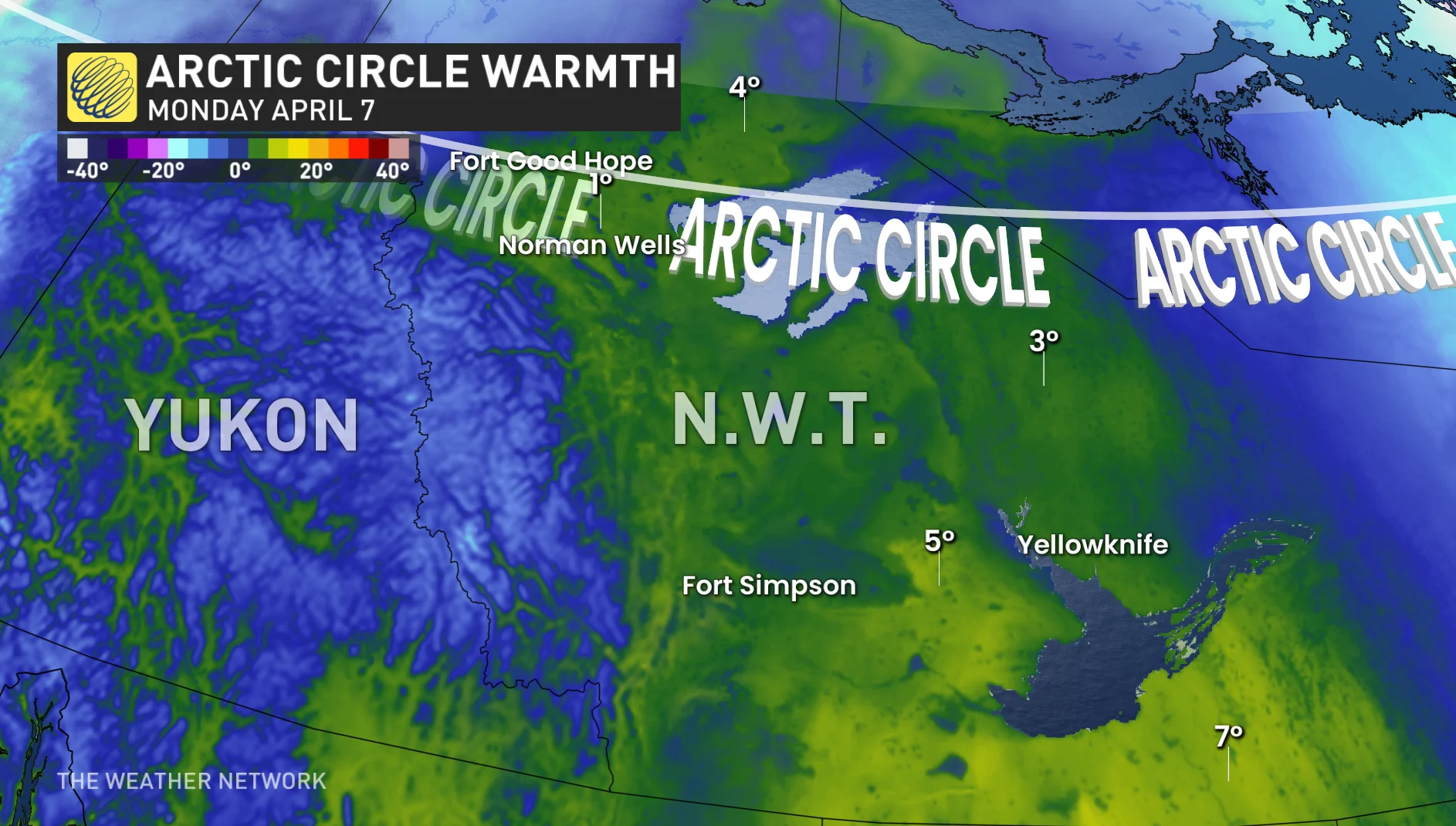
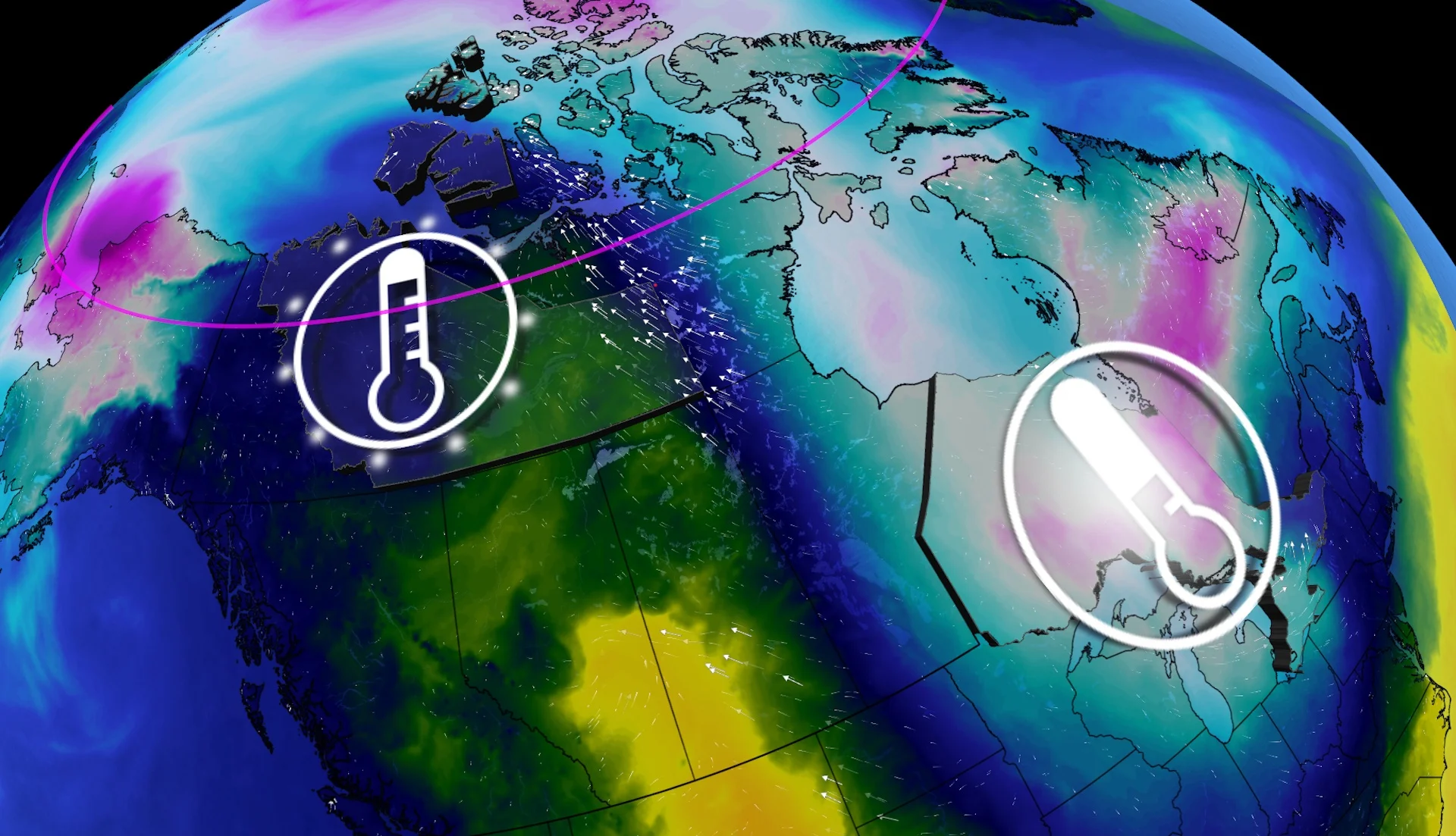
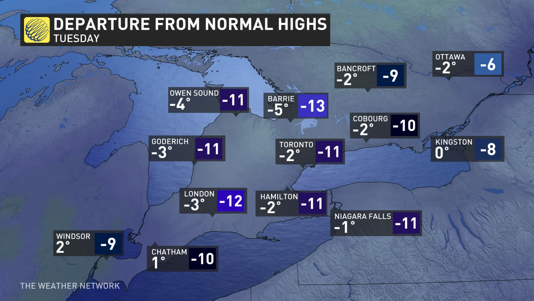
The best example of this pattern will unfold on Monday and Tuesday. Temperatures near the Arctic Circle are forecast to run up to 20°C above normal, with some regions of the Northwest Territories climbing several degrees above freezing.
Meanwhile, parts of Ontario and Quebec could see temperatures 10°C to 15°C below average, with a stubborn trough allowing Arctic air to spill south.
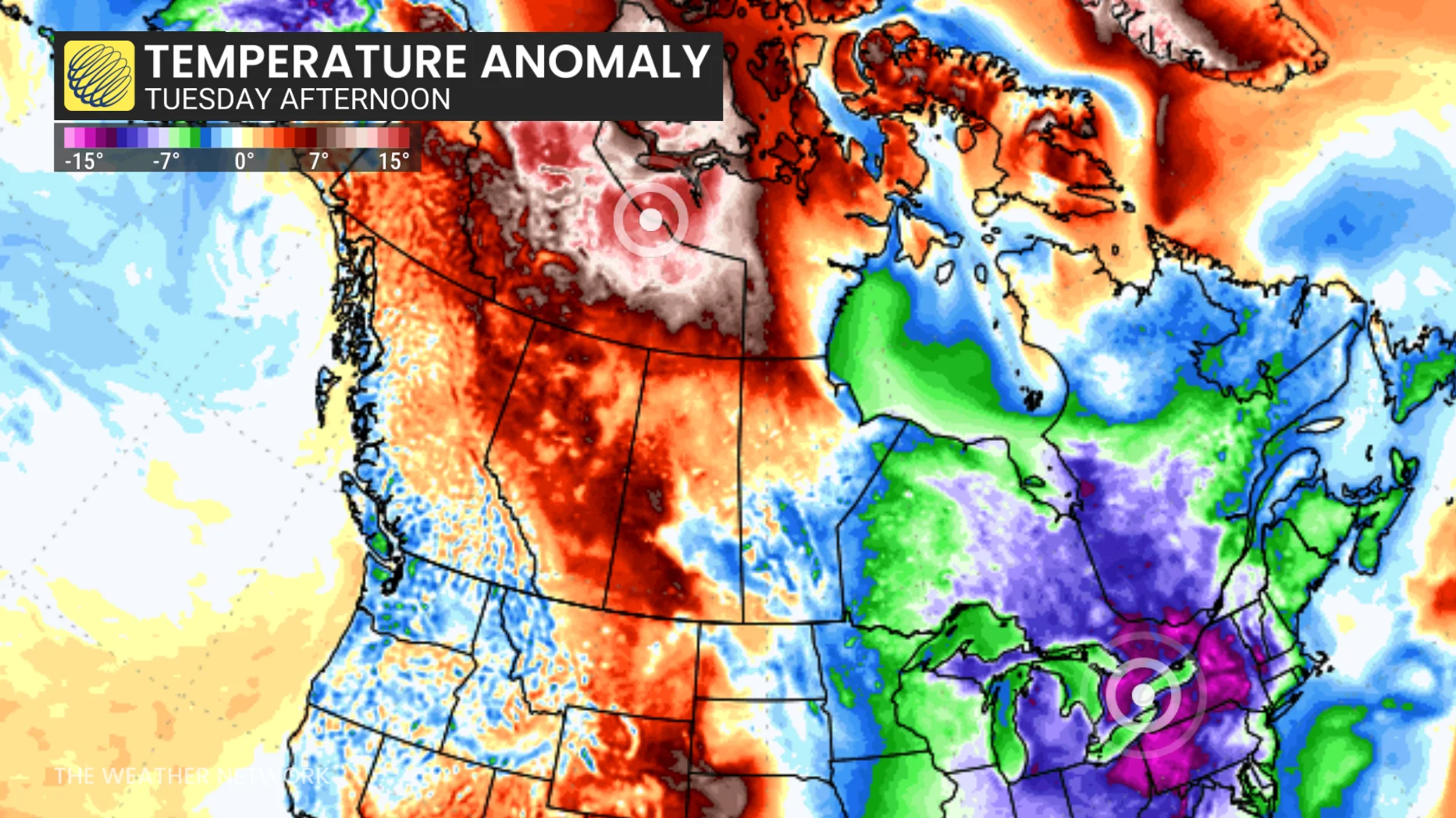
This dramatic contrast––visible on temperature anomaly maps––paints a surreal picture: The heart of Canada’s polar region will be milder than cities like Toronto, Hamilton, Ottawa, and Sault Ste. Marie, Ont.
The cause
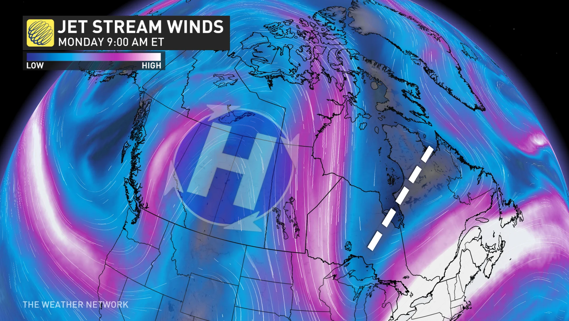
A highly amplified jet stream pattern is the root cause of the extreme temperature pattern across North America this week.
A strong Pacific jet stream lifts a mild southerly flow across the western portion of the Northwest Territories, but downstream over Hudson Bay, a sizable trough and northerly flow provides the Arctic chill directly from Northern Canada.