Canada stacked like a board game as series of lows makes wintry moves

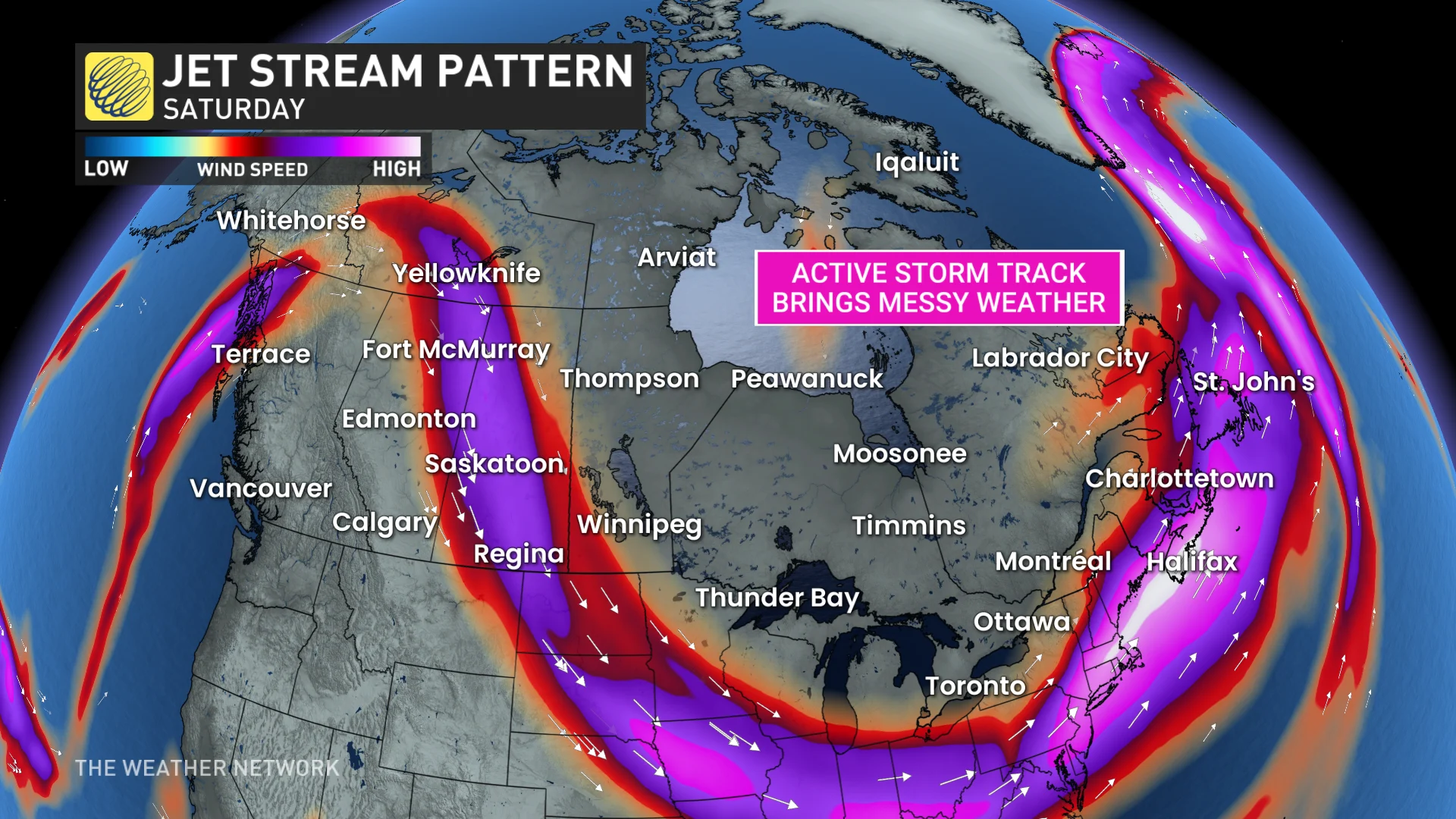
An active storm track is setting up across the country this week like a board game, allowing multiple low-pressure systems to position themselves to track through Canada into the weekend and early next week
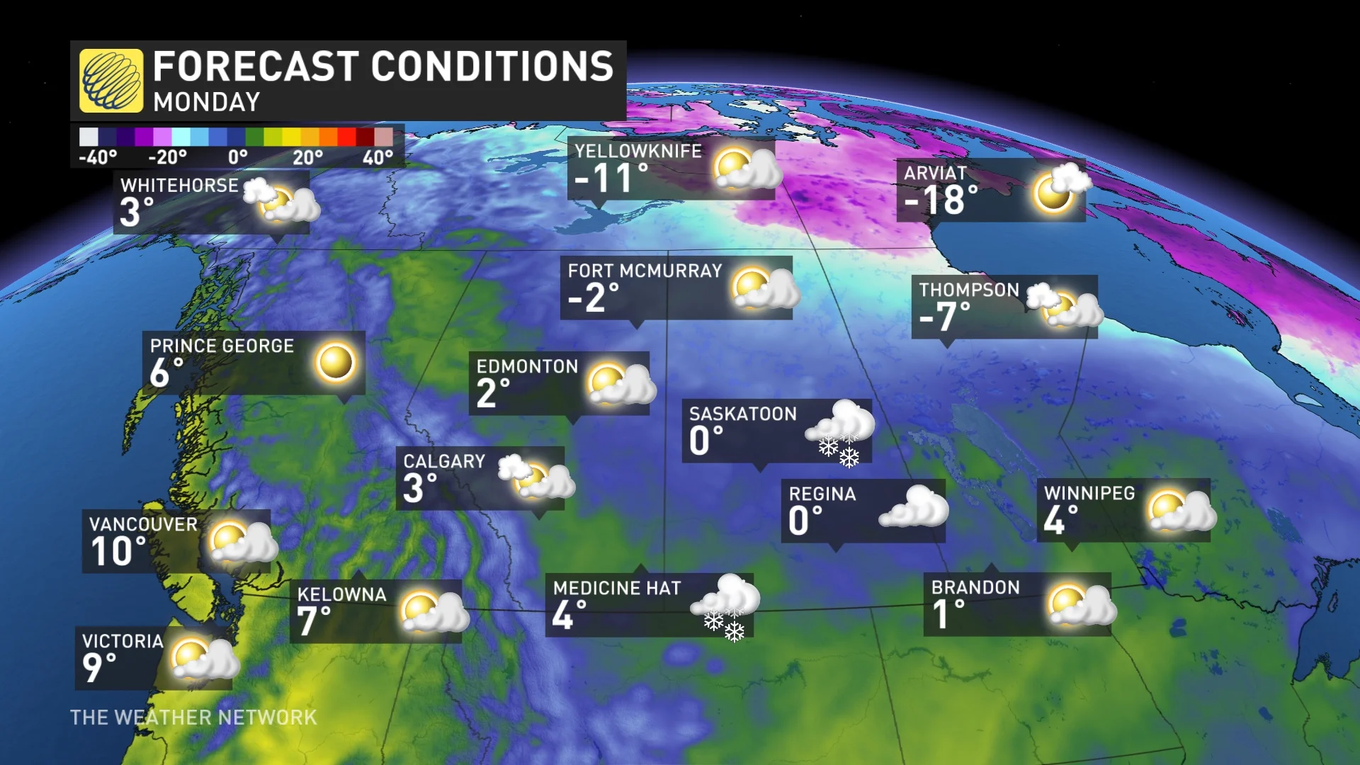
While much milder weather is covering most of Canada currently, winter is definitely not over as it will continue to throw punches for the foreseeable future.
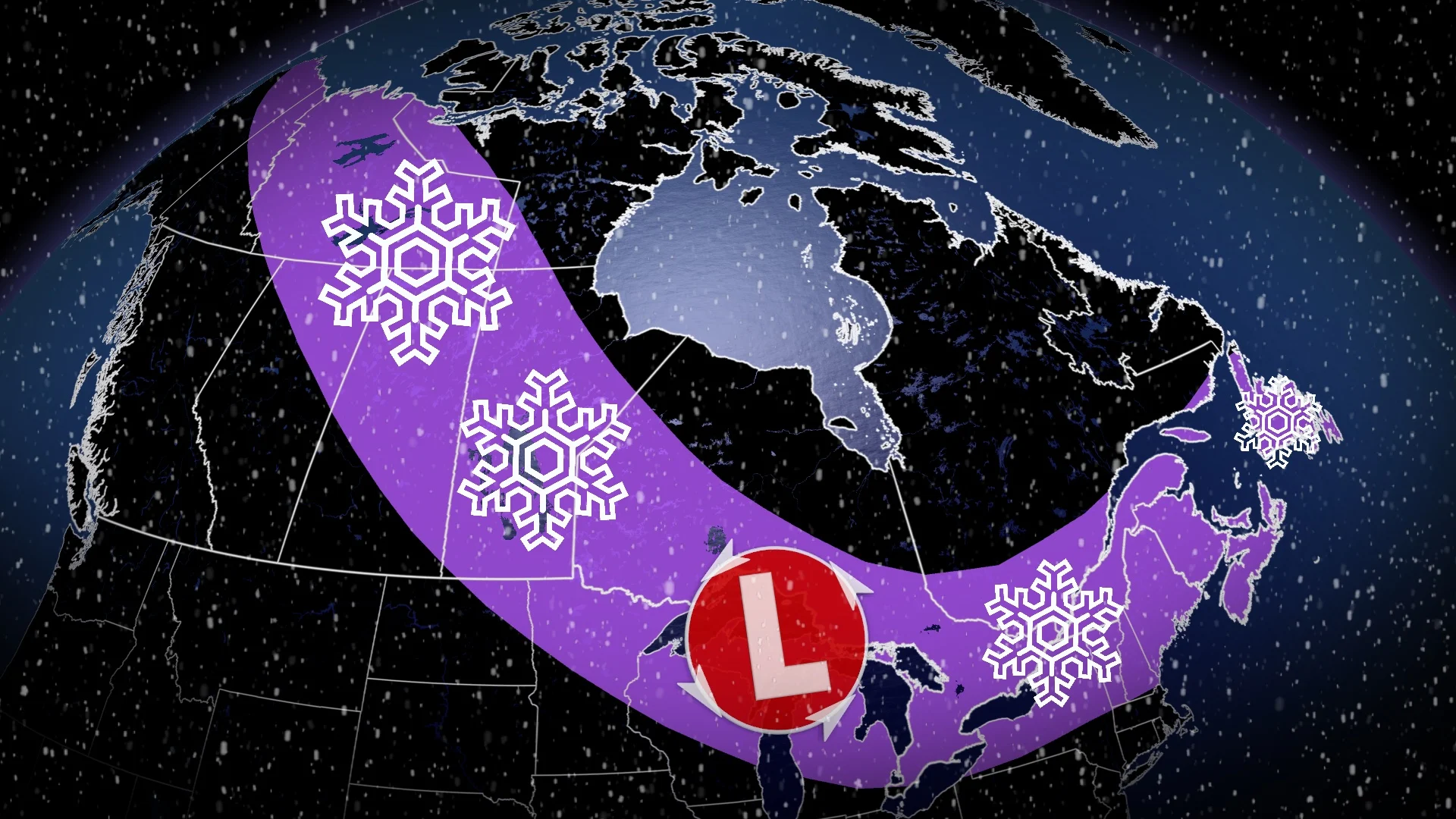
A prime example of that is what is lining up across Canada over the next several days, with not one, but four low-pressure systems strategically placed to cover most regions into early next week.
DON'T MISS: As tall as a giraffe: Snow total nears record levels in Canadian city
Most of the country is in line for some wintry impacts into the weekend and beyond. We break down the setup below.
Series of systems strategically set up to give Canada shots of wintry weather
Low No. 1 impacts Newfoundland on Wednesday with eastern sections seeing heavy rain and gusty winds while western sections get hit with hefty snowfall. The scenario will ensure the milder trends that St. John’s, N.L., has seen this winter continues.
But the heavy rain over the Avalon Peninsula threatens water pooling on roadways, and localized flooding, especially in poor drainage areas. Rainfall rates could reach 10-15 mm an hour at times.
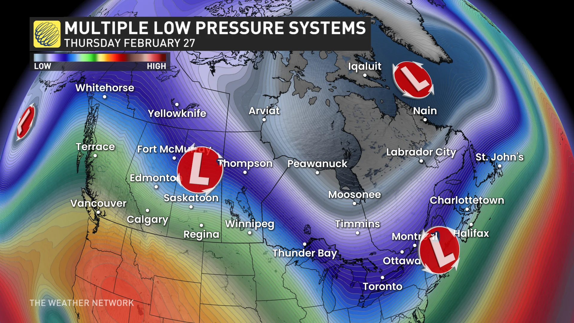
The second low we're watching is a weak clipper moving into Ontario and Quebec from Wednesday afternoon to Thursday morning, bringing in a light dusting of snow. Nothing excessive is expected, with 3-5+ cm for most areas.
As well, because of the temperature gradient, some areas in southern Ontario will also see some light rainfall and the chance of freezing rain and freezing drizzle.
It will then move into Atlantic Canada for Thursday afternoon to Friday morning with snow to start, followed by warming air moving in behind seeing a transition over to rain.
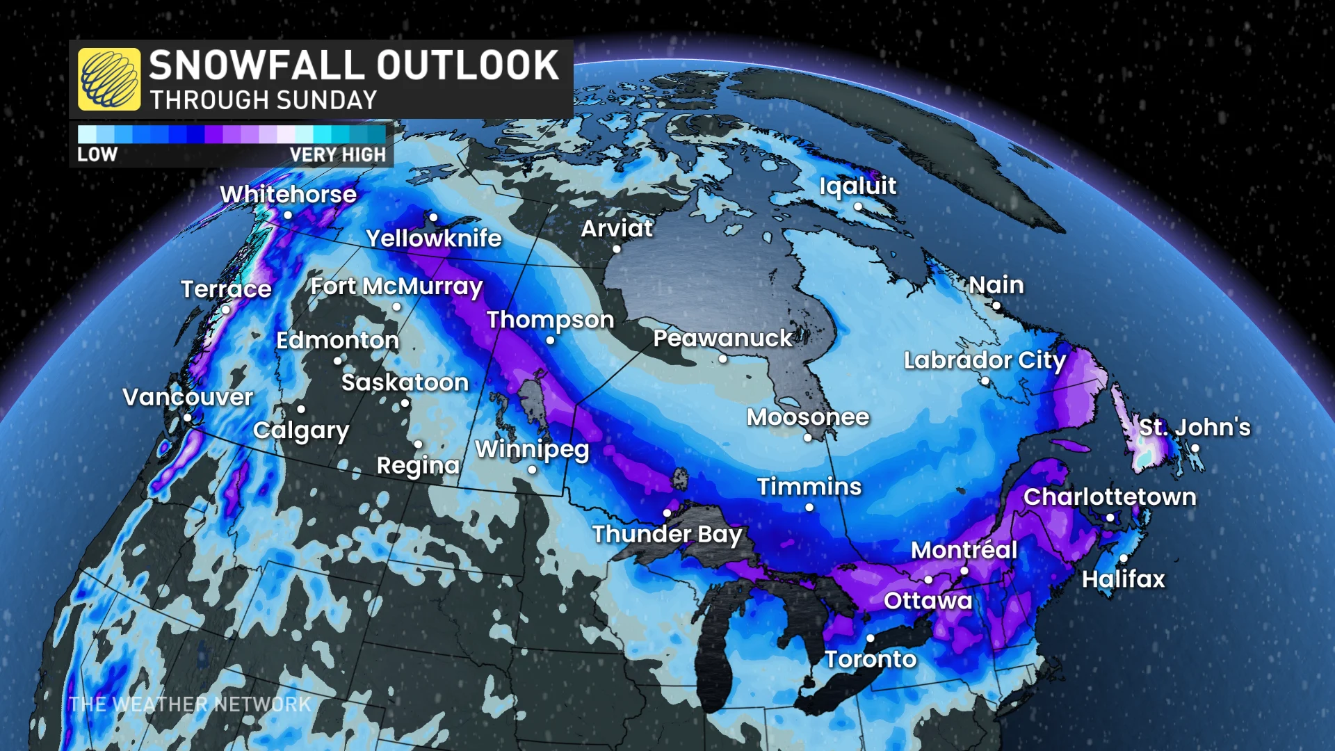
Next up is low No. 3, impacting northern B.C. on Wednesday and the Prairies from Thursday to Friday morning, bringing snow north of the Yellowhead Highway. Then, it takes a cross-country trek into Ontario and Quebec from Friday afternoon to Saturday morning with accumulating snow and the chance for some rain in the south.
By the weekend, the low takes aim at Atlantic Canada from Saturday to Sunday, bringing snow for the northern Maritimes and western Newfoundland, and then rain for southern and eastern sections of the latter.
We finish off with low No. 4. It starts on the West Coast for Saturday before becoming a northern clipper over the Prairies and Central Canada for early next week.
This wintry pattern continues into March, so stay tuned for the release of our March outlook on Friday, Feb. 28.
With files from Melinda Singh and Matt Grinter, meteorologists at The Weather Network, and Nathan Howes, a digital journalist at The Weather Network.