
B.C. should prepare for more high winds, heavy rain into Saturday
Our storm train continues into this weekend with the next system arriving into the day Saturday
Weather Highlights:
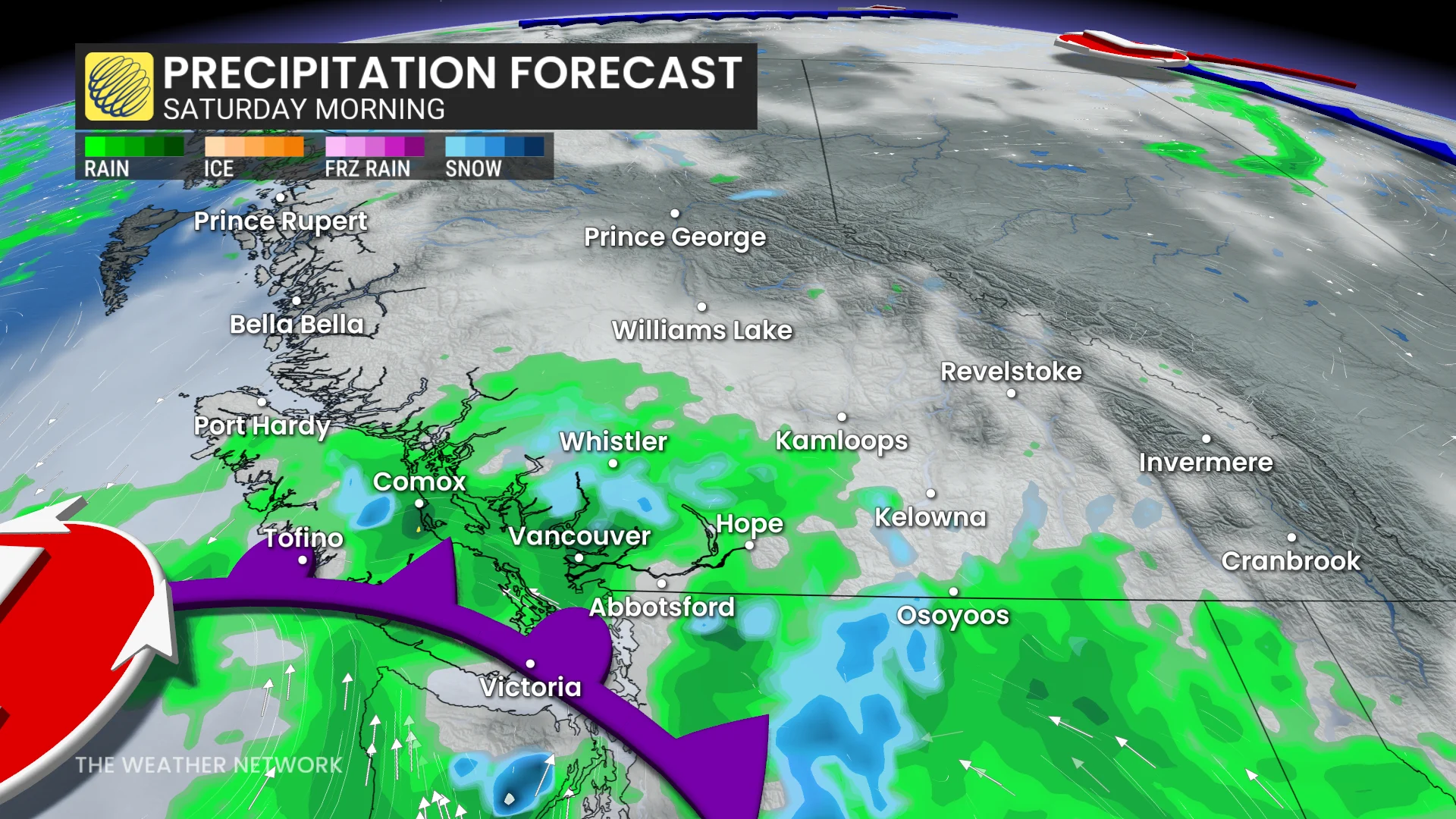
B.C.’s next system approaches from the southwest on Saturday
The heaviest rain will fall in the Lower Mainland late in the morning hours
Winds will rapidly increase across the region by Saturday evening
Prepare for ferry delays, power outages, and fallen tree branches
Another system arrives in B.C. on Saturday
The active pattern buffeting the West Coast continues into the final weekend of October as another system approaches the region heading into the day Saturday.
DON'T MISS: Winter-proof your home with a heat pump that even works in -30°C
An initial band of rain will sweep Vancouver Island during the mid-morning hours, eventually pushing toward Metro Vancouver later in the morning. Folks across the Lower Mainland could see two to four hours of steady rainfall, with the heaviest occurring in the late morning.
Behind the front, scattered showers will continue for the Lower Mainland and Vancouver Island through the day and into the overnight hours.

RELATED: Staying safe during a power outage
While the worst winds will remain focused south of the border, we can expect gusty winds to rapidly increase across Vancouver Island and the Lower Mainland into Saturday evening.
We could see gusts reach 50-70+ km/h throughout the region, including into the Fraser Valley. These conditions could result in ferry delays, power outages, and fallen tree branches, so residents should plan accordingly.
Temperatures across most of the province are forecast to remain cooler-than-seasonal through the end of the month, with daytime highs more typical of early November.
Header image created using graphics and imagery from Canva.