Blustery winds, downpours, hail mark eastern Prairies severe storm threat
Parts of the southern Prairies face ongoing storm activity on Sunday, with strong wind gusts and persistent downpours that will raise the risk of flooding
Parts of the Prairies' weekend could send on a stormy note as a risk of severe weather will surface once again for some areas, with more soaking rainfall possible on Sunday.
Canada's 2025 Fall Forecast: An extended pause could redefine the season ahead
Heavy rains targeted southeastern Saskatchewan on Saturday, with pockets of more than 50 mm near Estevan and Carlyle, Sask., and 30-50 mm in the Regina, Sask., area.
Stay alert for rapidly changing conditions in your area. Localized flooding is possible. Never attempt to drive across a flooded roadway. It’s impossible to tell how deep the water is until it’s too late.
It'll be important to remain weather-aware, and stay up-to-date on all of the latest watches and warnings as conditions change.
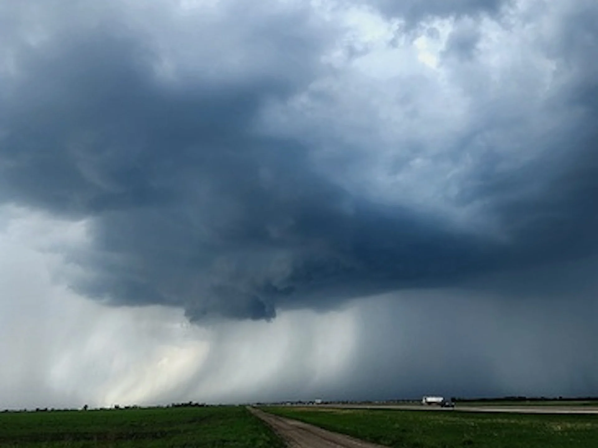
Severe storm threat bubbles up on the Prairies Sunday
A low-pressure system lifting north of the border will spark another round of strong to severe storms across parts of the Prairies to end the weekend.

Thunderstorms are expected to develop along a warm front through Sunday afternoon and into the evening hours.
The air mass associated with this is quite moisture-laden so heavy downpours are expected, with an elevated chance of localized flooding.
The greatest risk for severe weather will spread across southern Manitoba. The strongest thunderstorms could produce potent wind gusts, heavy rainfall, and large hail (nickel-sized or larger). Some wind gusts could exceed 80 km/h.

Southern Prairies will be the most active weather spot across Canada on Sunday since a majority of Canada's population will see dry weather for the next week or so.
Risk of thunderstorms persists into Monday, with it shifting into eastern Manitoba and northwestern Ontario. It will include the risk of large hail.

For most of the region, temperatures will be well above seasonal for the next 10+ days, even summer-like at times. However, temperatures will be much cooler where steady rain falls during the day.
Header image courtesy of Bob Ledoux, taken in Winnipeg, Man.
Stay with The Weather Network for all the latest on conditions across the Prairies.