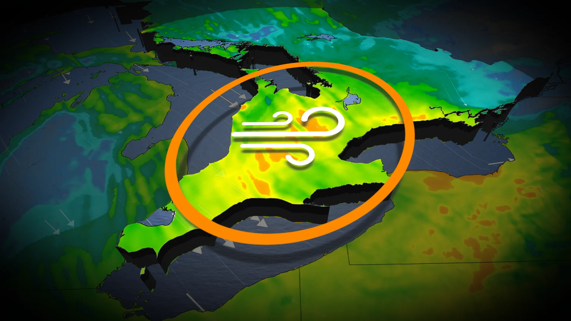
Blustery winds and temperature drop to hit Ontario before snow squalls
Change is on the horizon for southern Ontario as blustery winds and dropping temperatures will transition rain to snow for the second half of the week.
Southern Ontario is taking another plunge into winter this week and into December with several shots of Arctic air, gusty winds and lake-effect snowfall.
That means we will see multiple snow opportunities in the coming days, especially late week.
RELATED: Significant lake-effect snow squall event threatens 20+ cm in southern Ontario
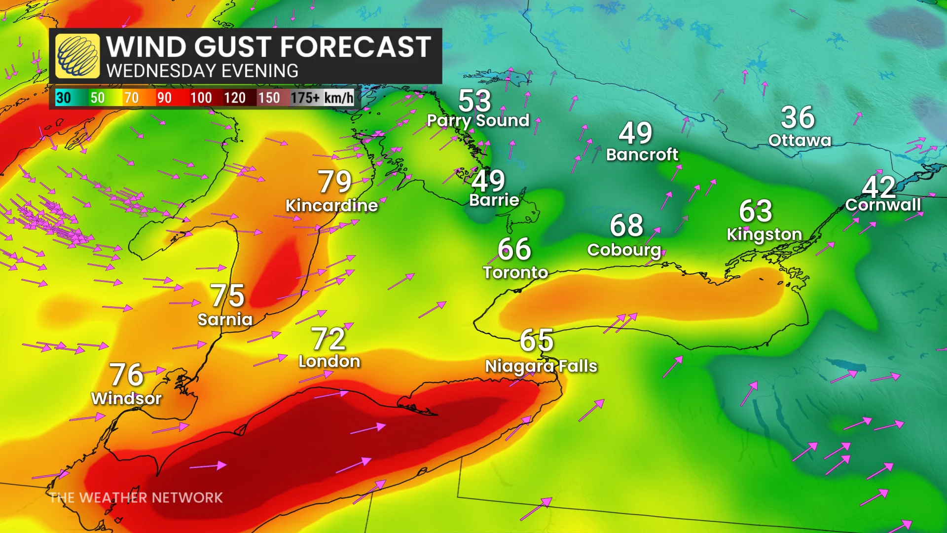
Before we get there, southern Ontario will be getting a considerable temperature plummet and blustery wind gusts as high as 80+ km/h for some areas on Wednesday, setting the stage for the significant, lake-effect snow squalls on Thursday and Friday.
Impacts include trickier drives with strong winds and possibility of localized power outages.
Wednesday: Wind gusts could cut power in some locales
Winds are forecast to pick up through Wednesday afternoon, bringing a steady fall in temperatures through the evening and overnight.
Southwesterly winds will begin to increase through the late morning into the early afternoon for southwestern regions. Gusts 60+ km/h are expected with exposed shorelines, which more likely to experience wind gusts near 80 km/h into the the afternoon hours.
DON'T MISS: Winter-proof your home with a heat pump that even works in -30°C
Widespread, southwesterly winds will blow across much of southern Ontario into Wednesday evening. Sustained winds of 40+ km/h and gusts 60-80+ km/h are expected. The strongest winds will be focused to the shorelines and southwest and parts of the Greater Toronto Area (GTA).
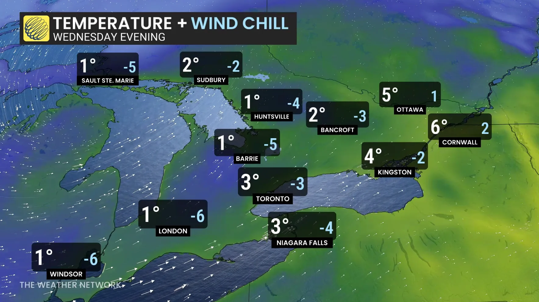
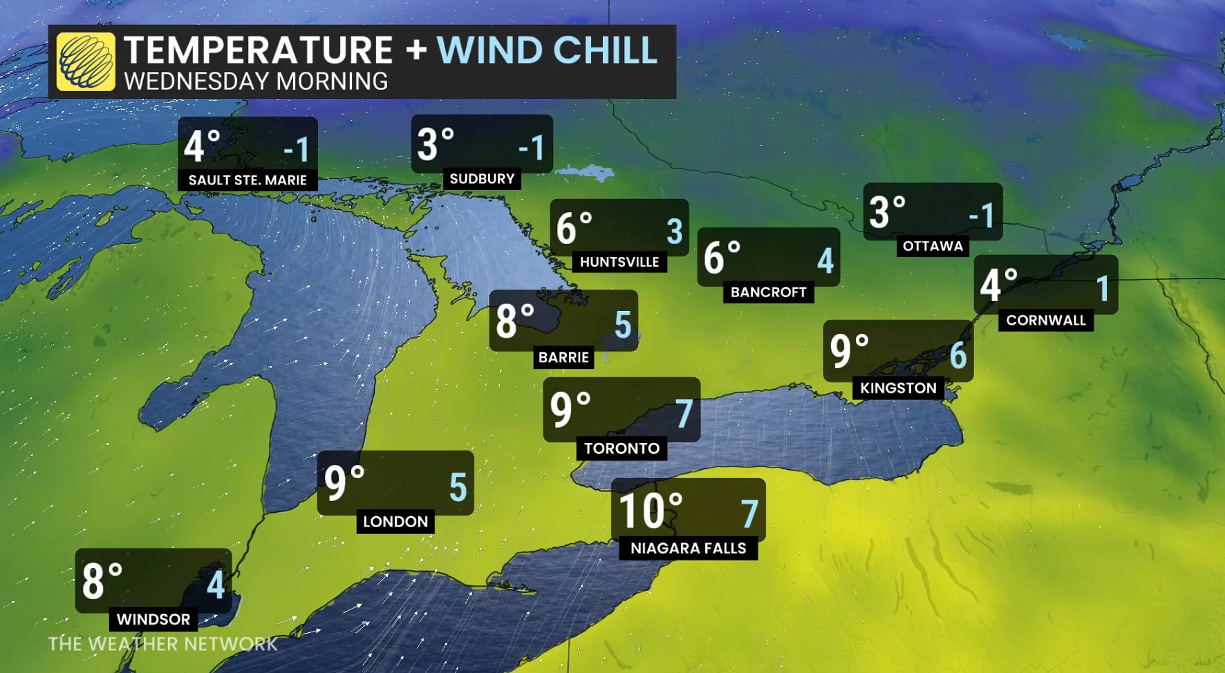
Late Wednesday and into Thursday is when conditions will begin to feel much more winter-like. Showers will transition to a wet mix and snow before winds align to deliver a heavy amount of snow in a multi-day, lake-effect snow event.
Rain-showers will transition to mixing and snow through the evening and overnight. Some slick roads are expected as temperatures tumble through the evening and overnight. Wind chills below the freezing mark will create a stark contrast to the double digits residents experienced in the morning.
Impacts include trickier drives with strong winds and possibility of localized power outages.
WATCH: Snow sweeps across Canada, but two provinces dodge the flakes
Stay tuned to The Weather Network for the latest forecast updates for Ontario.