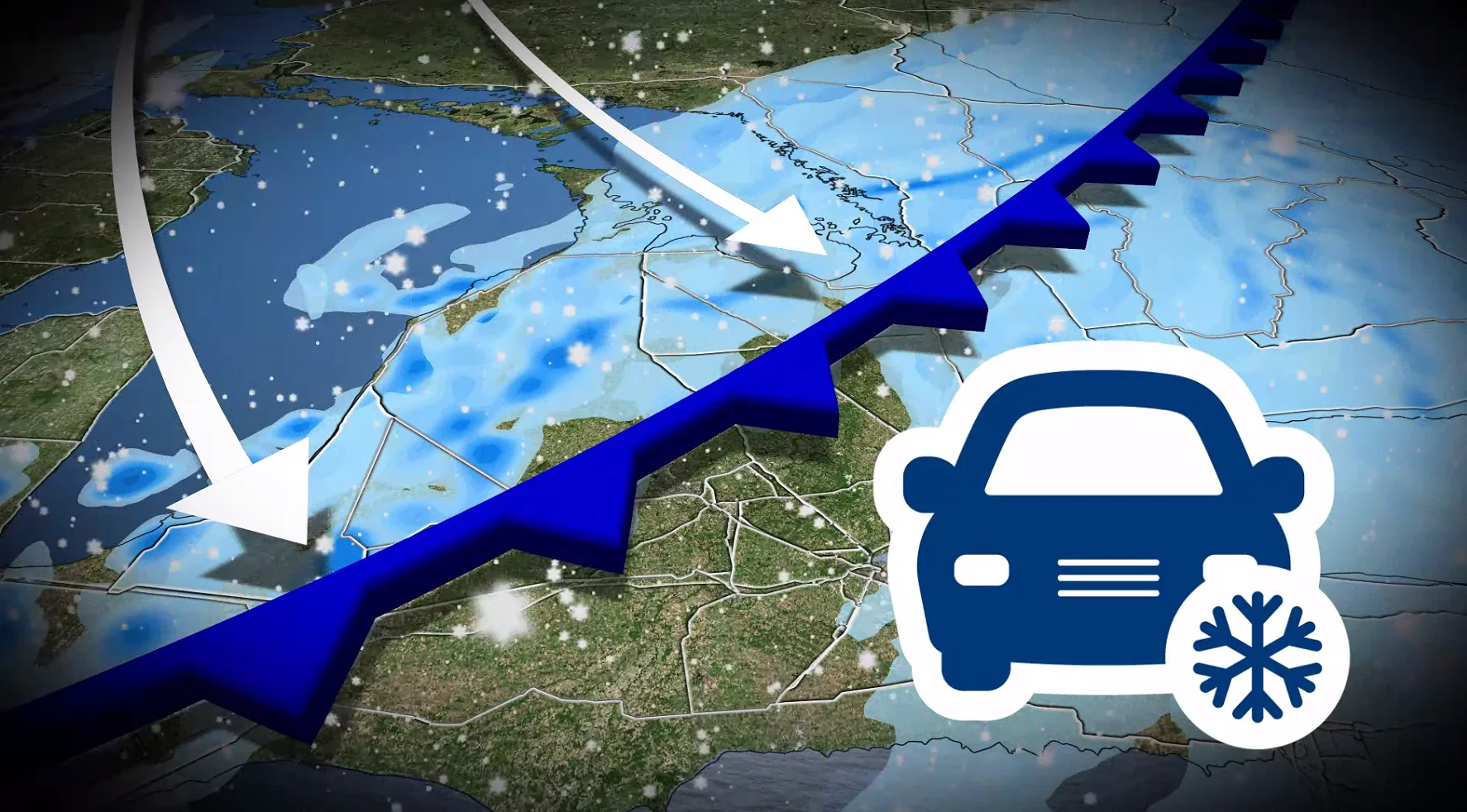
Blowing snow and dangerous wind chills start this weekend in Ontario
Snow and blowing snow on Friday are anticipated to cause poor visibility, whiteout conditions, and challenging travel. Temperatures are forecast to fall rapidly heading into Saturday, bringing the coldest wind chills of the season
Southern Ontario is set to experience intense snow bursts and strong wind gusts on Friday afternoon and evening. These conditions may lead to whiteouts and hazardous travel.
Temperatures are expected to drop significantly, as well, with wind chill values plummeting into the -30s.
DON'T MISS: A major mid-month pattern change will sweep Canada
Drivers are urged to exercise caution and plan for potential travel delays and even road closures into Saturday.
"Consider postponing non-essential travel until conditions improve," warns Environment and Climate Change Canada (ECCC) in the advisory. "If you become lost or stranded, remain where you are until conditions improve. Protect yourself from wind, cold and disorientation by staying sheltered, indoors or with your vehicle."
Snow to impact commute times on Friday
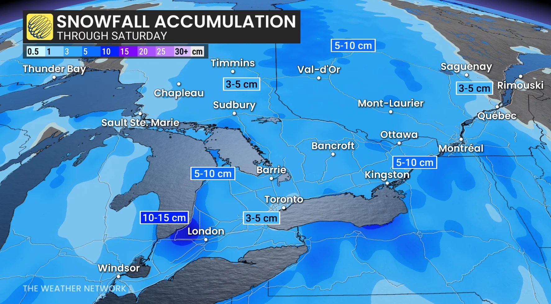
A clipper system from northwestern Canada will cross the province through Friday, resulting in 3-5+ cm of snow for most areas.
Locally higher amounts of 5-10 cm are expected for some areas outside of the GTA, towards Lake Huron, and across eastern Ontario.
Residents across the GTA and southern Ontario should prepare for snowy roads during Friday's commutes.

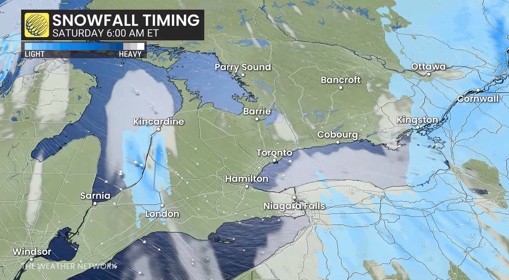
Frontal squall with blowing snow and whiteout conditions
As the low pressure system moves across Ontario, a strong frontal snowsquall will develop as Arctic air sweeps in behind a cold front. This squall could cause a rapid change from calm conditions to intense snow bursts, strong winds, and near whiteout conditions in some areas.
The front is expected to pass through late Friday afternoon into the evening, potentially impacting the evening commute in the GTA.
Winds are forecast to gust 50-70+ km/h, with stronger gusts possible along the lakeshore. Blowing and drifting snow could lead to reduced visibility, particularly on county roads and areas near the snowbelts. Use extra caution when travelling.
DON'T MISS: February’s significant daylight comeback is here, Canada
Lake-effect snow off Lake Huron is expected to develop overnight and persist into Saturday morning, leading to locally higher snowfall accumulations in the London area.
Risk for the coldest wind chill of the season this weekend
A surge of Arctic air will move into Ontario this weekend, delivering a blast of cold weather and bitter wind chills. Temperatures are set to plummet Friday evening, dropping rapidly at a rate of 3°C or more per hour overnight.
Daytime highs this weekend will hover in the mid-minus teens, while overnight lows could dip into the -20s. Wind chills are expected in the low -20s, with some areas seeing values in the -30s.

Prolonged exposure to these conditions increases the risk of frostbite, so limit time outdoors and dress in proper winter layers. Cold weather warnings are likely to be issued.
RELATED: Ontario’s longest cold snap in over a decade: Is the end near?
While temperatures in the -20°C range are not unusual for this time of year — the latest -20°C recorded in Toronto occurred on March 20, 1949 — the prolonged winter chill may feel particularly challenging for those ready for some spring-like conditions.
Temperatures finally return to seasonal values, but at the cost of messy storms
Long-range models suggest a potential weakening of the cold pattern gripping Ontario by late next week.
DON'T MISS: Groundhog Day 2026: See the predictions here!
While a significant warm-up isn't certain, the atmospheric blocking pattern causing well below seasonal temperatures could break down, allowing near or above seasonal highs—around -1°C in Toronto—to move in.

However, this shift in the jet stream could bring more active weather to the region. The setup may result in multiple types of precipitation, including freezing rain, as milder air mixes with lingering cold conditions.