50+ cm: Dangerous travel amid Prairies blizzard, intense snow squalls
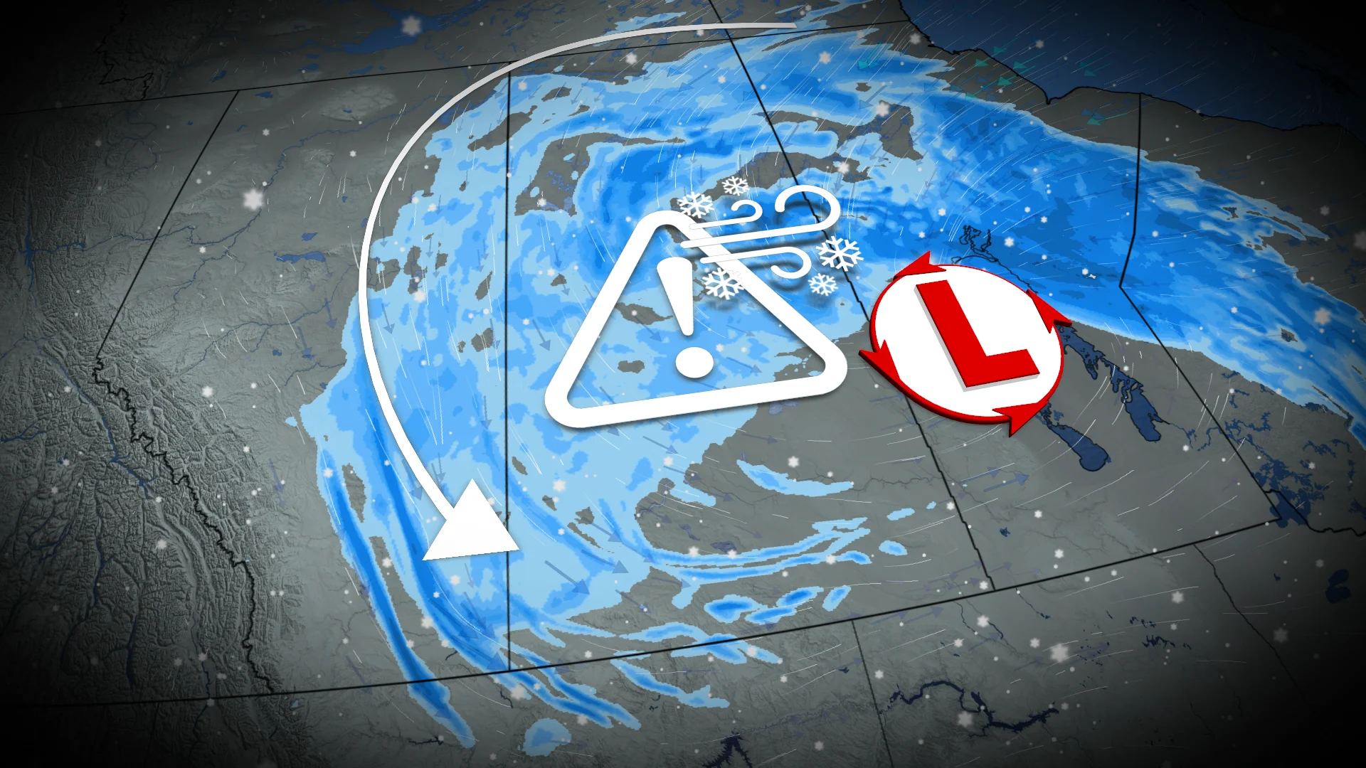
A powerful, slow-moving storm is expected to deliver 30–50+ cm of snow and whiteout conditions across parts of Saskatchewan and Manitoba, causing significant disruptions
A high-impact springtime snowfall moving across the Prairies will snarl travel from Alberta to Manitoba through the end of the week.
Expect strong winds and widespread heavy snowfall, with some areas likely surpassing 50 cm of accumulation.
The system is expected to retrograde westward into Saskatchewan on Friday, prolonging its impacts on the region before gradually dissipating this weekend.
DON'T MISS: Summer Sneak Peek: El Niño may split Canada’s summer in two
Weather Highlights:
Widespread snow on the southern Prairies with 20-50+ cm expected in the north
Strong winds will result in extensive, blowing snow and reduced visibility, especially on the Yellowhead Highway and along Highway 1 west of Saskatoon and Regina
The good news, at least, is that the precipitation is much-needed moisture as the region prepares for fire season
Travel disruptions and hazardous road conditions are likely, so plan accordingly and check local updates for the latest weather alerts.
Expect hazardous travel, blizzard conditions in some areas
Snow is falling and winds are howling across parts of the Prairies as our wintry storm brings a significant drop in temperatures and challenging weather conditions.
Wind gusts of 60-90 km/h will contribute to whiteout conditions, making travel dangerous with reduced visibility.

RELATED: What turns a snowstorm into a raging blizzard?
Heavy snowfall continues across northern Saskatchewan and Manitoba, with wind gusts exceeding 60 km/h, resulting in poor visibility and hazardous conditions.
An orange blizzard warning was issued for parts of central and northern Manitoba due to the severe blowing snow and reduced visibility.
Alberta snow squalls forecast as storm lingers over the Prairies
Atmospheric blocking will keep the system stalled over the Prairies, forcing it to retrograde westward. This shift will trigger local snow squalls and bands of heavy snow beginning late Thursday in parts of Alberta.

Snow squalls, which are brief but intense, may develop near Edmonton, Cold Lake, and Prince Albert on Thursday evening. These narrow bursts of heavy snowfall will create rapidly changing conditions, including reduced visibility and localized impacts.
By Friday morning, these snow bands are expected to intensify and spread further into Alberta, resulting in unpredictable and challenging commutes. Snowfall totals from squalls could reach 5-15 cm, though their exact location remains difficult to pinpoint.

Meanwhile, northern Saskatchewan and Manitoba will continue to experience ongoing heavy snowfall, with accumulations of 30-50+ cm expected by the time conditions begin to ease on Saturday.
Drivers are advised to prepare for whiteouts and to monitor local forecasts for sudden changes in weather through Friday.
Stay tuned to The Weather Network as we continue to update the forecast for the Prairies.