
Blizzard conditions, up to 50 cm possible as nor’easter arrives
Intense snowfall rates and high winds will buffet portions of Atlantic Canada through the beginning of the week
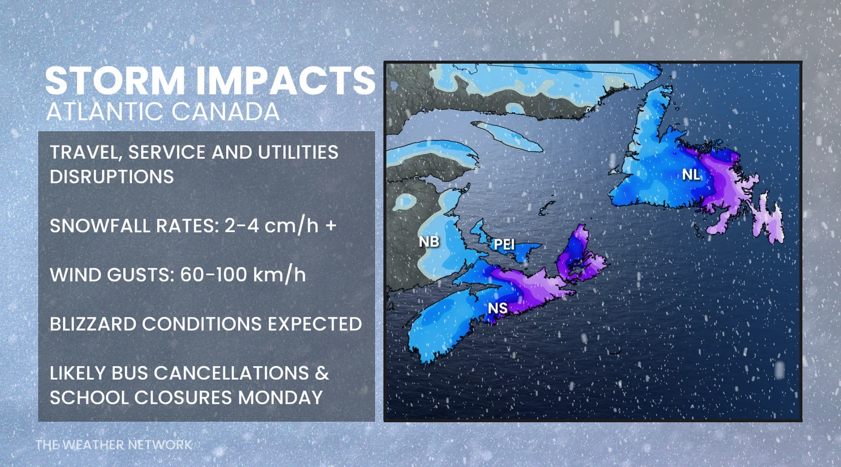
A powerful nor’easter rolling toward Atlantic Canada could produce significant and widespread disruptions on Monday and Tuesday.
The system threatens up to 50 cm of snowfall for some areas, while blustery winds could lead to blizzard conditions during the height of the storm.
DON’T MISS: Brewing nor’easter drops 40+ cm of snow in rare southern storm
Hazardous winter conditions continue through Monday
A powerful nor’easter formed off the coast of North Carolina late Saturday night, helping to bring historic snowfall totals to the region. All that energy and moisture is heading straight for portions of Atlantic Canada to start the new workweek.
Snow already began pushing into the southern Maritimes late Sunday afternoon, with snowfall rates and wind gusts intensifying through Monday morning. Before dawn, Halifax had already picked up 11 cm of snow, prompting some school closures and delays. Groundhog Day events in Nova Scotia were also cancelled due to the forecast.
Blizzard conditions and 50+ cm of snow for parts of Newfoundland
The greatest impacts however, are expected across eastern Newfoundland and the Avalon Peninsula, where schools closed first thing Monday morning and buses were pulled off the roads. Municipal buildings were also closed and services cancelled.
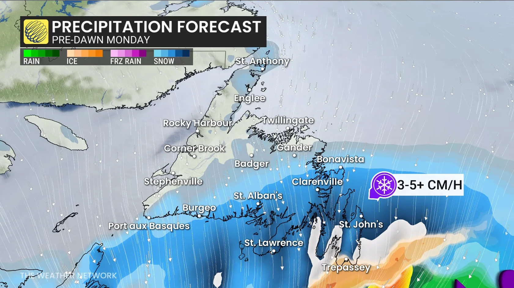
Peak snowfall rates of 3-5 cm per hour will pair with 60-90+ km/h winds here to create whiteout conditions. Travel will be nearly impossible given reduced visibility and rapid snow accumulation.
As the centre of the low makes a close pass southeast of the Avalon late Monday morning, some mixing is possible as temperature warm just above the freezing mark. Don’t be fooled by this transition, though, as another heavy burst of snow is expected to develop Monday night.

By the end of the storm, totals may exceed 50 cm in and around St. John’s, with widespread accumulations of 20-40 cm expected throughout eastern Newfoundland.
Snowfall totals have trended downward in Nova Scotia, with 10-15 cm on tap for the Halifax area, and heavier totals in the forecast closer to Sydney.
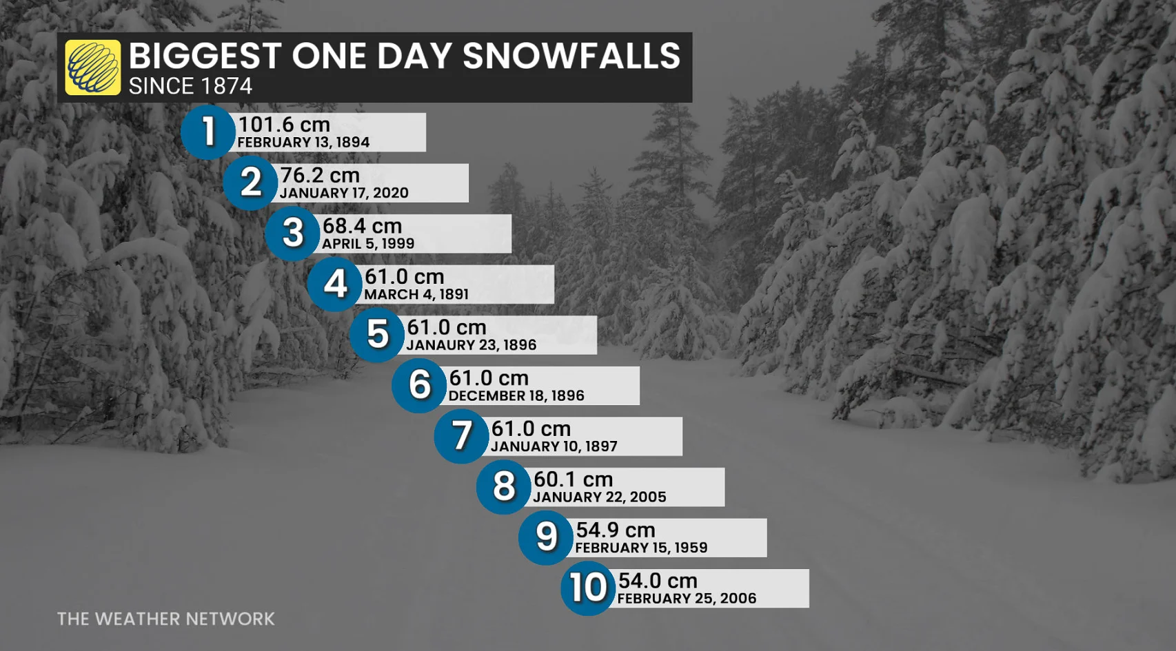
While that St. John’s total is quite hefty and disruptive, this likely wouldn’t be one of St. John’s largest snowfalls on record. That’s a high bar to reach in Canada’s easternmost city, where 16 days on record have produced at least 50 cm of snowfall.
The snowiest day on record at the St. John’s Airport was Feb. 13, 1894, which saw a whopping 101.6 cm of accumulation. The number-two spot was the memorable snowfall of Jan. 17, 2020, when the city picked up 76.2 inches by the end of the day.
Stay with The Weather Network for all the latest on this East Coast nor’easter.