Plan ahead, Ontario. Risk of freezing rain Tuesday
Southern Ontario faces snow Monday, freezing rain Tuesday, and a milder, wet end to the week. Plan ahead, and brace for the changing conditions
A blast of snow moves through southern Ontario Monday, potentially disrupting commute times as traffic patterns return to normal post-holiday season.
Parts of the Greater Toronto Area (GTA) are under a Yellow Warning for snowfall with up to 10 cm possible throughout the day.
DON'T MISS: January outlook: Winter hits pause in Canada before striking back
Travel may be impacted, so prepare for delays and changing road conditions. Plan ahead and keep an eye on highway conditions before hitting the road on Monday.
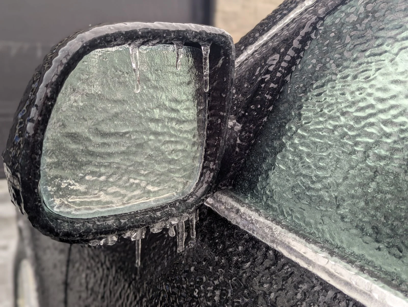
A new system is set to arrive on Tuesday as well, bringing a warm front and a risk of freezing rain to areas northwest of the GTA. This includes regions that experienced similar conditions during last weekend's system. Stay alert for possible weather advisories and icy road conditions.
Snow hits Monday with the return to work and school
Snow began early Monday west of the Niagara Escarpment, continuing to spread eastward through the morning hours.
Peak snowfall rates of 1-2 cm/hour are forecast between 7-11 a.m. for northern GTA areas and regions north of Lake Ontario, making for a slow and hazardous commute.

By the afternoon, snowfall will taper as the system moves east, though light snow will persist in eastern Ontario. By Monday evening, only light flurries are expected.
Drivers should allow extra time for travel delays as snow accumulates. Active plowing on main highways is likely to cause additional slowdowns.

Winds will remain between 20-30 km/h, limiting blowing snow, but visibility may be reduced under heavier snow bands.
WATCH: Poorly-timed snowfall will hit GTA's morning commute
January thaw brings messy system on Tuesday
Looking ahead, a Colorado low arriving Tuesday will bring our next bout of messy weather. The system will drag much milder air across the region, but the cold air is forecast to put up a fight.
We’ll see a wintry mix develop by late Tuesday morning, spreading in from southwestern Ontario. This warm front will tend to produce freezing rain inland, across similar locations northwest of the GTA that dealt with the system over Boxing Day weekend.

The warm air will likely fail to fully push across eastern Ontario, so precipitation north of the wintry mix is forecast to remain primarily as snowfall.
Additional snowfall totals of 5-15 cm are forecast north of the GTA and extending into eastern Ontario, including for cottage country. The highest amounts are expected north of Highway 7 toward Ottawa, while totals across cottage country and Georgian Bay could exceed 10 cm as well.

Combining both systems, some regions are looking at more than 20 cm of additional snowfall over the next few days, particularly in areas with the highest existing snowpack.
Mild and wet end to the week
The active weather pattern persists with two additional systems expected to impact the region later this week. The first system arrives Friday, bringing widespread rain as mild temperatures rise to the upper single digits. Originating from the southern U.S., this system carries warmer conditions.

The second system on Saturday may bring a more wintry mix, including various precipitation types, stronger winds, and greater potential impacts.
WATCH: January cold hits pause before winter stages a comeback in Canada
Stay with The Weather Network for the latest updates across Ontario