
B.C. to see another burst of heat with fall just around the corner
A new heat wave is forecast in B.C’s valleys this week, with temperatures expected to reach or surpass the 30-degree mark before the fall season arrives
After parts of B.C. received a good soaking on the weekend from an atmospheric river, other areas of the province are set to see another late-summer heat wave just days before the official start of fall.
The southern Interior will be especially warm, with a few of the traditionally hot locations expected to top the 30-degree mark by Tuesday.
Canada's 2025 Fall Forecast: An extended pause could redefine the season ahead
The South Coast region won't be as hot, and will be closer to seasonal or a few degrees above seasonal, but it will still see a very nice stretch of weather. However, the heat wave will be short-lived as temperatures will drop on the weekend, with a bout of rainfall for many areas, too.
Late-summer heat wave before the arrival of fall
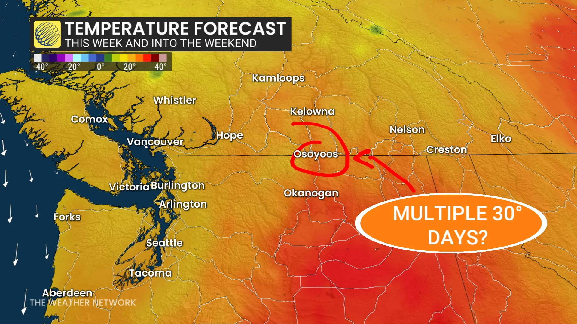
More 30-degree days are possible through this week in B.C. under a mid- to late-September heat wave.
High pressure moving in Tuesday will cause temperatures to soar 5°C to 10°C above normal for this time of year across B.C.'s South Coast.
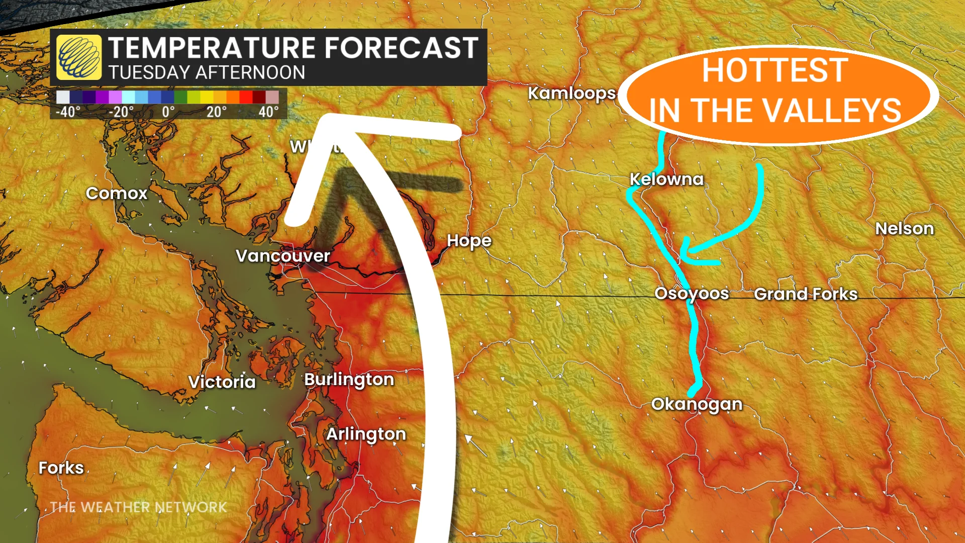
Vancouver's forecast for Tuesday calls for a temperature of 27°C, seven degrees above normal (20°C).
Meanwhile, Kamloops, Kelowna and Osoyoos have chance for high 20s or the low 30s admist full sunshine.
On Wednesday, the coast will be cooler thanks to an onshore flow expected to settle temperatures closer to seasonal, but that is not the case for the valleys.

Heat and sunny skies in the valleys will persist through the week and into the weekend. The Osoyoos will have the multi-day opportunity to see 30-degree readings through Saturday. Meanwhile, the normal for this time of the year is 20°C.
So far, it has had 66 30-degree days this year. There have only been a handful of dates of recorded 30°C readings on or after Sept. 20 in Kamloops (nine to be exact). The most recent occurred on Sept. 24, 2011, and the latest took place on Oct. 8, 1911.
However, the start of the rainy season is in sight. It may miss the Interior, but it will offer cooler, more seasonal temperatures in the long-range.
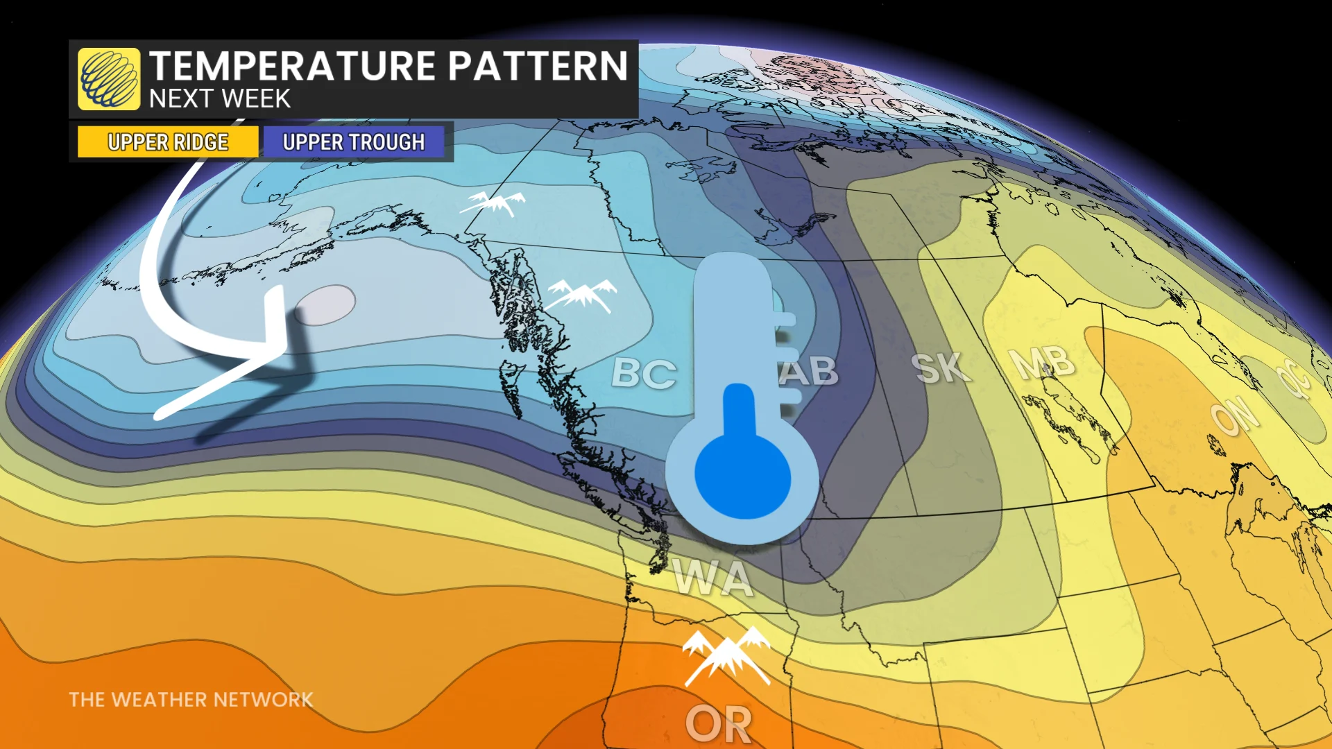
Widespread rain is expected to develop for the South Coast region this weekend as a system tracks in. A wetter-than-normal pattern is expected for the final week of September with a few systems tracking into the region, bringing the potential for heavy rain and cooler but seasonal temperatures.
Stay with The Weather Network for all the latest on conditions across B.C.