Parts of Newfoundland to see blizzard conditions as potent storm packs wallop
Powerful winds and heavy snowfall are expected to stick around through Monday overnight in Newfoundland, creating blizzard conditions for parts of the province
An intensifying low-pressure system that brought parts of the Maritimes a bout of heavy snow on Monday, leading to hazardous travel and the closures of some Nova Scotia schools, will now focus its efforts on Newfoundland into Tuesday.
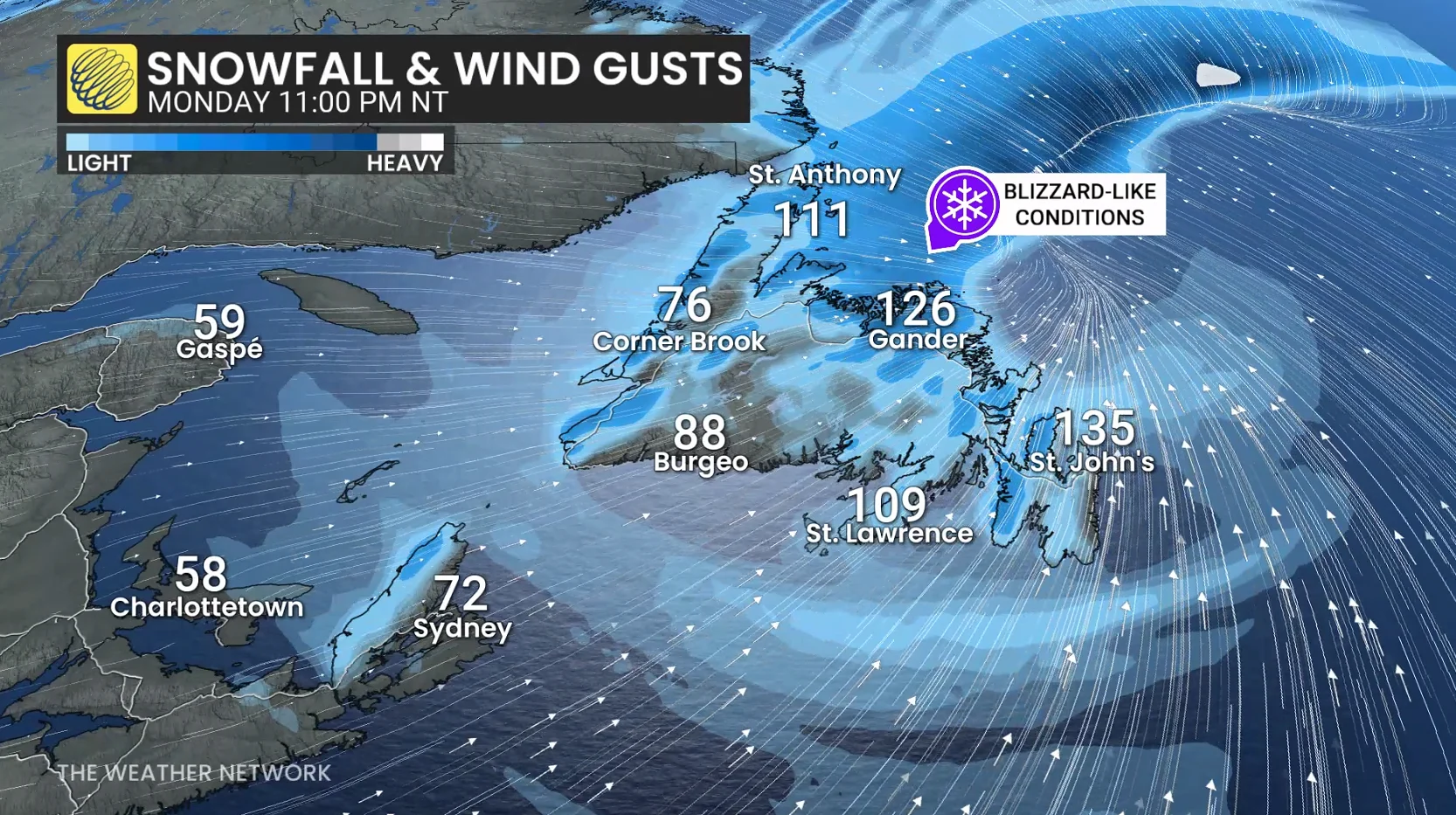
Some areas could see 20-40+ cm of snow through Tuesday. Widespread warnings are in effect, including wind warnings, with gusts between 100-130 km/h expected.
DON’T MISS: What turns a snowstorm into a raging blizzard?
As well, Visibility will likely be suddenly reduced to near zero at times amid heavy snowfall, creating blizzard conditions for parts of Newfoundland.
Residents are advised to secure outdoor items that strong winds could lift, prepare for potential prolonged power outages, and keep mobile devices fully charged.
Dangerous blizzard conditions likely across Newfoundland
The Avalon Peninsula transitioned to snow and blowing snow, which will persist Monday overnight.

Heavy snow will continue across central and western parts of Newfoundland, with sea-effect snow and widespread, blowing snow through the evening and overnight.
Intense wind gusts will continue through the overnight, too. Wind gusts of 100-130 km/h are forecast for some areas, with coastal areas exceeding 130 km/h through the evening and overnight. That includes the Avalon and city of St. John’s.
Blizzard conditions are forecast for central and western parts of the island though the evening and overnight, with widespread, blowing snow across the entire island.
Non-essential travel is not recommended Monday evening and overnight due to hazardous conditions.
20-40+ cm of snow is forecast across central and western parts of the island through Tuesday, with less than 10 cm forecast for the Avalon.
On Tuesday, widespread snow will ease through Tuesday morning. Powerful winds will ease but blustery, windy conditions will continue through the day, with blowing and drifting snow--making for difficult travel still.

Even though the snowfall will have diminished, visibility and poor travel will still be expected with the winds.
Likely impacts include closures, outages
Anyone can easily become disoriented in near-zero visibility, even just venturing a short distance away from safe shelter. Power outages and tree damage are likely amid the storm’s high winds.
Expect school closures and activity cancellations as a result of this storm.
Widespread travel delays are likely, including ferry delays and cancellations. Strong winds may easily exceed the safe operating limits of passenger flights into and out of the region, prompting additional delays and cancellations.
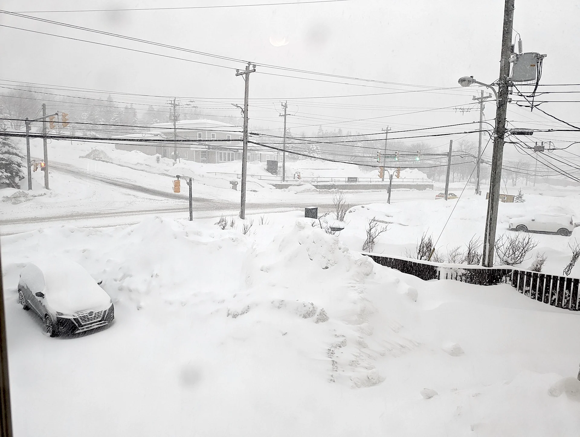
Thumbnail courtesy of Colin Lane.
WATCH: Nova Scotia hammered with heavy snow to start the week
Be sure to check back for the latest weather updates across Atlantic Canada.