Autumn weather in full gear in Ontario with rain, snow and waterspout risk
A more typical autumnal pattern has returned this week for southern Ontario. Chilly, wet weather is anticipated for the Great Lakes with bands of lake-effect rain, and maybe even waterspouts. Northern parts of Ontario could see some wet snow.
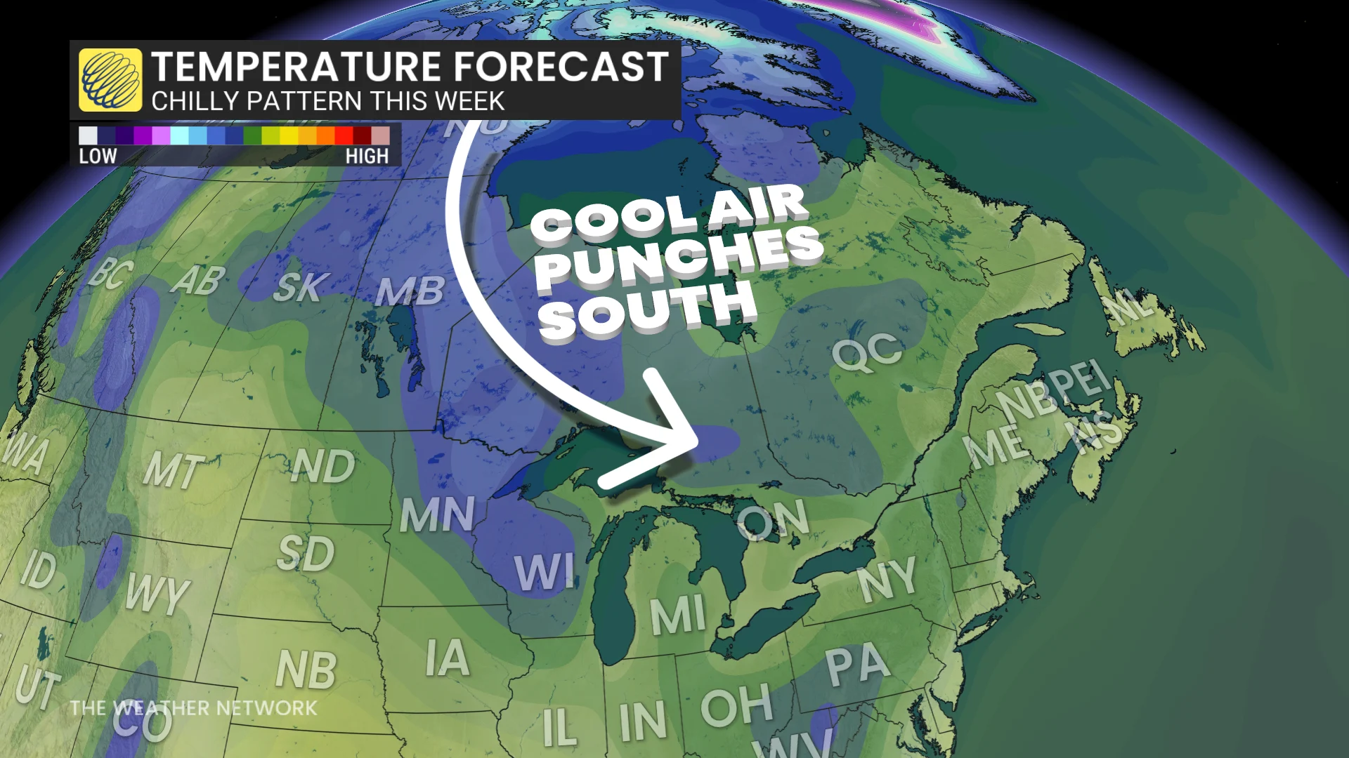
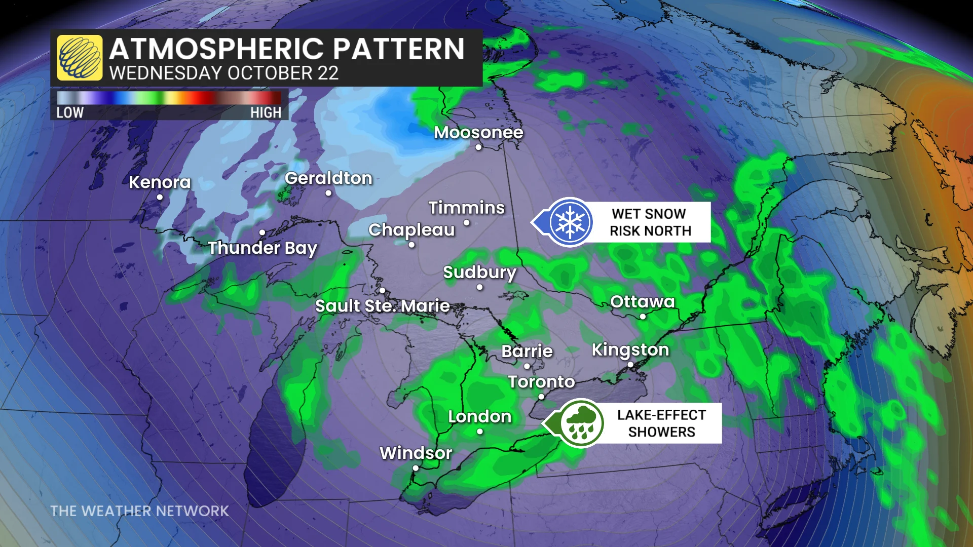
A cold, upper-level trough will tumble into Ontario this week and stir up the atmosphere with thunderstorms, showers, lake-effect rain, possible waterspouts and even snow for northern portions of the province.
Ontario likely saw its last 20°C of the year on Sunday, so we hope you enjoyed it. A chillier, more seasonal conditions will finish off October.
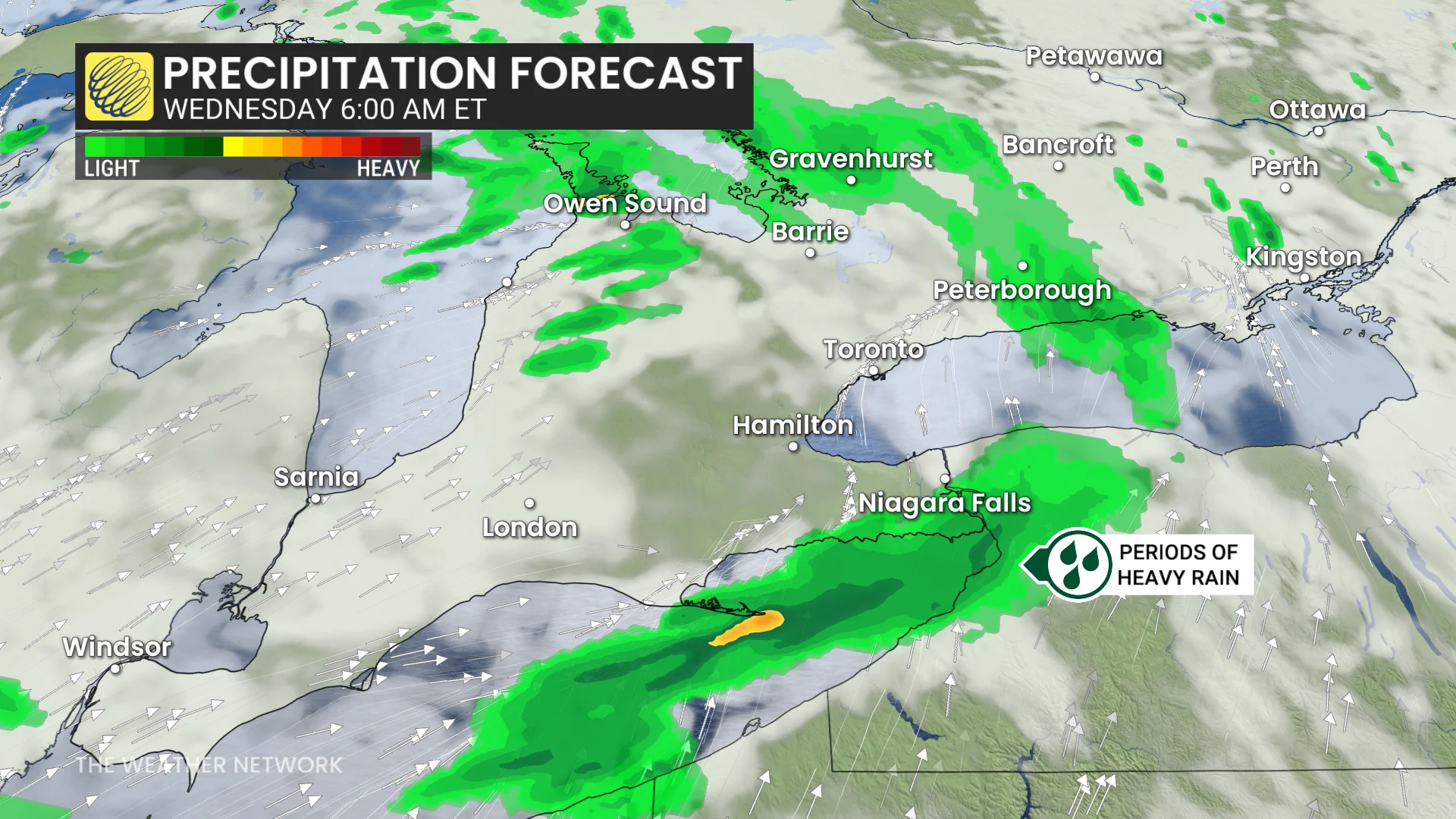
The unsettled weather will include an intense band of heavy, lake-effect rain off Lake Erie, expected to reach into southern parts of the Niagara region, including Fort Erie and possibly into Niagara Falls. Localized rain totals could reach 50+mm, with the potential for thunder, hail, and graupel.
DON'T MISS: Winter-proof your home with a heat pump that even works in -30°C
Wednesday and beyond:
A potent pattern change begins. From Wednesday into the weekend, expect much chillier temperatures that will be a few degrees below seasonal--low double digits.
DON’T MISS: Warmth hangs on through fall—but winter's closing in
Behind the cold front, chilly and brisk, westerly winds will move over the relatively warm waters of Lake Erie and Lake Huron. That will set the stage for respectable, lake-effect showers Tuesday night through Wednesday. Areas impacted will see prolonged periods of rain.
Bruce County will be the target for lake-effect rain off Lake Huron, possibly totalling 10-30 mm. Rain will be spotty through Wednesday morning before becoming organized by the evening.
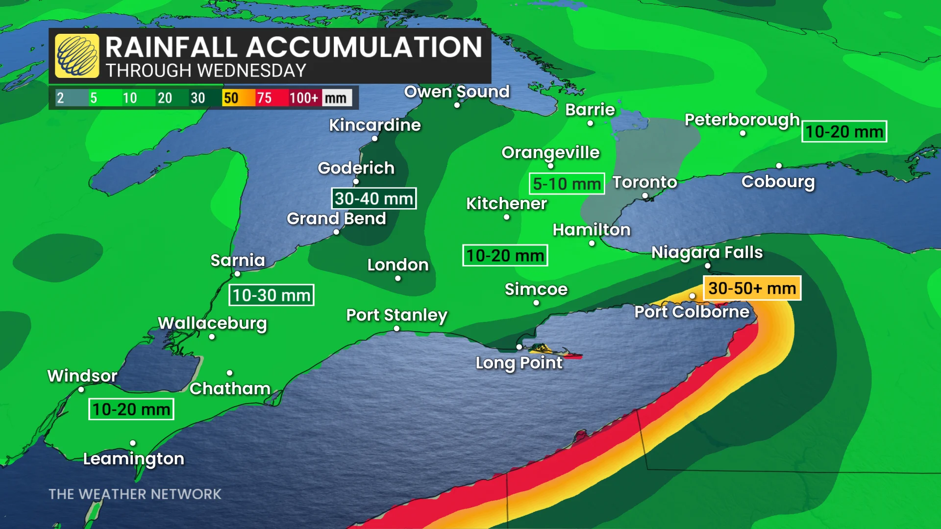
However, 50+mm is possible for Norfolk, Haldimand County and Niagara because they will be under an intense, lake-effect rain band off of Lake Erie that may come with lightning or hail due to its convective nature. Some travel disruptions in the morning commute is possible.
There is the potential for waterspouts, as well, due to a sharp contrast between lake surface temperatures and air temperatures aloft.
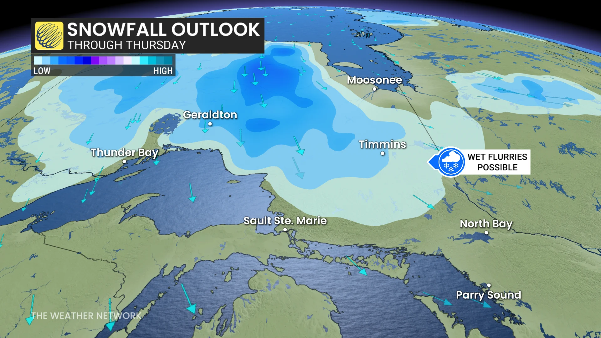
North of the Great Lakes, rain and snow-showers will be ongoing from Tuesday to late Friday across the districts of Kenora, Thunder Bay and Cochrane.
Snow accumulation will be slim to none thanks to marginal temperatures, which will hover around the freezing mark, and weak precipitation rates.