August wraps up in stormy summer heat across British Columbia
Meteorological summer may be coming to a close, but the summer heat and thunderstorms in British Columbia heading into the long weekend are not.
Starting on August 24th, Lytton reached a high of 40.3°C, then over the 25th and 26th, the high jumped to 41.3°C, reaching a Canadian all-time high for this year’s summer. Then, once again on Wednesday, preliminary temperatures reached 40.1°C, marking a consecutive 4-day stretch of above 40°C.
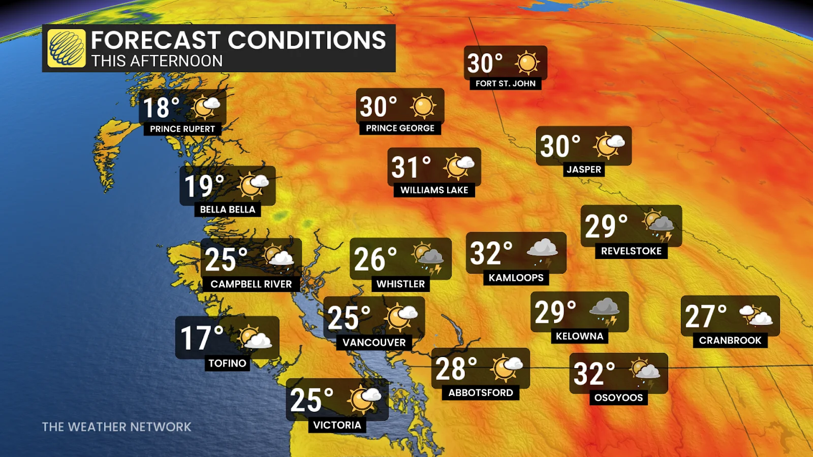
While temperatures will ease slightly heading into the long weekend, the persistent heat will give way to a thunderstorm risk.
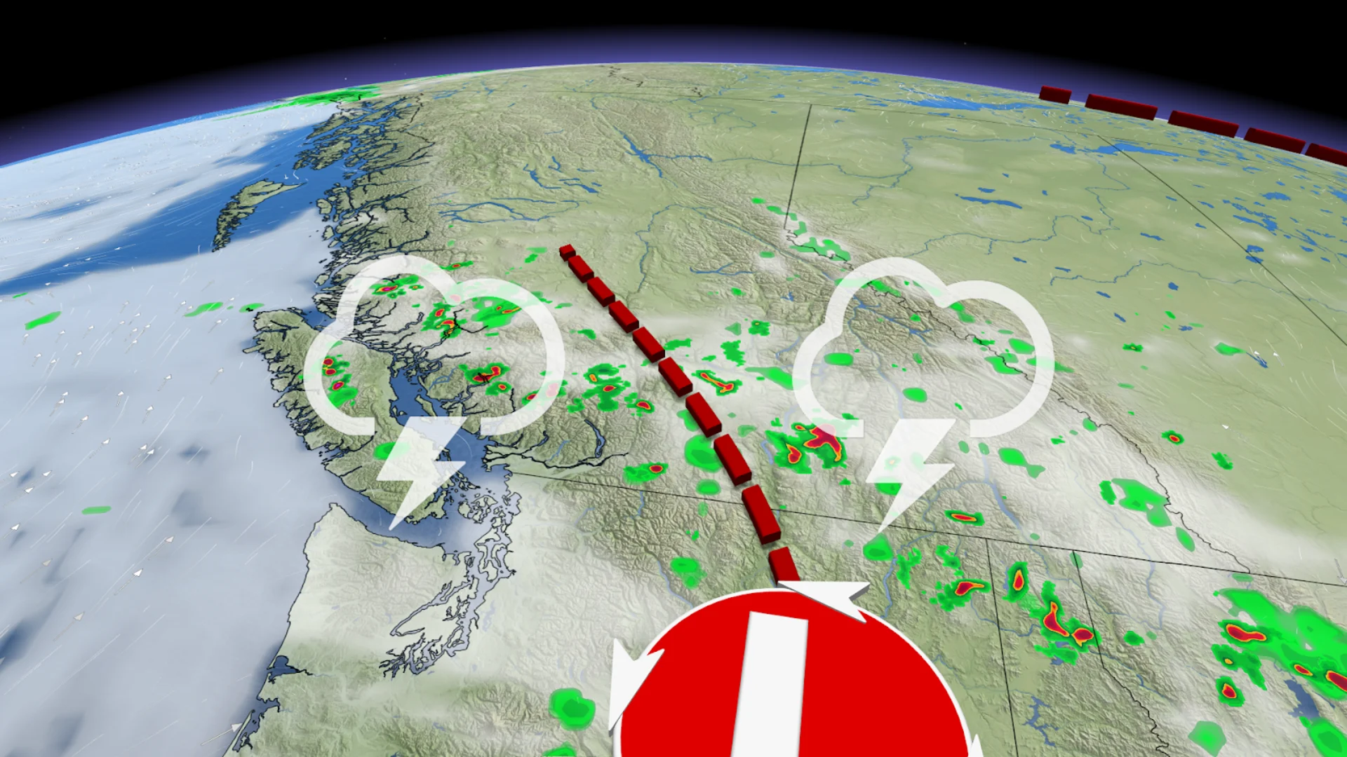
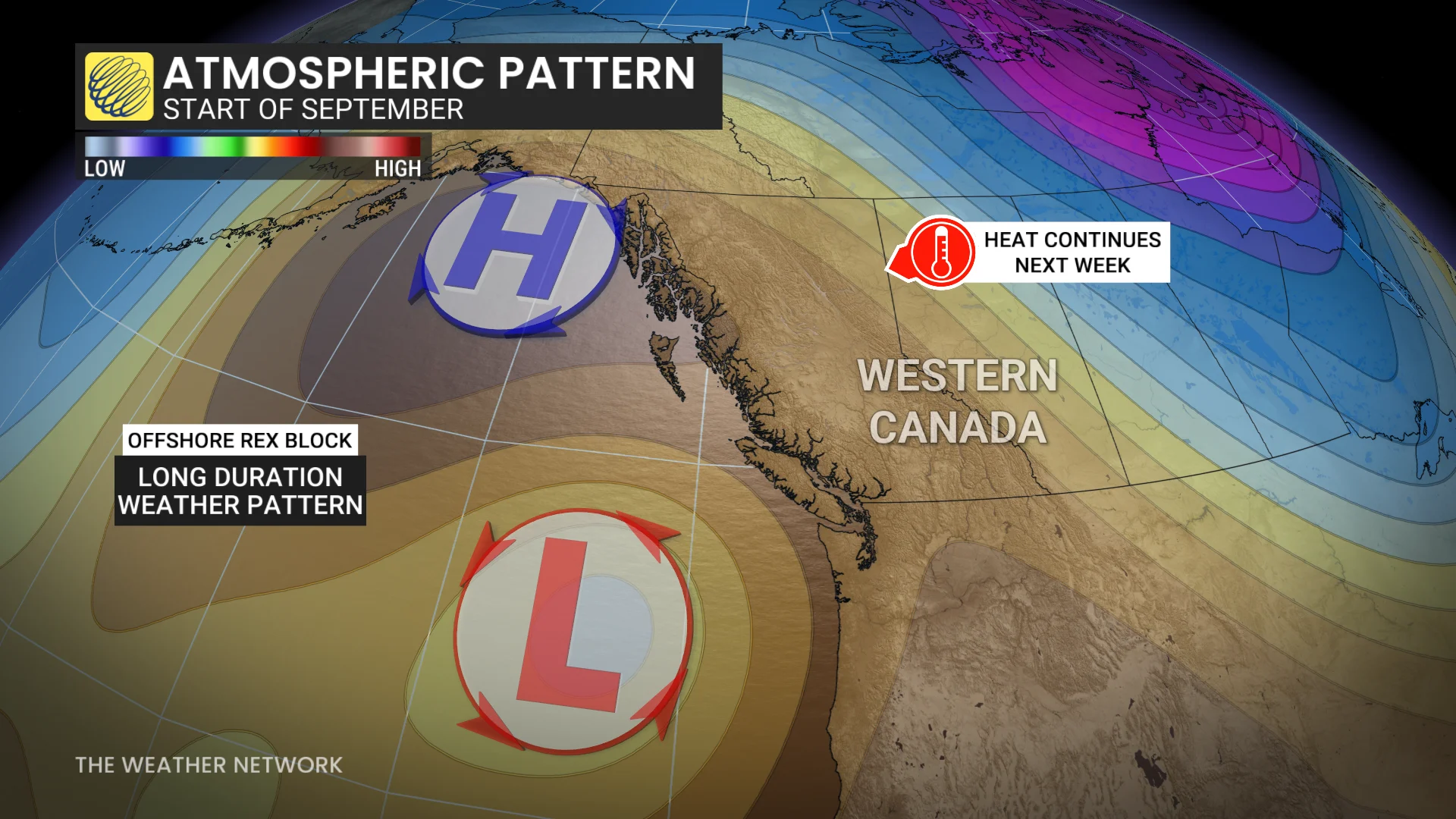
A ridge in the upper atmosphere has been pulling hot southern air up into B.C. for the past while, but a trough at the surface and a Pacific low will throw a wrench in the atmosphere's stability.
SEE ALSO: Destructive hailstorms carved 400+ km scar on the Prairies
The surface trough will bring a slight break to the extreme heat across the province, although it will still be hot, and the Pacific low sliding up the West Coast will fuel the instability in the atmosphere heading through the weekend.

The heat has been fairly dry across the province, so the storms won't have much moisture to tap into through the long weekend. That means we likely won't be seeing much heavy rain and localized flooding, but it also increases the risk of dry lightning, which could ignite wildfires in dry areas.
B.C., except for the South Coast, can expect to see high 30s for most of the long weekend into the beginning of September, with risks of another heat wave as brief high pressure builds in the north next week.
Long weekend kicks off with a risk of thunder
Folks in the Kootenays may have been woken up by some rumbles of thunder early Friday morning as storms fired up in the pre-dawn hours.
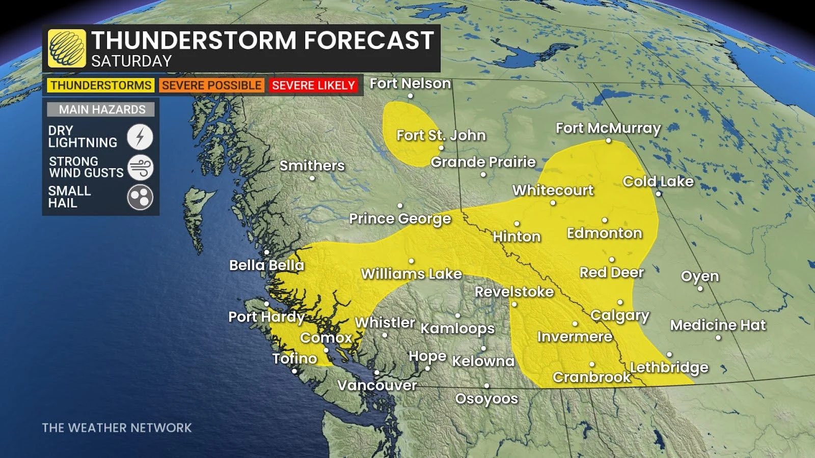
Instability in the atmosphere will continue to build through Friday afternoon, with a widespread risk of thunderstorms extending from the Rocky Mountains and into the Fraser Valley.

Further west, Vancouver Island and the Sunshine Coast may also see some thunderstorms pop up in the afternoon and evening hours.
Strong wind gusts and small hail may also accompany some of these storms. The storms are expected to stay non-severe in nature, though.
DON'T MISS: Wildfire near Peachland, B.C., being held after evacuation, Highway 97 closure
This pattern will continue to interrupt the day through Saturday, with only the Okanagan being safe from the thunderstorm risk.

Conditions improve Sunday and Monday
The second half of the weekend will feature fewer stormy or rainy interruptions for most of the province.
Folks across the Interior can expect a mix of sun and cloud to close out the month and welcome in September, but we will see a chance for isolated showers to pop up across the Lower Mainland.
We could also see a storm or two fire up in the Fraser Valley and on Vancouver Island.

You can expect next week to be another run of high temperatures, 5-10 degrees, or more above normal, with many areas in the 30s. This’ll continue the heightened fire danger and health risk, especially for vulnerable people.
Stay with The Weather Network for more information and updates on your weather across B.C.
