Atmospheric river will deliver a month's worth of rain in just 3 days
An atmospheric river is on track to impact the B.C. coast, delivering much-needed relief to areas experiencing dry conditions and an elevated wildfire risk.
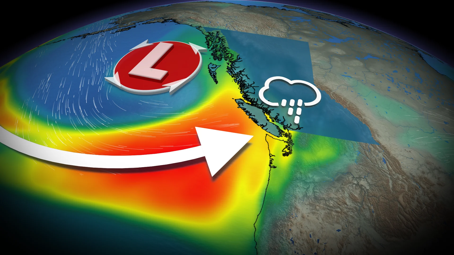
A Gulf of Alaska low-pressure system is ushering in significant rainfall and a cooldown for B.C.'s South Coast, bringing fall-like conditions to the region.
This developing system will draw in a stream of Pacific moisture, establishing an atmospheric river along the B.C. coastline. Rain is set to begin Thursday and will become more widespread and organized throughout the day.
SEE ALSO: 'Megathrust' earthquake fault line confirmed off Haida Gwaii, capable of generating large tsunamis
It will be a highly beneficial rainfall since it will be spread out over a more extended period of time. The recent dry conditions across the B.C. coastline have been a huge contributor for the wildfires in the area.

Rain relief arrives Thursday and will continue for days
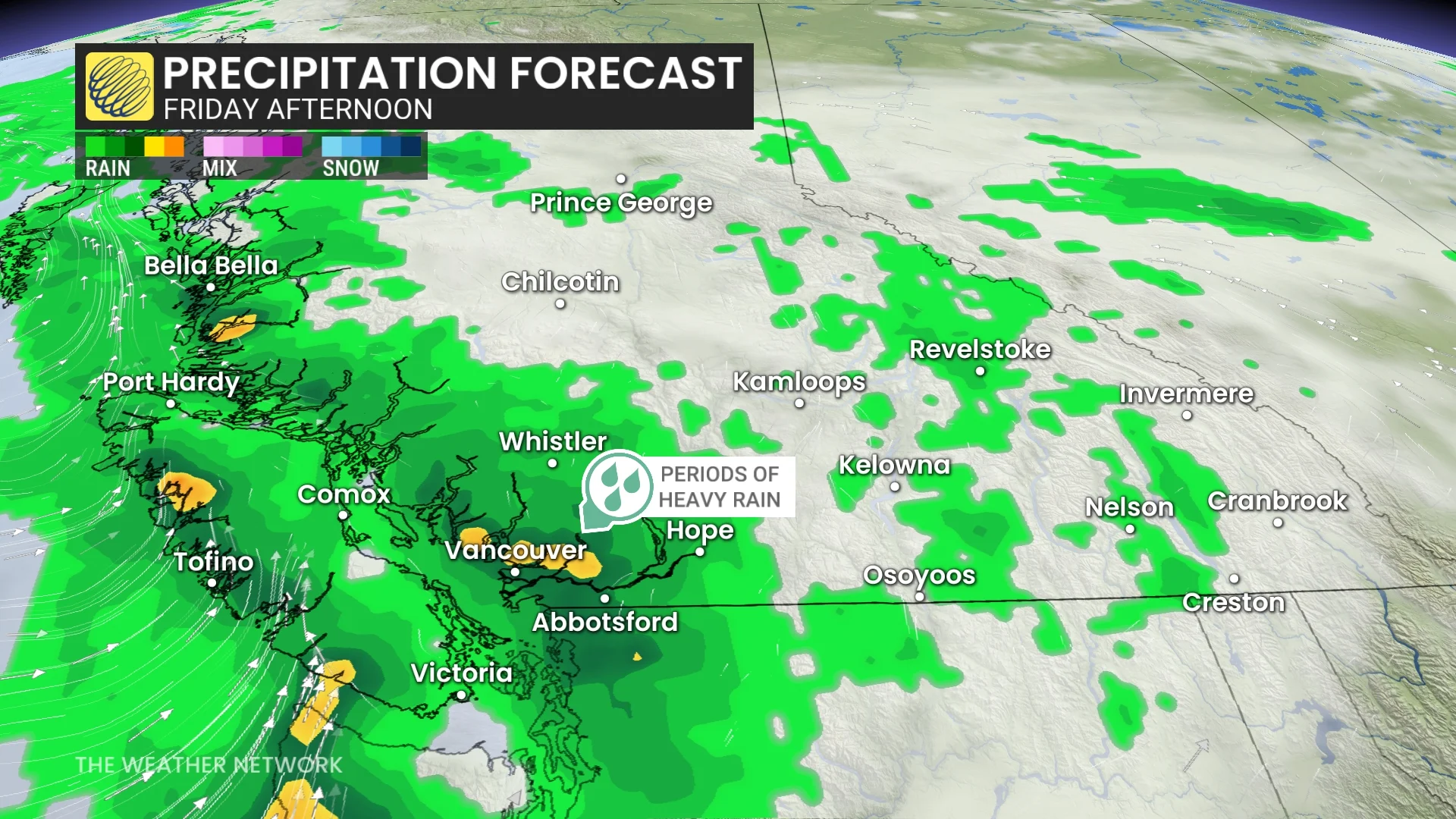
Heavy showers are set to arrive on Vancouver Island late Thursday afternoon, spreading to the Lower Mainland by the evening. The most intense rainfall is expected on Friday.
The Okanagan and Interior will also benefit, with steady rain anticipated from late Friday through Saturday.
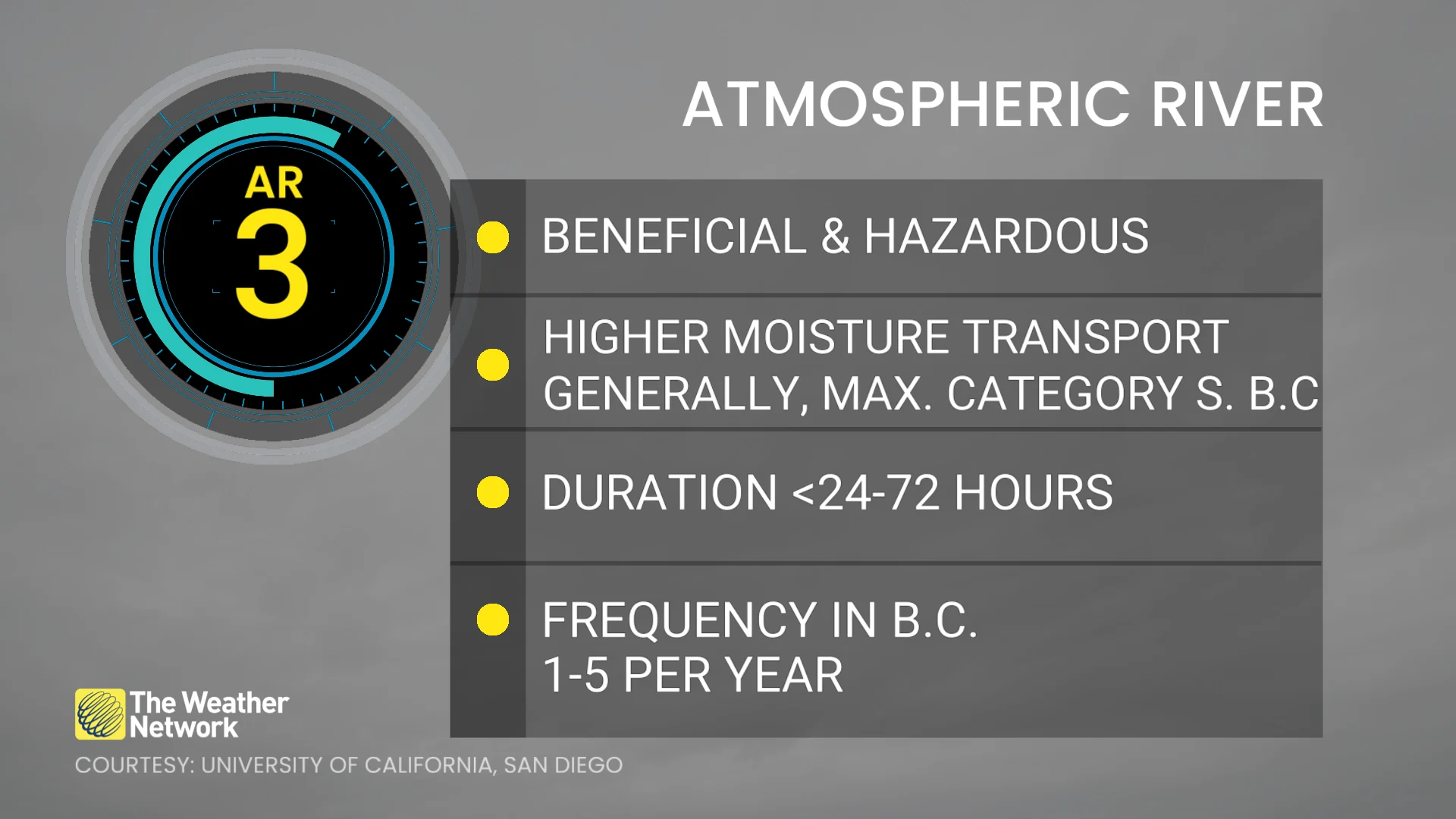
This event will be classified as an atmospheric river.
RELATED: Canada introduces an impact scale for atmospheric rivers
An atmospheric river is exactly what it sounds like – it’s a long, narrow river of water vapour in the lower atmosphere.

These rivers in the sky transport moisture from the subtropics to the mid-latitudes.
Rainfall intensity will vary across regions, with central B.C.’s coastline east of Haida Gwaii expected to experience an AR3 event, while southern Vancouver Island will see AR1 to AR2 conditions.
This rainfall will provide much-needed relief for ongoing wildfires and dry conditions in parts of the B.C. coastline, ranging from moderate drought to abnormally dry.
A month's worth of rain: Accumulations could be significant
Rainfall accumulations could be significant, with Vancouver Island's western regions and the central coastline forecast to receive over 100 mm.
SEE ALSO: 'Explosive' fire growth near Port Alberni, B.C., unusual for Vancouver Island
The North Shore and Lower Mainland are expected to total 30-60+ mm. Many areas could see a month’s worth of rain in just two to three days.

Under persistent rain, coastal temperatures will cool to the low 20s heading into the weekend, with seasonal mid-20s forecast for the Okanagan. Showers are expected to linger into Sunday.
Cooling temperatures and summer snow
Freezing levels will drop below 3000 m on Saturday and to around 2500 m Sunday, with some high-elevation snow possible on mountain peaks near Tsʼilʔos Provincial Park.
A shift to drier conditions with a warming trend is anticipated by mid to late next week. Temperatures are forecast to remain cooler than seasonal from late this week into the weekend and early next week. However, a return to seasonal temperatures—and potentially warmer-than-seasonal conditions—is expected later in the week.
Stay with The Weather Network for more information and updates on your weather across B.C.