Atmospheric river soaks through B.C.'s weekend, up to 100 mm possible
An atmospheric river is on track to impact the B.C. coast, delivering much-needed relief to areas experiencing dry conditions and an elevated wildfire risk.
A Gulf of Alaska low-pressure system is ushering in significant rainfall and a cooldown for B.C.'s South Coast, bringing fall-like conditions to the region.
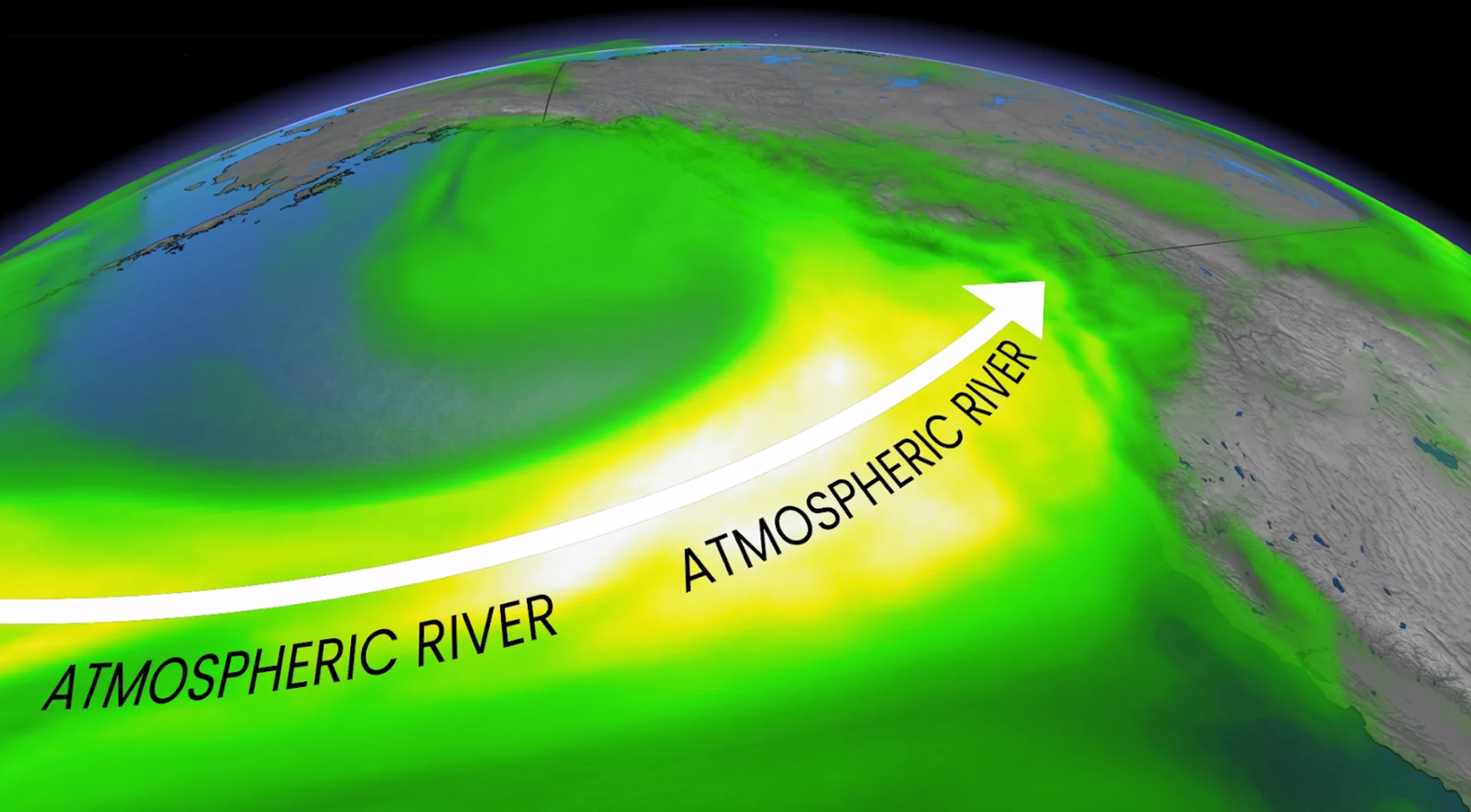
This developing system will draw in a stream of Pacific moisture, establishing an atmospheric river along the B.C. coastline. The rainy event kicked off Thursday and is forecast to stick around through Saturday for many.
SEE ALSO: 'Megathrust' earthquake fault line confirmed off Haida Gwaii, capable of generating large tsunamis
It will be a highly beneficial rainfall since it will be spread out over a more extended period of time. The recent dry conditions across the B.C. coastline have been a huge contributor for the wildfires in the area. However, we will also see some hazards pop up from the heavy rains.

Atmospheric river brings relief and hazards into the weekend
This event will be classified as an atmospheric river. An atmospheric river is exactly what it sounds like – it’s a long, narrow river of water vapour in the lower atmosphere.
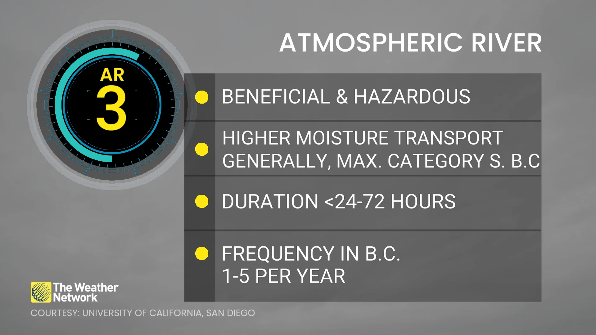
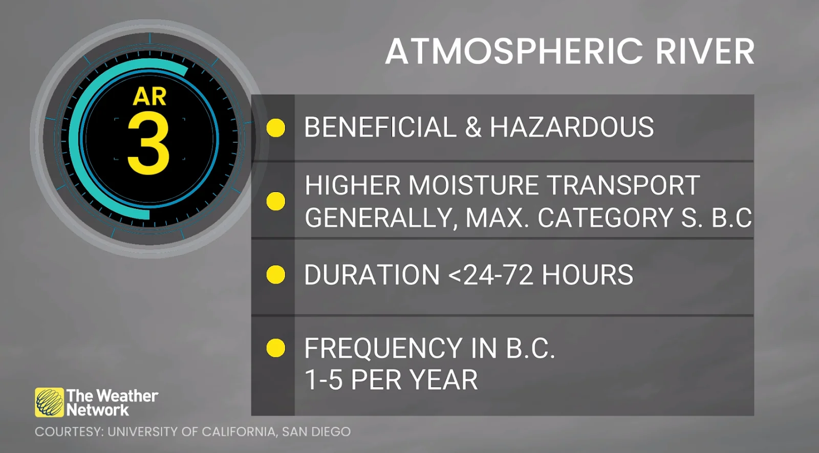
These rivers in the sky transport moisture from the subtropics to the mid-latitudes and are ranked in intensity on a scale of 1-5.
Rainfall intensity will vary across regions, but folks can expect an AR2 event through Friday across Vancouver Island and along the South Coast, and an AR3 event on Saturday for the central coast.
The rain will begin to ease on Saturday for the south as the atmospheric river shifts northward.
Mountainous regions could see over 75 mm of rain over the weekend with this event.
The South Coast and Lower Mainland could see 30-50 mm of rain, with the bulk of it falling on Friday.
RELATED: Canada introduces an impact scale for atmospheric rivers
Localized flooding will be a hazard to look out for if the ground is unable to soak up the rains fast enough. Roadways will also become slick and visibility may be reduced during particularly heavy periods of rain.

This rainfall will, however, provide much-needed relief for ongoing wildfires and level 3 drought conditions on Vancouver Island and parts of the B.C. coastline.
It will only take recording over 28 mm of rain to reach the record for the rainiest day in Vancouver so far in 2025--which we could very well see happen on Friday. If the rain reaches 40 mm, Friday would become one of the top five rainiest August days on record!
Cooling temperatures and summer snow
Freezing levels will drop below 3000 m on Saturday and to around 2500 m Sunday, with some high-elevation snow possible on mountain peaks near Tsʼilʔos Provincial Park.
A shift to drier conditions with a warming trend is anticipated by mid to late next week. Temperatures are forecast to remain cooler than seasonal from late this week into the weekend and early next week. However, a return to seasonal temperatures—and potentially warmer-than-seasonal conditions—is expected later in the week.
Stay with The Weather Network for more information and updates on your weather across B.C.