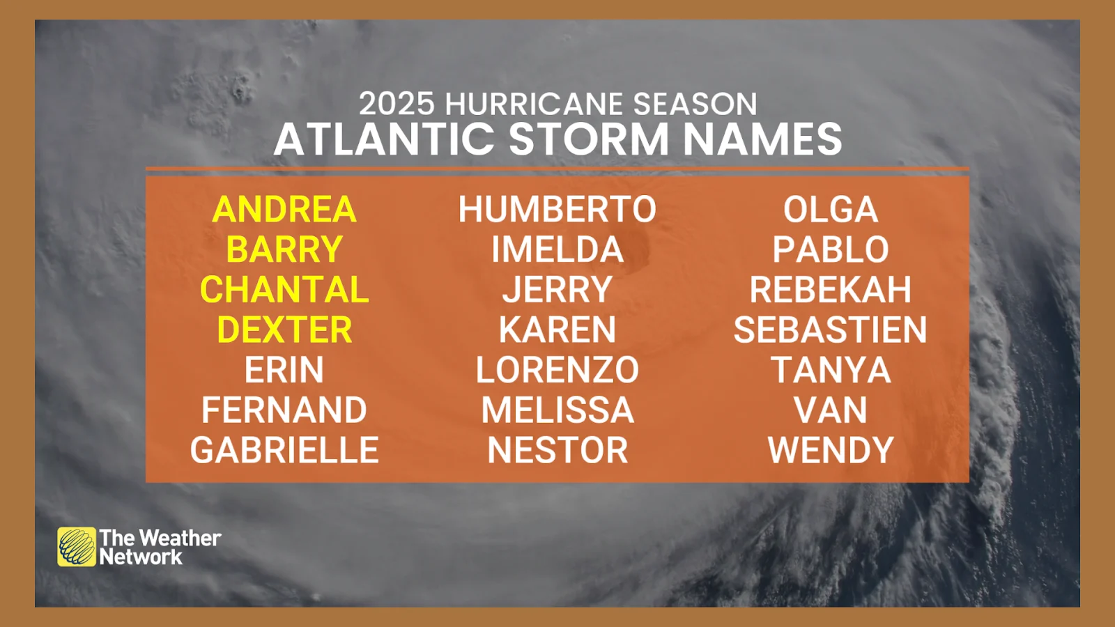
Atlantic hurricane season stirs to life with storm Dexter, more to come
Dexter came to fruition on Monday amidst an active return to Atlantic tropical activity. Forecasters are also monitoring the potential development of two other disturbances in the region
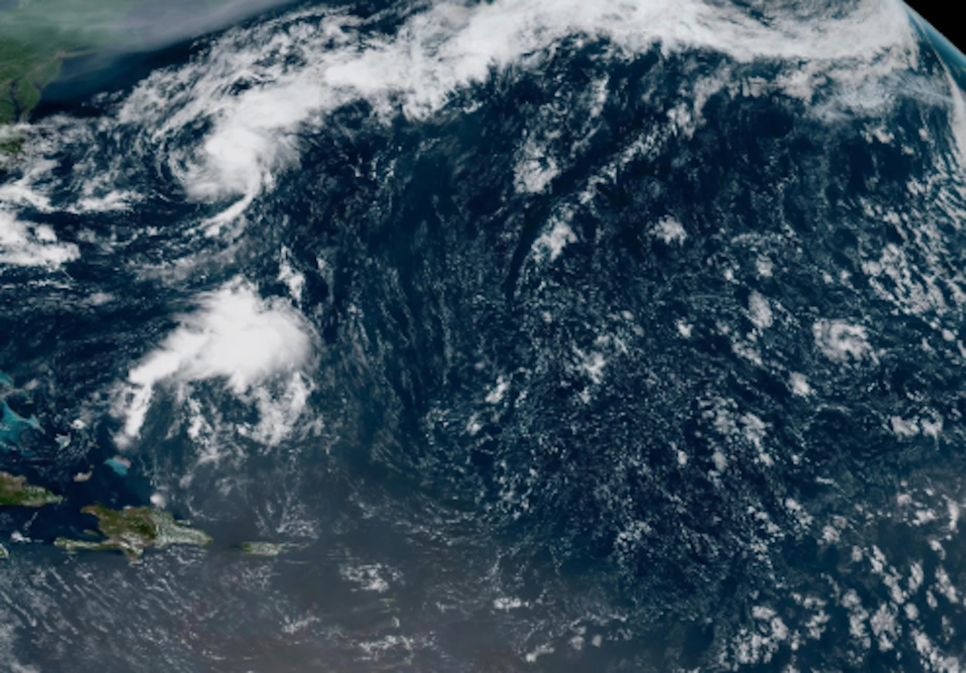
The snooze button has been released in the Atlantic. Tropical activity in the basin has picked up again after a longer-than-expected lull in the hurricane season.
Tropical Storm Dexter was born on Monday, off the U.S. East Coast, but is now turning farther away from the land and is also expected to stay north of Bermuda as it churns into open waters.
RELATED: One hurricane ever? Why the South Atlantic is a dead zone for hurricanes
While that storm poses no threat to land, it serves as a reminder that the peak of the hurricane season is still to come and folks, especially in at-risk regions, should be on alert and pay close attention to the forecasts.
But forecasters with the U.S. National Hurricane Center (NHC) are also keeping their eyes on two other areas of interest and potential development in the Atlantic over the coming days.
Dexter comes to life, poses no threat to U.S. East Coast
As of Sunday afternoon, Dexter is moving toward the northeast at a fairly steady speed of 22 km/h. A similar northeastward or east-northeastward motion is expected over the next few days.
While Tropical Storm Dexter is not expected to bring direct impacts to Atlantic Canada, its effects may still be felt offshore.
Forecasters say larger swells could push northward, generating hazardous surf and wave activity south of Sable Island.
Wave heights near the island may reach two to three metres, with seas farther offshore potentially building to four or five metres.

Maximum, sustained winds are near 45 km/h with higher gusts. Some slight strengthening is forecast during the next couple of days, but Dexter is likely to become a post-tropical cyclone by the middle to latter portion of this week.
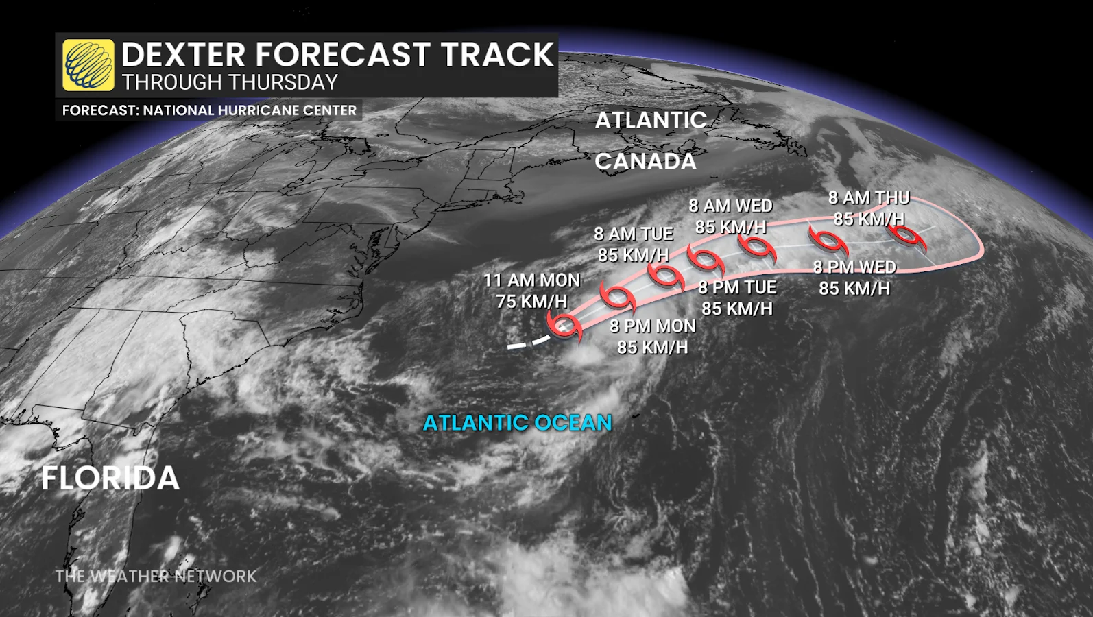
Tropical-storm-force winds extend outward up to 165 km from the centre.
Two other areas of interest for possible subtropical or tropical formation
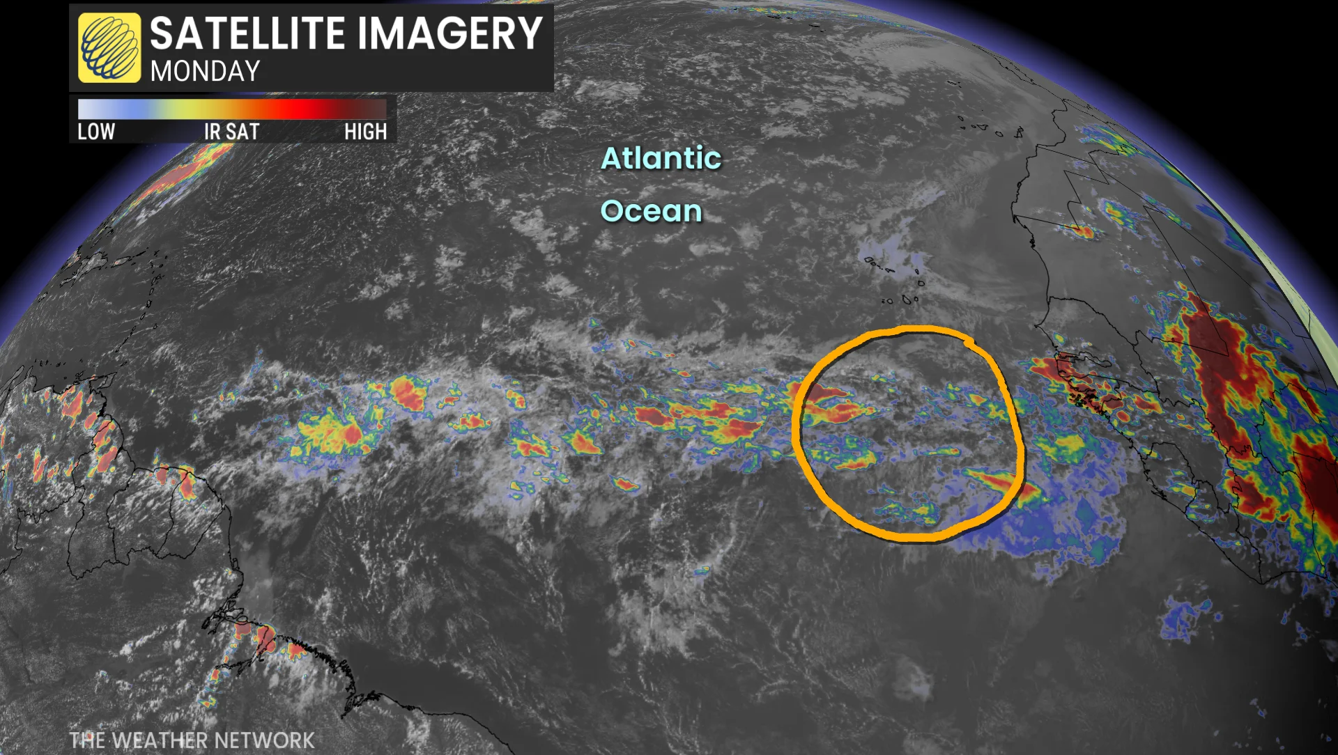
Meanwhile, NHC forecasters are monitoring two areas of interest in the Atlantic for potential development over the next seven days.
The first is situated in central tropical Atlantic. A tropical wave moving off the west coast of Africa is currently producing only limited shower activity.
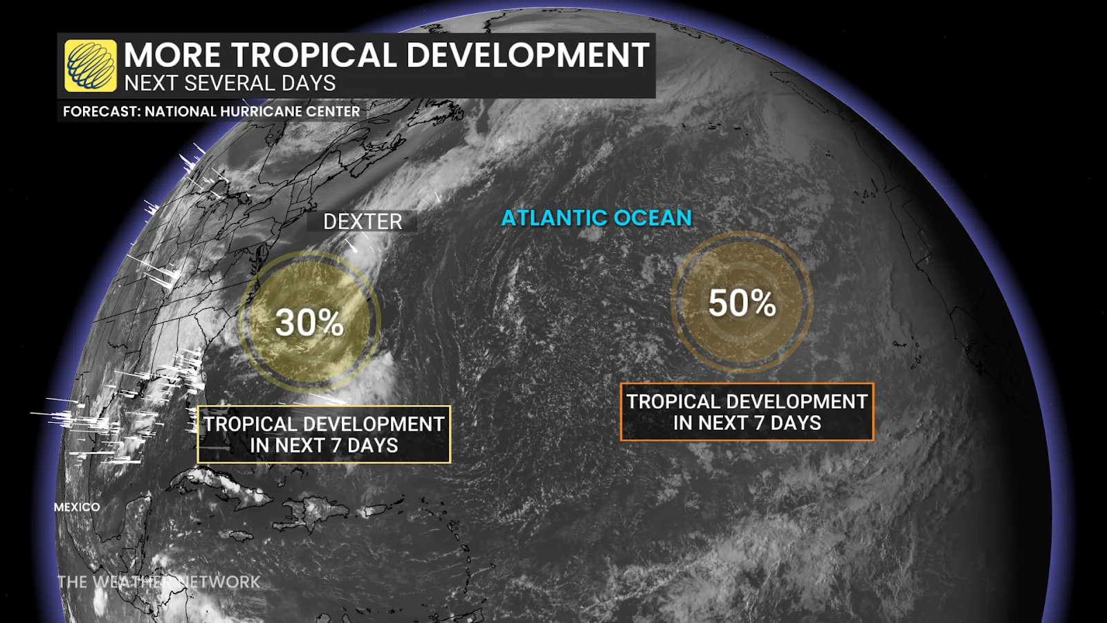
In a few days, however, environmental conditions are forecast to become favourable for gradual development, and a tropical depression could form by the latter portion of this week as it moves generally west-northwestward across the central tropical Atlantic. Formation chance through the next seven days is 50 per cent (medium).
Next area of concern is off the southeastern United States coast. A broad area of low pressure is forecast to develop in a couple of days several-hundred kilometres off the coast of the southeastern United States.
Some gradual development of this system is possible during the middle or latter portion of this week as the system drifts slowly westward to northwestward. Formation chance through the next seven days is 30 per cent (low).
The second week of September is the climatological peak of hurricane activity across the Atlantic, with an end date of Nov. 30.
WATCH: South American hurricanes: Fact or fiction?
Thumbnail courtesy of NOAA.
Stay tuned to The Weather Network for the latest forecast updates for the Atlantic hurricane season.