Another 10-20 cm possible: Swath of heavy snow pushes through Atlantic Canada
Travel will remain difficult in parts of Atlantic Canada on Thursday as snow continues to push across, with a further 10-20 cm possible for some areas
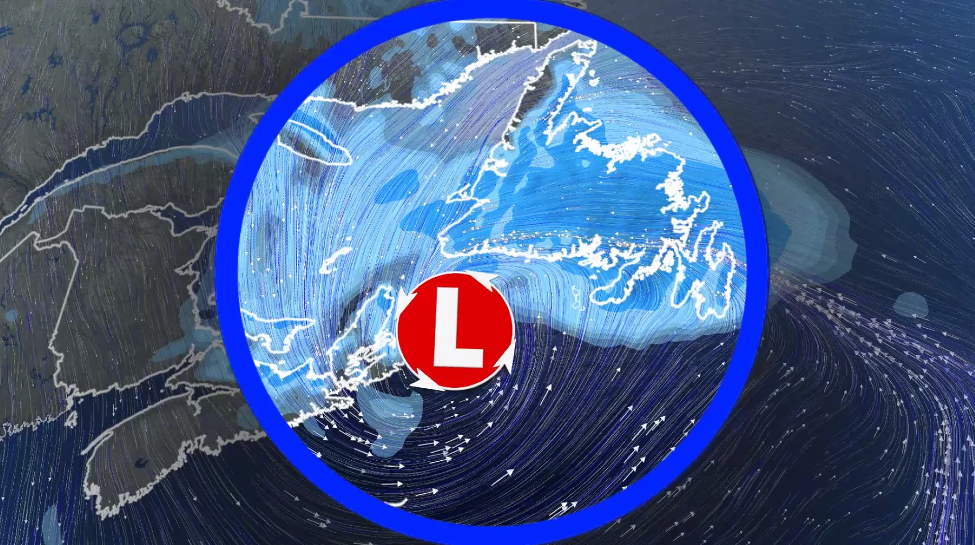
Tons of cold air have been pouring across the Atlantic Ocean thanks to Arctic air from the North Pole. This acts like storm fuel, enhancing the development of low-pressure systems south of Atlantic Canada.
DON'T MISS: Canada’s 2025-26 winter report card: Did your province pass?
As a result, a potent low brought a swath of heavy snow to parts of the Maritimes on Wednesday, and will continue into Thursday for Newfoundland. Some areas could see an additional 10-20 cm of snow.
Roads and walkways will likely be difficult to navigate due to accumulating snow. There may be a significant impact on rush-hour traffic. Local utility outages are possible.
Snow spreads into Newfoundland Thursday
Wednesday overnight, moderate to heavy snowfall continues across eastern Nova Scotia, P.E.I., Cape Breton and western Newfoundland as the low continues its trek east.

Freezing drizzle is likely for northern and eastern parts of Newfoundland, including St. John’s, with temperatures hovering near or just below the freezing mark.
Light snow will stick around for eastern parts of the Maritimes through the first half of Thursday.
Snow will spread across Newfoundland through the morning, with the chance for some wet mixing for southern and eastern parts of the island, limiting snowfall totals.

Winds are not forecast to be especially strong but coastal communities with fresh snow may experience some blowing and drifting snow. Wind gusts of 50-70 km/h are expected, especially to Atlantic coastal regions and through the Gulf of St. Lawrence.
Beyond, we are closely watching the track of a Texas low, but it appears that the storm track will stay well south of the region with minimal impact.

However, a more active pattern is expected for the second half of next week and into the following week with a couple of significant and messy systems. Temperatures are expected to be changeable with the more active pattern, but overall, they will be near or above seasonal.
WATCH: Check out the deepest low on Earth this week
Stay with The Weather Network for all the latest East Coast forecast updates.