
Alberta’s volatile weather on display as fall and summer clash
A stark temperature contrast will build across Alberta to close out the weekend
Alberta is about to showcase why the province has some of the most volatile weather in all of Canada.
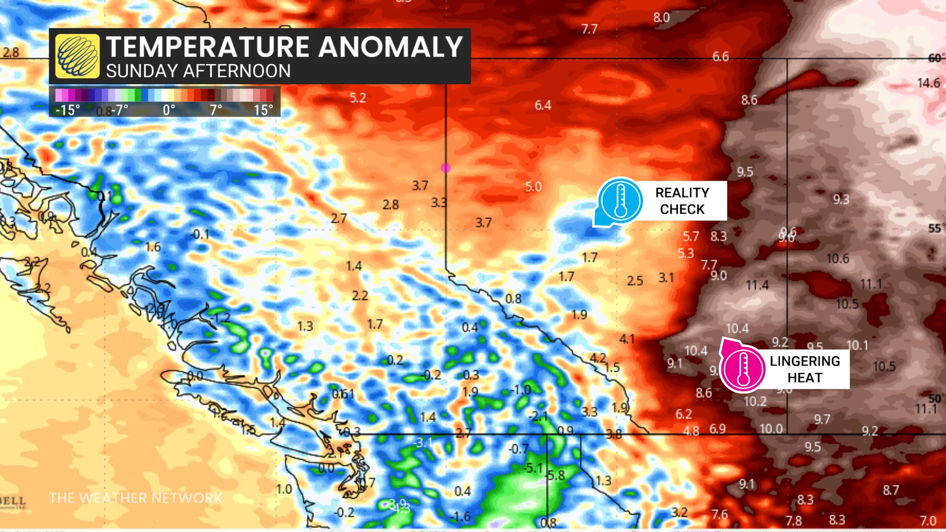
A dramatic cold front pushing into the region will create a sharp temperature contrast between lingering summer heat and a fall-like airmass arriving into the day Sunday.
Visit our Complete Guide to Fall 2025 for an in depth look at the Fall Forecast, tips to plan for it and much more!
Big temperature swings over short distances
A developing low-pressure system will sweep into Alberta on Sunday, pulling much cooler air over the Rockies. This shift will force temperatures to plunge by Sunday evening across central Alberta.
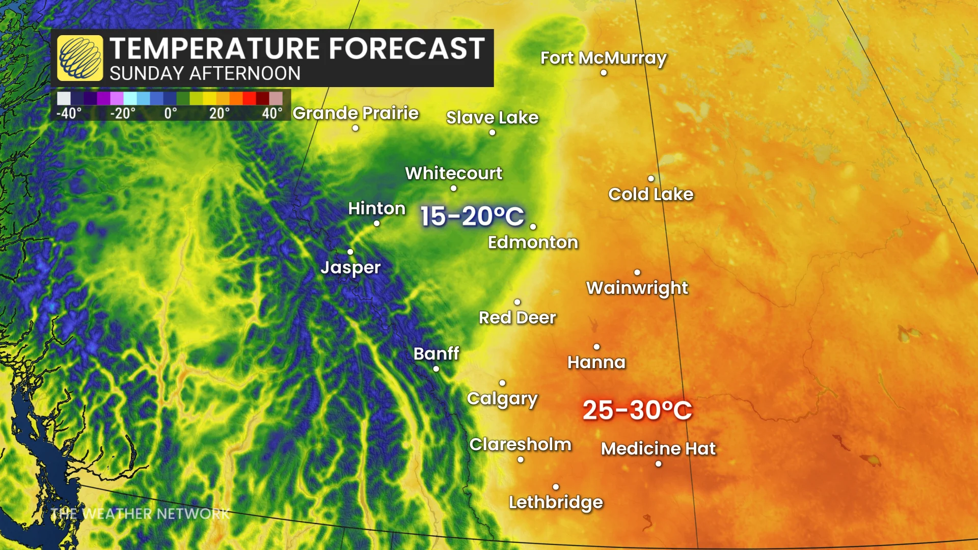
Edmonton, Jasper, Hinton, and Whitecourt are on track to see the greatest temperature drop behind this approaching cold front. Readings here will fall below 15°C after coming in well above seasonal during the day Saturday.
DON’T MISS: Why do frigid mornings keep getting colder after sunrise?
We’ll see scattered showers and blustery winds accompany the falling temperatures. Sunday night may even see bursts of wet snow higher in the Rockies.
By contrast, southeastern Alberta will remain firmly in summer’s grip with Sunday’s daytime highs well into the 20s. We may even see a 30-degree reading in or around Medicine Hat, Lethbridge, and Hanna.
Comfortable temperatures are expected across the province by the start of the new workweek. Monday will feature highs in the 20s along and east of the QE2, while locations from Banff to Grande Prairie see highs in the upper teens.
Stay with The Weather Network for the latest on conditions across Alberta.