Thunderstorms and rain across the Prairies, as Alberta faces rare summer snow
Unseasonably cold weather will bring mountain snow, heavy rain and icy conditions to parts of Alberta. While a high amount of rain covers cities like Calgary and Winnipeg
Another round of thunderstorms are expected to hit the Prairies through Monday afternoon, with severe weather spreading from southern British Columbia right through to western Manitoba.
A powerful shift in Alberta's summer weather is underway, as well, with a developing trough bringing plunging temperatures, heavy rain and even mid-summer snowfall to some areas.
By Tuesday, conditions will cool sharply, with temperatures expected to fall 10 to 15 degrees below seasonal in central and southern Alberta.
Thunderous start to the week
Another round of widespread thunderstorms are expected from B.C. and right across the Prairies to start out the work week on Monday.

The Interlake Region in Manitoba faces the potential for thunderstorms capable of producing heavy rain and large hail as a low pressure system tracks through the area.
Additionally, a second cold front moving from Prince Albert, Sask., to areas just east of Calgary, Alta., could bring storm activity, with similar risks of heavy rainfall and hail development.
Beware of nighttime storms
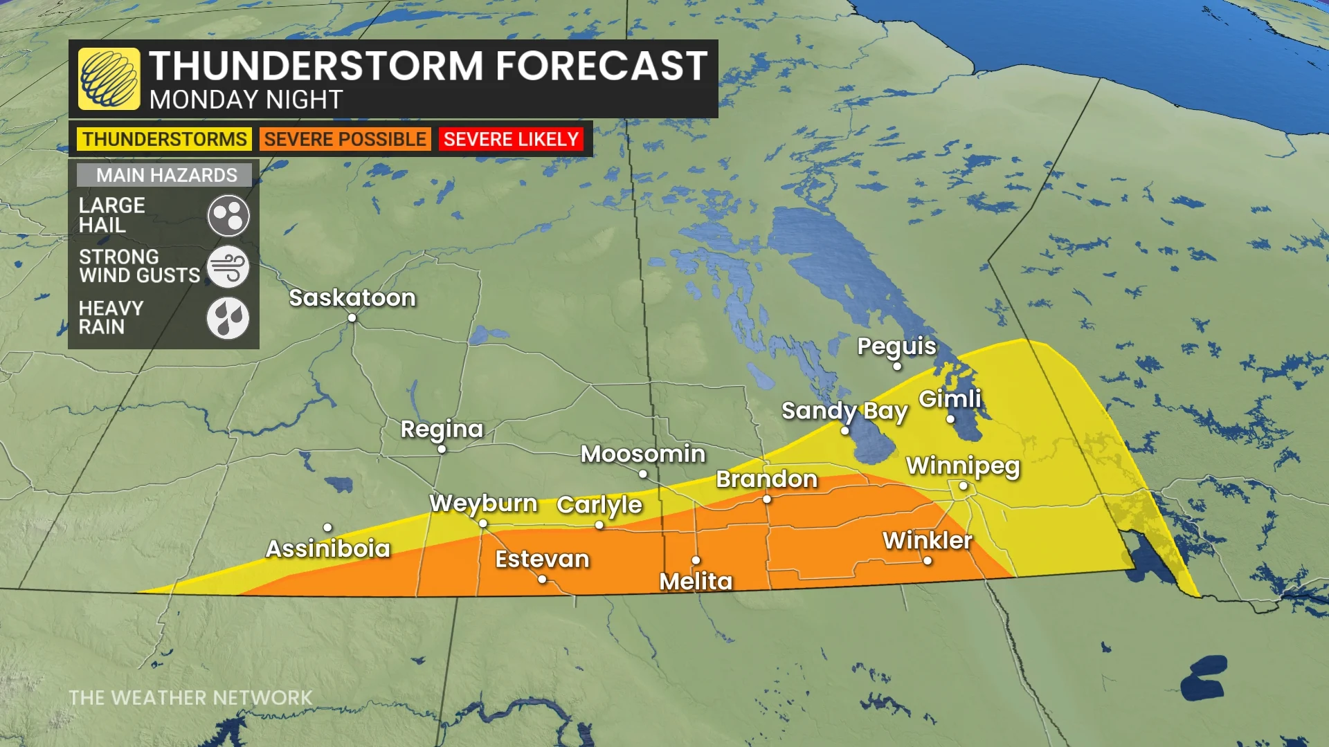
A low tracking northward will steer storm clusters from Montana into the Dakotas, bringing storm activity to the extreme southern areas of Saskatchewan and Manitoba by Monday night.
Heavy rain, large hail, and strong wind gusts will be the main threats once again.
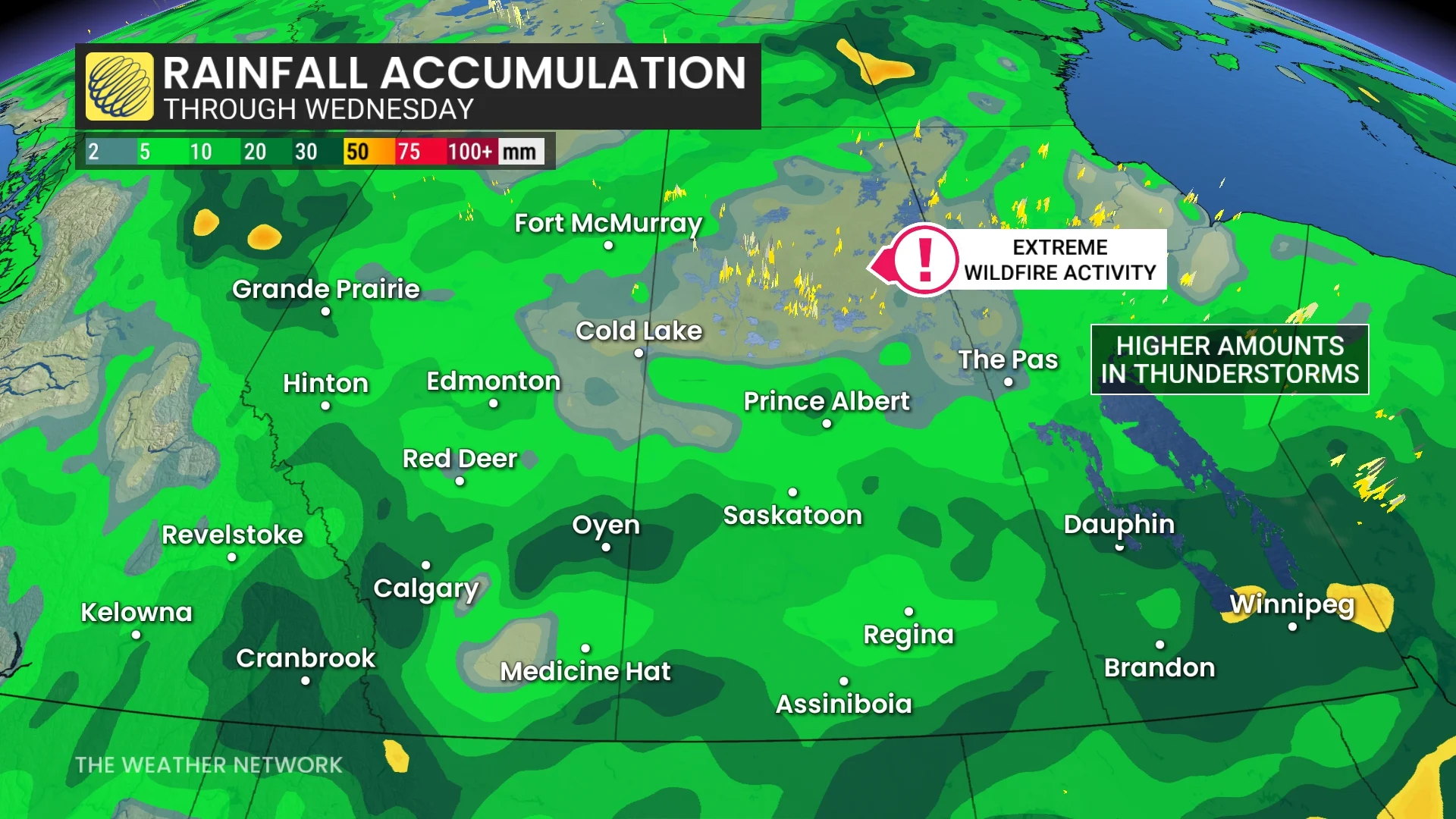
Calgary could see 20 to 30 mm of rainfall between Monday night and Tuesday morning, adding to a month that has already received 100 mm — far exceeding the July average of 66 mm.
Other estimated totals:
Red Deer: 15-20mm
Lethbridge and Medicine Hat: 10-15 mm
Edmonton: 5–10 mm
Fort McMurray: less than 2 mm
While Tuesday will be a clearer day by comparison across the Prairies, there will still be pockets of severe weather between Alberta and Saskatchewan. Another severe possibility will stretch from southeastern Manitoba extending to Pickle Lake, Ont., as well.

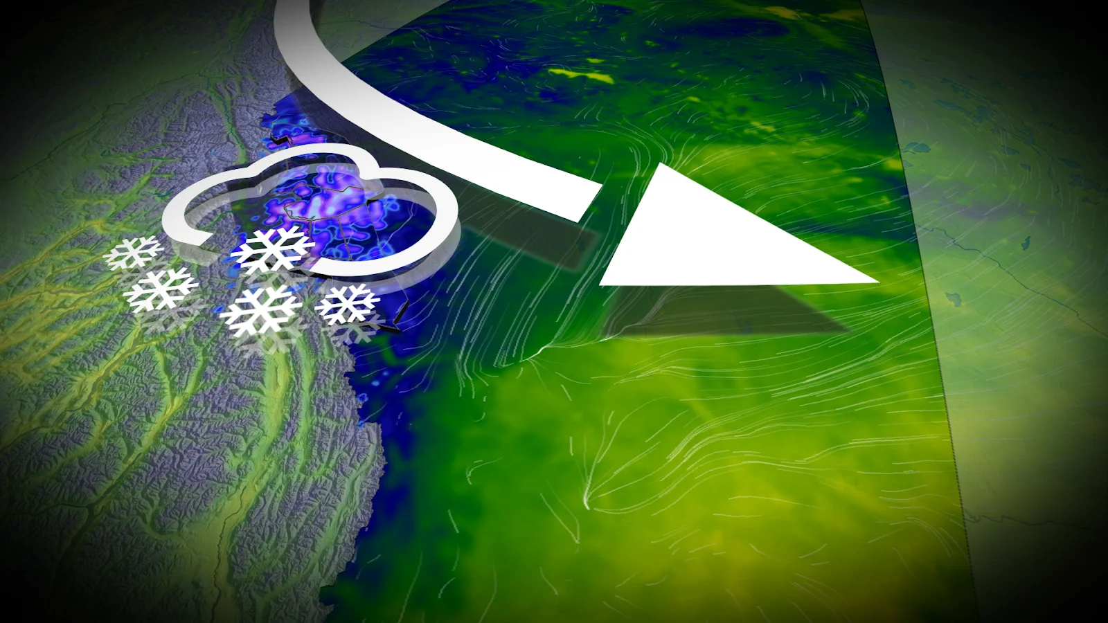
Summer snow sneaks into Alberta's mountains
Meanwhile, the cooldown will be sufficient enough to start accumulating snow in the Rockies, particularly in elevations above 2,000 metres.

Temperatures are expected to be below normal across southern Alberta, with the lowest being 15°C below the usual number for this time of year.
The Jasper region and Icefields Parkway are likely targets, with snow forecast just 60 km west of Calgary in the higher elevations near Banff.
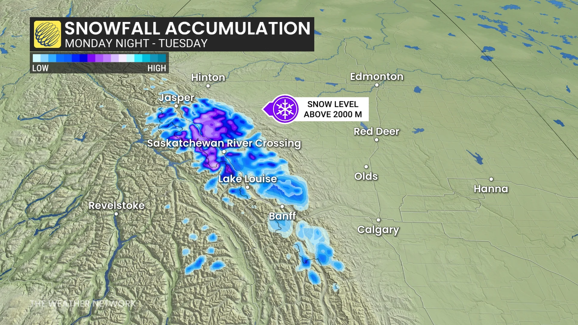
Travellers and outdoor workers in these areas should prepare for locally slippery conditions, with a reminder that summer snow in Alberta's mountains, while uncommon, is not unheard of.
SEE ALSO: Canada's fire bans and danger ratings explained
Ponding water and reduced visibility may have an impact on driving, particularly in areas where rain coincides with slippery mountain roads.
The majority of the rainfall is expected to end by Tuesday morning as the trough moves east.