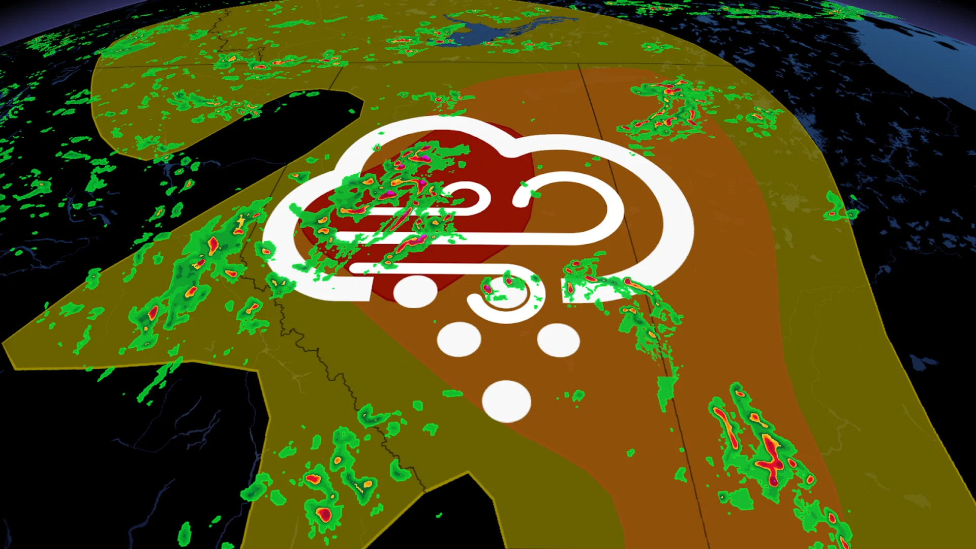
Severe storms fire up in Alberta, prompting tornado warning
A severe thunderstorm capable of producing a tornado has been detected in Alberta. Residents in the affected regions should be in their shelters.
A tornado warning has been issued in Alberta as storm spotters have reported a funnel cloud and a thunderstorm capable of producing a twister has been seen on radar, according to Environment and Climate Change Canada (ECCC). In addition to potentially producing a tornado and intense winds, large hail and locally intense rainfall are possible. See below for the details.
Current tornado warnings
Brazeau Co. near Cynthia and Lodgepole
Brazeau Co. near Drayton Valley and Breton
5:15 PM MDT: Environment Canada meteorologists are tracking a severe thunderstorm that is possibly producing a tornado. Damaging winds, large hail and locally intense rainfall are also possible.

The thunderstorm producing a tornado is located just north of Lodgepole, and is heading to the northeast at 15 km/h. Very large, tennis ball-sized hail and very strong winds are also possible.
This is a dangerous and potentially life-threatening situation.
Take cover immediately, if threatening weather approaches. If you hear a roaring sound or see a funnel cloud, swirling debris near the ground, flying debris, or any threatening weather approaching, take shelter immediately.
Go indoors to a room on the lowest floor, away from outside walls and windows, such as a basement, bathroom, stairwell or interior closet. Leave mobile homes, vehicles, tents, trailers and other temporary or free-standing shelter, and move to a strong building if you can. As a last resort, lie in a low spot and protect your head from flying debris.
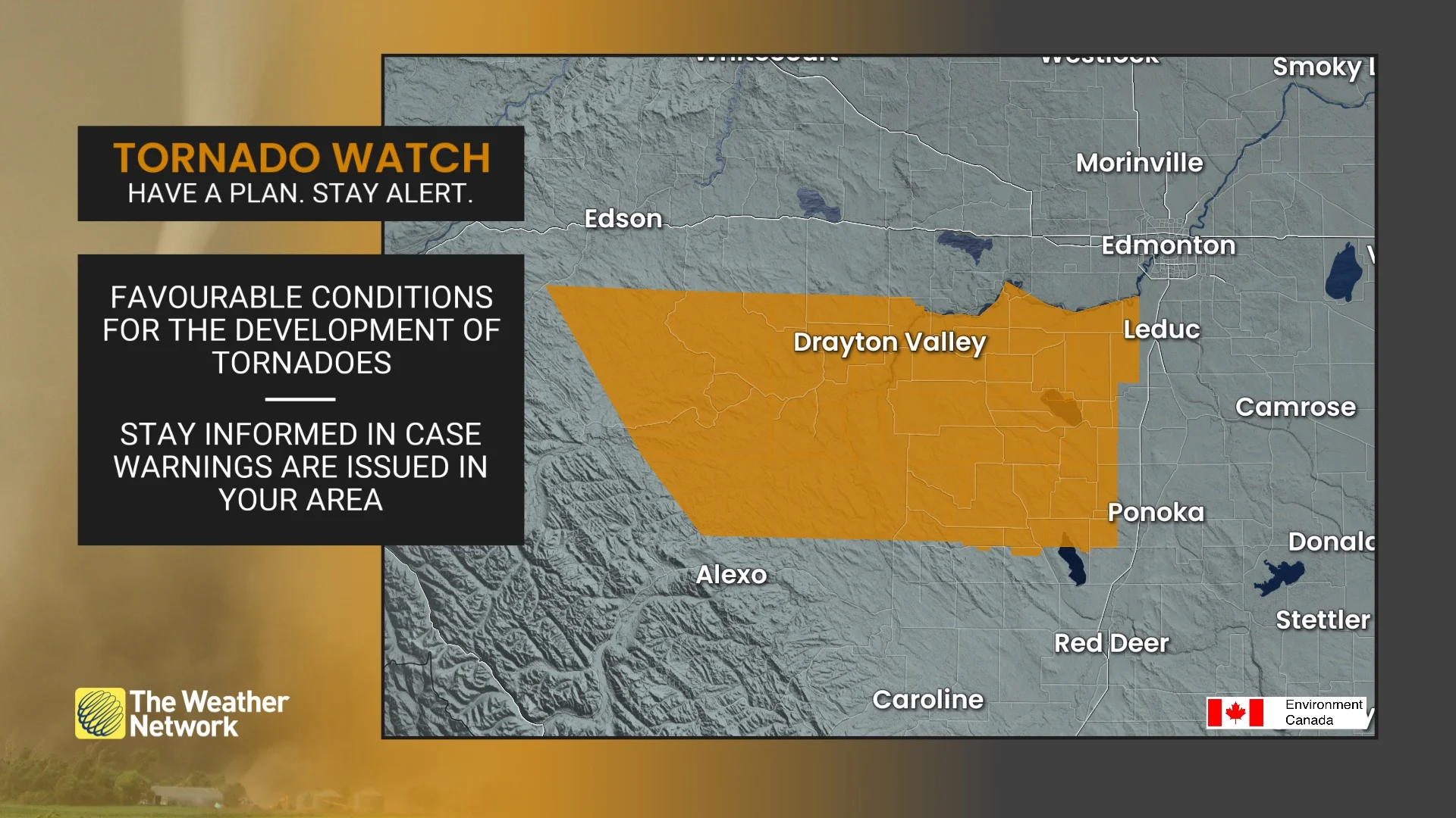
Current tornado watches
Spruce Grove - Morinville - Mayerthorpe - Evansburg
Drayton Valley - Devon - Rimbey - Pigeon Lake
Woodlands Co. near Fort Assiniboine Timeu and Topland
Co. of Barrhead near Thunder Lake and Holmes Crossing
Co. of Barrhead near Neerlandia Bloomsbury and Vega
Co. of Barrhead near Barrhead and Lac La Nonne
M.D. of Lesser Slave River near Chisholm and Cross Lake
Westlock Co. near Larkspur Fawcett and Jarvie
Westlock Co. near Westlock and Clyde
Whitecourt - Edson - Fox Creek - Swan Hills
4:49 PM MDT: Conditions are favourable for the development of funnel clouds and possibly brief, weak tornadoes. Strong winds, large hail and heavy rain are also possible.
In the event of a tornado, or if a tornado warning is issued for your area, it is recommended you take the following actions: Go indoors to a room on the lowest floor, away from outside walls and windows, such as a basement, bathroom, stairwell or interior closet. Leave mobile homes, vehicles, tents, trailers and other temporary or free-standing shelter, and move to a strong building if you can. As a last resort, lie in a low spot and protect your head from flying debris. Lightning kills and injures Canadians every year. Remember, when thunder roars, go indoors!
Tornado watches are issued when atmospheric conditions are favourable for the development of thunderstorms that could produce tornadoes.
Severe weather spins up again in Alberta on Wednesday
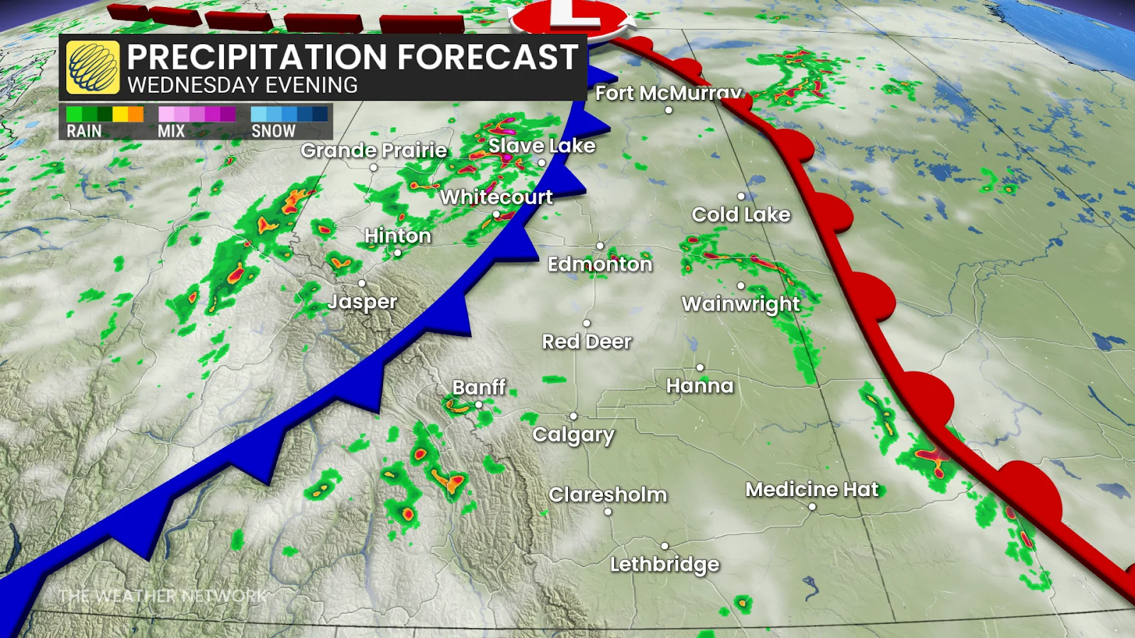
A cold front sweeping across Alberta will clash with the heat that has been looming over Alberta, triggering more storm development on Wednesday afternoon and evening. The severe threat will also spill into Saskatchewan, along the provincial border.
Once again, central Alberta, particularly the areas around Grande Prairie, Hinton and Whitecourt, faces a risk of damaging hail, some of which could be larger than 4 cm in diameter.
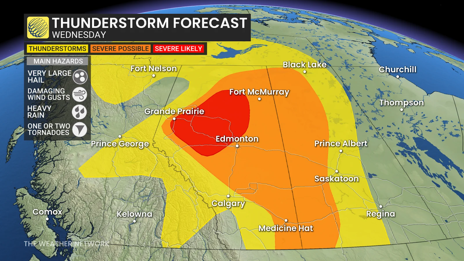
The heat and humidity are fuelling instability in the atmosphere, giving storms plenty of energy to work with.
The key threats this time:
Very large hail (over 4 cm)
Damaging winds (90-110 km/h)
A low-to-moderate tornado threat, with brief spin-ups possible
Unlike slower systems that stay and cause flooding, Wednesday's storms are projected to move quickly east-northeast at speeds ranging from 60-80 km/h.
SEE ALSO: Scud clouds are scary tornado lookalikes - how to tell them apart
This speed reduces the risk of flash flooding—however it does not eliminate the threat of damaging winds or hail.
Storm threat shifts into Saskatchewan, Manitoba on Thursday
The same cold front to trigger Wednesday's storms will makes its way east into Saskatchewan and Manitoba on Thursday, triggering another risk of thunderstorms; although there is still some uncertainty as to how strong the storms will be.
Thunderstorm energy over the Prairies will still be high, though, so we will see a risk of severe storms developing along the Saskatchewan-Manitoba border in the late afternoon to evening hours.
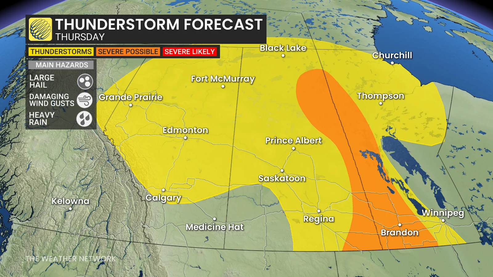
We could once again see some large hail, between 3-5 cm in diameter, and damaging winds between 90-110 km/h with any severe storms that pop up.
As the week wraps up, the Prairie provinces are anticipated to get some relief from both the heat and the storms, with cooler air coming in by Friday.
In the meantime, residents are urged to remain weather-aware. Those in high-risk areas should pay attention to alerts, particularly in the late afternoon and evening.
Stay with The Weather Network for more information and updates on your weather across the Prairies.