A wintry Easter Sunday on tap for Atlantic Canada with a new, messy storm
More wintry, messy weather is moving across the East Coast as the Easter long weekend winds down.
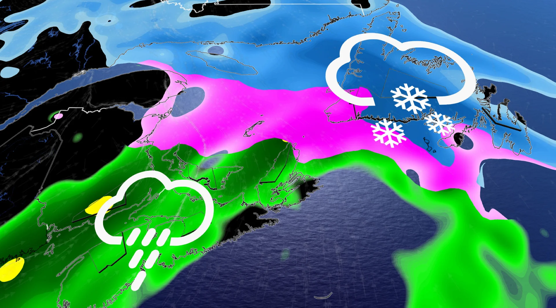
The second of a pair of messy systems will bring a new round of winter-like impacts across Atlantic Canada on Sunday. Expect more snow, ice, and rain. As a result, travel disruptions and power outages possible.
Weather Highlights:
Wintry mess (rain, snow and ice) will impact East Coast on Sunday
Areas expecting snow could see another 10-20 cm of accumulation
Expect travel disruptions, potential road closures and power outages
DON'T MISS: Will Canada's April bring a summer preview or a winter rewind?
Easter weekend ends with a second East Coast winter storm
The next Atlantic storm will spread a wintry mix of precipitation to the north, while communities across the south deal with rain on Sunday.

Another 10-20 cm of snow is expected across extreme northern New Brunswick, with several more hours of freezing rain in some areas as warm air moves above the cold surface.
This will make for some tricky travel north of Fredericton, along Highway 8 toward Miramichi. Highway 11, north of Shediac, will also likely be slick throughout Sunday, as a wintry mix sweeps across the area before transitioning to rain in the afternoon.
P.E.I. and Cape Breton will also endure a brief period of wintry precipitation on Sunday afternoon.

Newfoundland precipitation will initially begin as snow Sunday evening, but will quickly transition to a winter mix across much of the southern sections of the province.
Wind gusts on Sunday night are forecast to be as high as 80-90 km/h for eastern Newfoundland as the frontal system crosses the province.

RELATED: Are we on the cusp of a “Super El Niño?” Here’s how strong it may grow
Another stalling frontal system will keep up the showers across eastern Newfoundland on Monday.
Pockets of 30 mm of rainfall are forecast across southern Newfoundland through Monday.

Behind the stalled system, in western Newfoundland and the Maritimes, we will see cooler air fill in and maybe a few bursts of snow-showers.
Is there more?
A weaker system is set to arrive midweek, bringing the threat of additional snowfall across coastal sections as a weak low skirts the Atlantic coast.
Stay with The Weather Network for more information and updates on your weather across the East Coast.