
A new atmospheric river will drag potent moisture into B.C.
Prepare for several days of unsettled conditions across British Columbia as a renewed surge of moisture streams into the West Coast
Several waves of moisture will push into British Columbia beginning this weekend, a fresh round of unsettled weather that may prompt an elevated flood risk and avalanche concerns for some areas.
DON’T MISS: What’s a Pineapple Express? Diving into this robust atmospheric river
Atmospheric river aims for the West Coast
The renewed atmospheric river expected to move into the West Coast this weekend is a pineapple express, a potent type of atmospheric river that transports moisture straight from the region around Hawaii.

We’ll see two waves of moisture linger along the coast beginning late Sunday and lasting through Wednesday. Heavy rainfall is expected across Vancouver Island, the South Coast, and Coast Mountains.
Rainfall totals through Monday will easily exceed 50 mm for most coastal areas, with the highest totals expected along the North Coast.
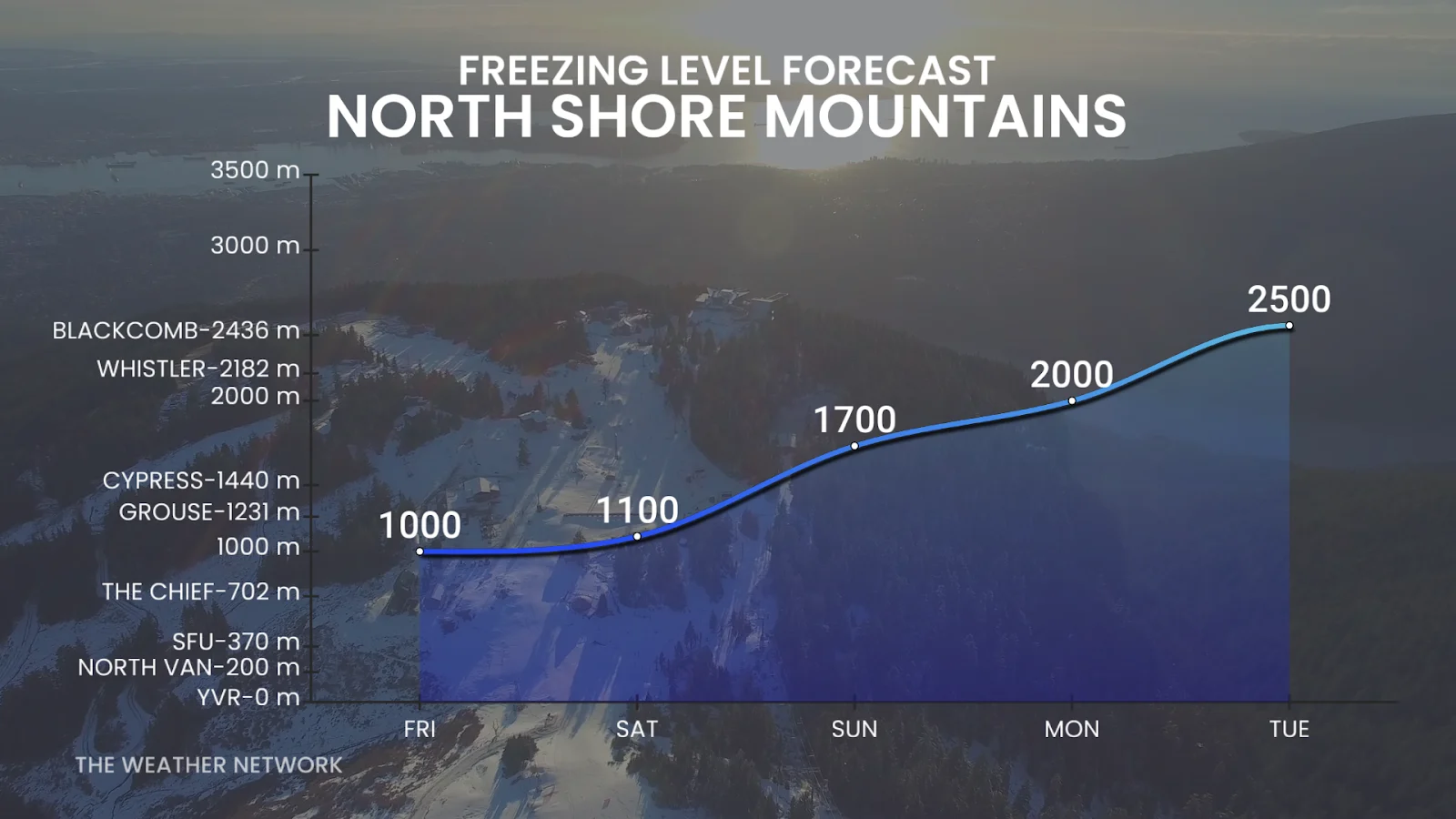
Freezing levels are expected to quickly rise to 2,000 metres or higher by Sunday. This warmup will allow rain to reach well into the alpine regions and accelerate snowmelt throughout the mountains.
Heavy rain and warmer temperatures will lead to dangerous avalanche conditions in some areas amid a destabilized snowpack. An elevated flood risk will also exist in steep terrain and regions with poor drainage.
Stay with The Weather Network for all the latest on conditions across British Columbia.