
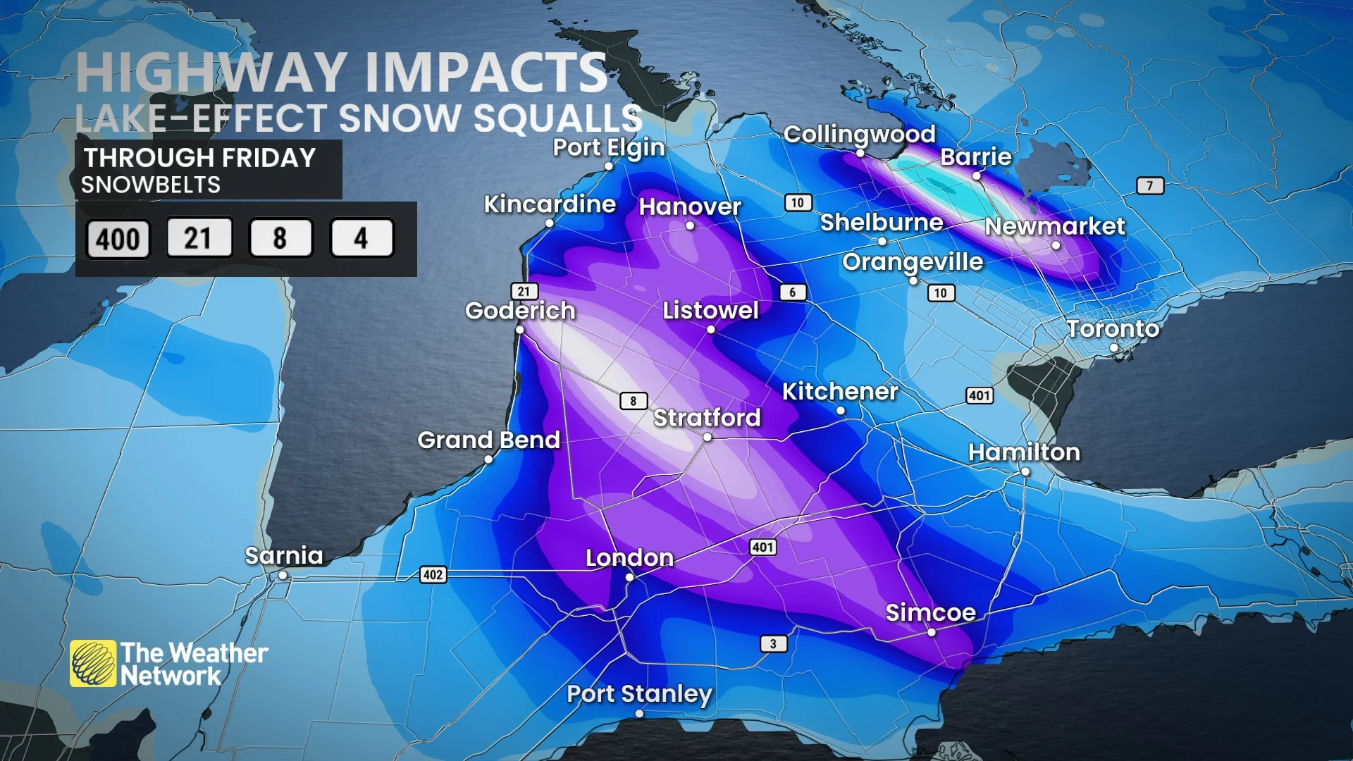
15-50+ cm: Ontario snowbelt regions in for another wintry blast from lake-effect
After a clipper coated southern Ontario with a decent amount of snow, the lake-effect machine will kick into high gear on Thursday--firing up potent snow squalls that could drop another 15-50+ cm of snow in some areas
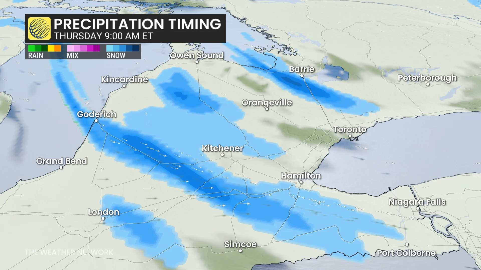
After a snowy Wednesday that led to scores of collisions across parts of southern Ontario, some of the snowbelt communities will be bracing for a considerably bigger snowfall hit as the lake-effect machine kicks up on Thursday.
There is the potential for some areas to see 15-50+cm of snowfall through Friday, depending on location and if the snow squall can lock in for a prolonged period of time.
RELATED: In Photos: Southern Ontario faces mid-week snowy blast
Travel will likely be challenging, if not hazardous. Roads and walkways will likely be difficult to navigate due to accumulating snow. Expect significant delays and possible road closures.
Be sure to monitor the forecast for updates regarding snowfall amounts and impacts, as well as any alerts as conditions change or deteriorate.
Lake-effect machine kick-starts fresh round of snowfall, threat of 50+ cm for some
Lake-effect snow will develop behind the passing clipper, targeting communities southeast of Lake Huron and Georgian Bay.
The snow squall off of Lake Huron will meander across London, Kitchener and communities north and along Highway 21.
DON'T MISS: Canada’s December outlook holds a strong, cold start to winter
A widespread 15-30 cm of snow is possible with changeable weather conditions as the squall snakes back and forth.
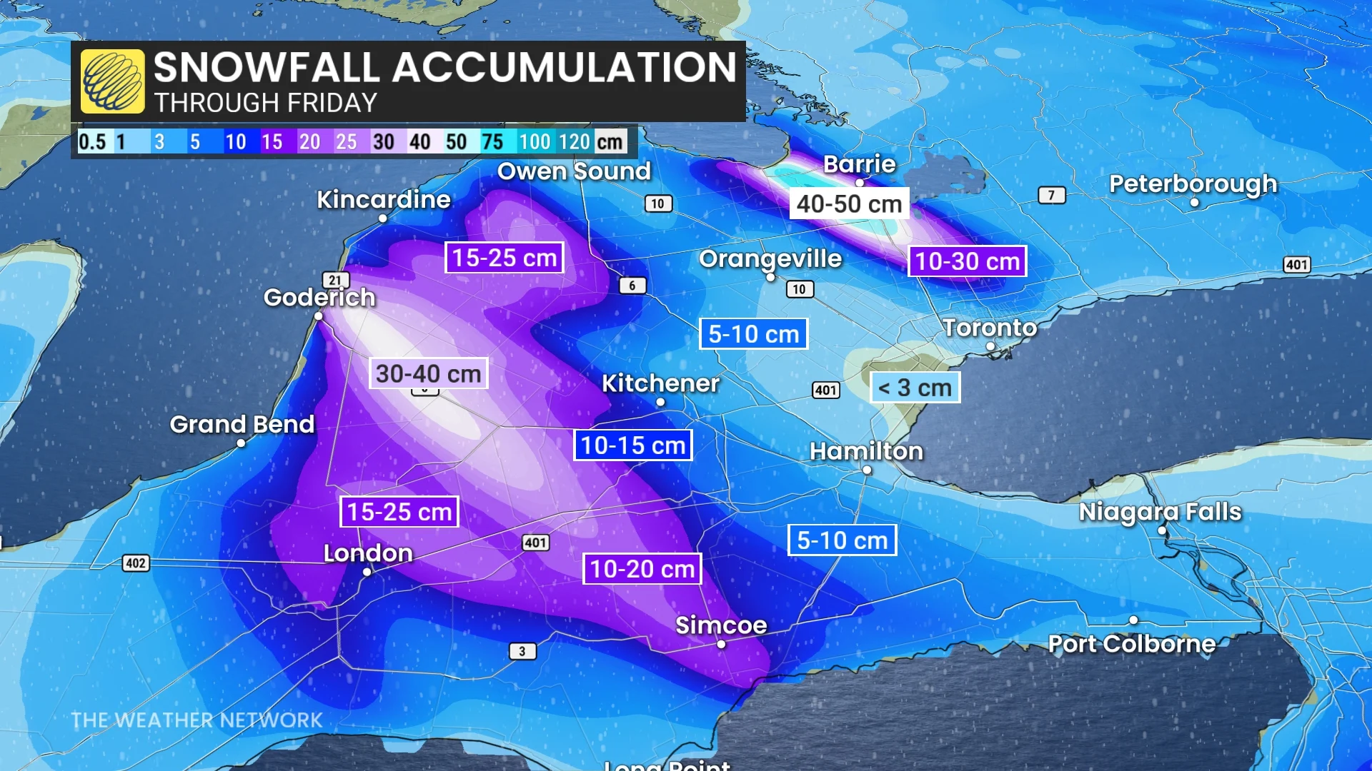
The snow squall off Georgian bay is more locked in, however, leading to the potential of very high snowfall totals. Significant snow will fall Thursday and Friday, targeting parts of Highway 400 near and south of Barrie.
A whopping 40-50+cm is possible, with a wider range of 10-30 cm possible in Bradford, Newmarket, Aurora and Uxbridge.

Snow squalls are very narrow bands of intense snow. So, it might be sunny in one area and extremely snowy in another, not far away. Expect travel disruptions if you drive on the 400 north of Toronto, in particular.
WATCH: Heavy, wet snow fills Ontario streets ahead of colder air
Uncertainty regarding holiday weather
There is a lot of uncertainty regarding our weather for the week before Christmas.

There will be a lot of Arctic air available in the pattern, but very mild air will also attempt to spread into the region. That could result in changeable temperatures and an active pattern.
Unfortunately, that leaves a lot of uncertainty regarding whether we will have a white Christmas outside of the snowbelt regions.
Stay safe out there as hypothermia can be a real risk this time of year.
Stay tuned to The Weather Network for the latest forecast updates in Ontario.