
10-25+ cm: Major U.S. storm will bring snow impacts to Atlantic Canada
A major U.S. winter storm will impact Atlantic Canada Sunday into Monday, bringing frigid temperatures and severe wind chills ahead of the system
A major U.S. winter storm is forecast to intensify as it tracks south of Atlantic Canada late Sunday night. The storm track has shifted north, increasing confidence for heavy snow in Atlantic Canada. Snowfall totals of 10-25+ cm are expected, with impacts continuing into Monday morning.
DON'T MISS: Extreme cold targets Canada as the polar vortex buckles
Colder weather is set to move in on Friday, as well, bringing frigid conditions for the weekend. Daytime highs across New Brunswick are forecast to drop near -20°C, with similar conditions extending into PEI and parts of Nova Scotia. Southern Nova Scotia will see temperatures in the minus teens.
Brace for impacts: Frigid air and heavy snow
A frigid Arctic air mass in eastern Canada will clash with a warm, moist air mass from the Gulf of Mexico, creating a boundary that will produce heavy snow and ice all the way from Texas to the Atlantic coast.

This weekend, the Maritimes will experience very cold Arctic air, with daytime highs ranging from minus teens to -20°C. Halifax is forecast to see a high of -14°C on Saturday — a rarity, last observed in February 2023, December 2016, and January 2014.
Wind chills could drop to -20 to -30 or lower.

RELATED: When is the cold too cold? How extreme cold warnings are issued
A strong U.S. storm system is expected to move into the U.S. Northeast on Sunday. The northern edge of the system will bring snow to the Maritimes beginning Sunday evening. By overnight and into Monday, snowfall rates and wind gusts will intensify.
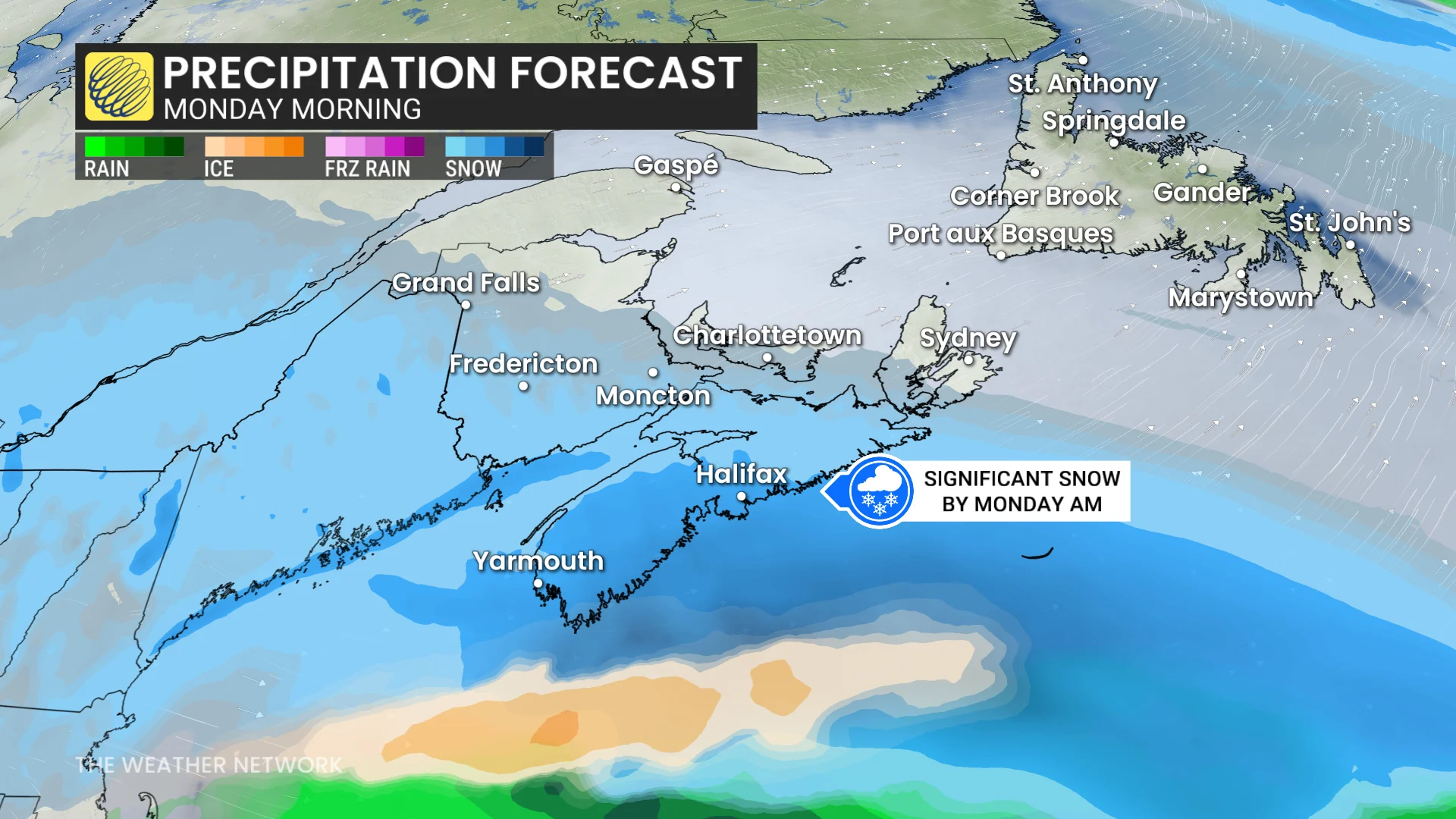
Snowfall totals of 10-25+ cm are possible, with the heaviest accumulations expected in Nova Scotia.
Residents should prepare for potential school and business closures, as heavy snow and blowing snow could result in hazardous winter travel conditions.
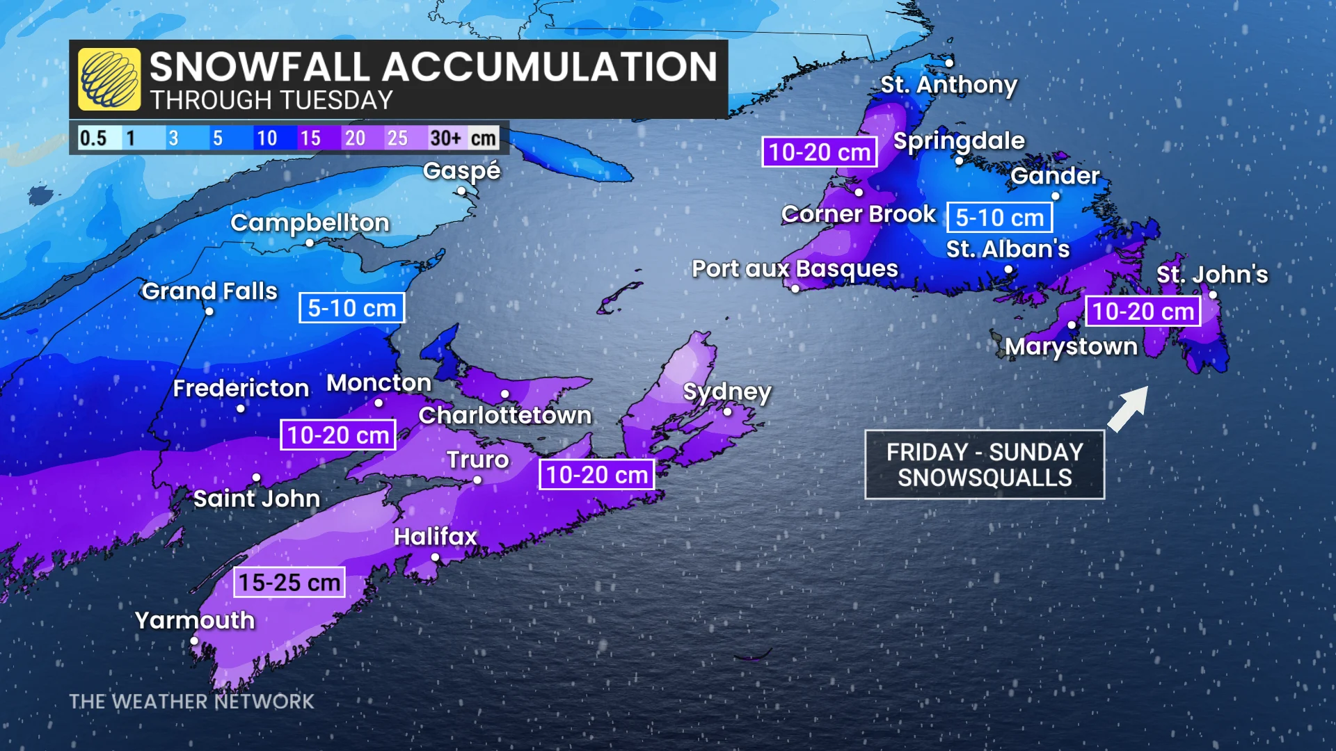
Confidence remains lower for impacts in Newfoundland, with 5-15 cm of snow currently forecast for Tuesday.
Stay updated for any changes in the storm’s track and its potential impacts.