10-20+cm of snow: Calgary, other Alberta cities at risk
After receiving double the average snowfall in March, Calgary and other Alberta cities are set to be hit by another significant snow event at the beginning of April, potentially impacting the Thursday morning commute.
Alberta will be ushering in April with another bout of impactful snow.
Weather Highlights:
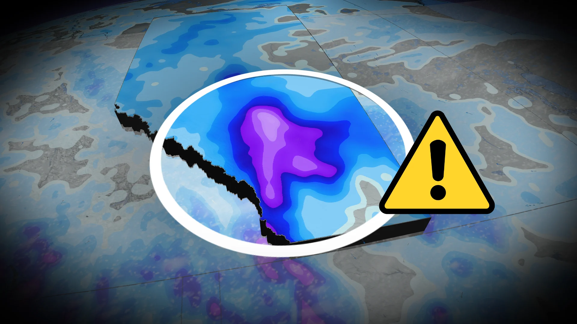
Substantial snow (10-20+cm) risk for southern Alberta from Wednesday night through Thursday
Hardest-hit areas uncertain but may include Red Deer, Calgary and Lethbridge
Prepare for possible winter travel Thursday, with slower commutes
DON’T MISS: North Calgary sees biggest snowfall of the year, more possible this month
As a reminder: Spring is the snowiest time of the year in Alberta. While it may be unpleasant for many, snow is a common sight for this time of the year.
Poor travel conditions expected through Thursday morning. Allow extra time for travel.
10-20+ cm of snow possible for parts of Alberta through Thursday
A low developing over Washington state will drive a westerly wind direction. Air will be forced onto the Rocky Mountains and upwards, condensing and precipitating along the foothills.

Upsloping snowfall is expected with cold temperatures in place Wednesday overnight.
By Thursday early morning, the low strengthens and moves into Alberta.
Snowfall rates intensify and spreads from the foothills, and moves across the QE2 and regions farther east.

Impacts will be felt near Calgary, possibly in Red Deer, depending on how far north the storm lifts, and possibly south of Calgary, depending on if the track remains south.
There is a risk for 10-20+cm of snowfall along Alberta’s busiest commuting corridor.
The snowfall will last through Thursday, lifting by the evening.

Folks should brace for winter travel, with a very difficult and slow commute Thursday morning and onwards. Impacts include all highways in and near Red Deer, Calgary and south, including QE2 and the Trans-Canada.
However, there is plenty of uncertainty on where the heaviest amount of snow will fall at this time, depending on the location of the developing low and how far north it tracks.
Beyond, somewhat changeable temperatures are expected but overall, near-seasonal or colder-than-seasonal daytime highs are expected during early April.
Stay with The Weather Network for the latest on conditions across Alberta.