
What is a mesoscale convective system? How an 'MCS' can spell danger

Mesoscale convective systems (MCS) are common across Canada during the summer. Here’s a look at these storms and how they form
Blazing summertime heat can lend thunderstorms a mean punch. Vivid lightning, ripping winds, large hail, and even tornadoes are common across Canada during the heart of the warm season.
Many of these storms sweep through as mesoscale convective systems (MCS). Forecasters watch for potential MCS development when dangerous conditions align on a hot, muggy day.
DON'T MISS: Science behind the weather: What is a derecho?
Thunderstorms inhale and exhale air
These systems begin with individual storm cells.
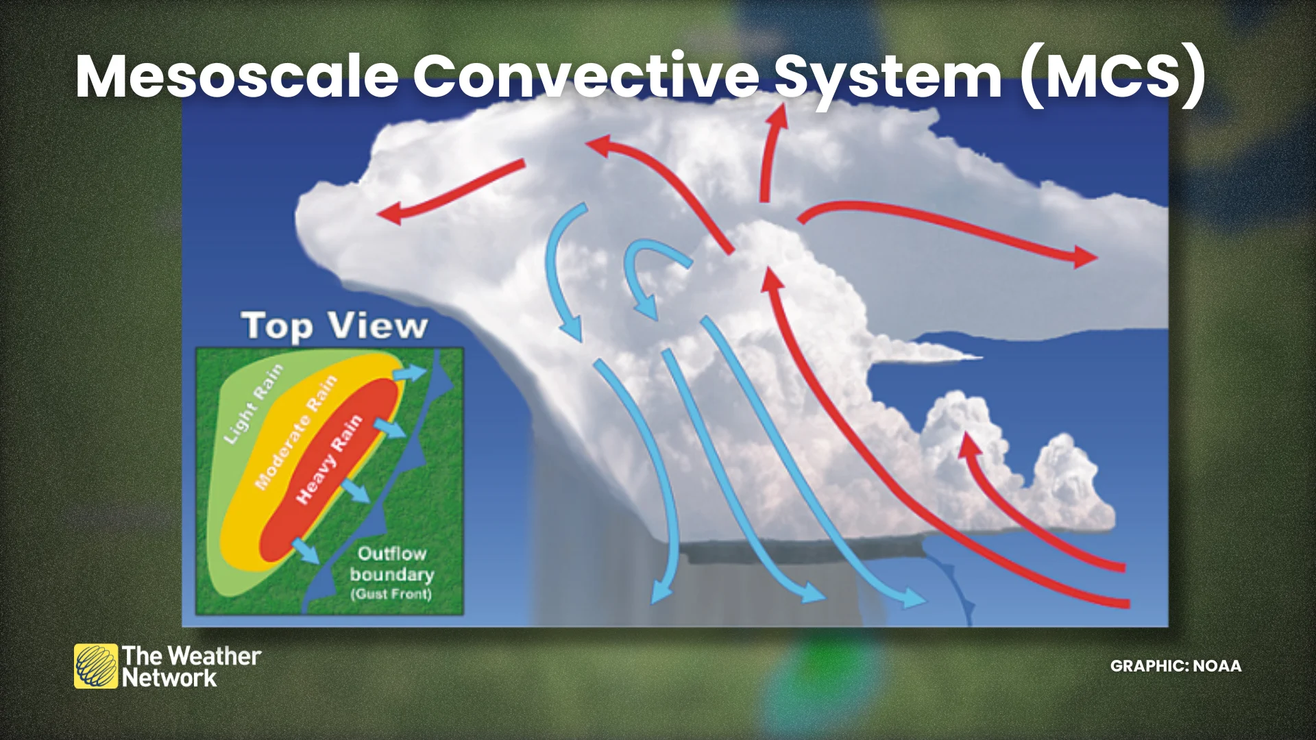
Thunderstorms breathe in warm, unstable air through their updrafts and exhale cool, stable air through their downdrafts. A thunderstorm will grow and thrive for as long as the updraft has a supply of unstable air to inhale.
Downdrafts cause cool, dense air to pool up beneath a mature thunderstorm. The leading edge of that cold pool, called an outflow boundary, is responsible for that refreshing breeze you feel ahead of a storm.
Individual storms combine to create an MCS
Outflow boundaries act like miniature cold fronts that scoop up unstable air and trigger new thunderstorm development.

MUST SEE: How Doppler radar revolutionized weather and saves lives
If these new storms form close enough together, they can share a cold pool—allowing them to grow and move in unison along the outflow boundary. This newly formed cluster of thunderstorms is called a mesoscale convective system (MCS), which often takes the form of a squall line.
This setup is most common along a boundary like a stationary front or the edge of a strong ridge of high pressure. MCSes frequently develop around the edge of a ridge that’s producing a heat wave. Meteorologists call this setup a “ring of fire” because of the high temperatures nearby.
An MCS can create damaging wind gusts
Due to complex internal dynamics within the cluster of thunderstorms, a fast-moving jet of winds can develop and blow from behind toward the leading edge of the MCS.
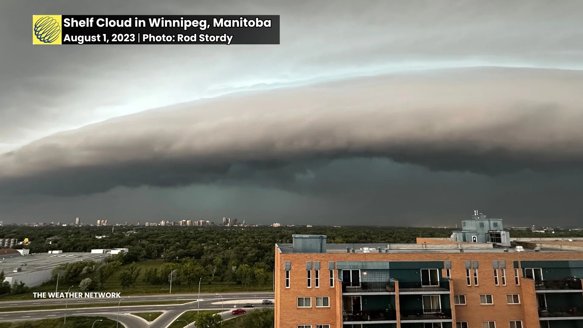
Downdrafts sinking out of the storms shove this jet of winds toward the ground, leading to powerful wind gusts that can easily exceed 100 km/h. Some pack wind gusts higher than 150 km/h.
A prominent shelf cloud can sweep over communities shortly before the high winds and torrential rains arrive. Areas of rotation can develop along the edge of an MCS, which can produce fast-hitting, short-lived tornadoes embedded within the system’s strong winds.
Long-lived MCSes can cause widespread damage
The cluster of thunderstorms will finally start to die out when it runs out of unstable air, or when the internal structure starts to falter and fall apart. Before that happens, though, we can see a robust MCS spend 8+ hours travelling more than half the width of North America before finally petering out.
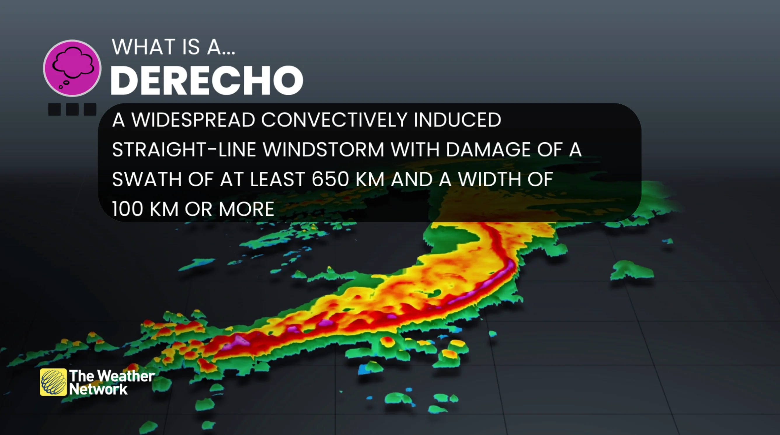
A particularly intense and long-lived MCS can produce damage along a path stretching hundreds of kilometres long. These are called derechos, and they’re responsible for some of the worst bouts of severe weather we can see during the summer months. Not every MCS is a derecho—only a handful of these storms ever reach the threshold needed to qualify as one.
Canada’s worst derecho in recent memory struck Ontario and Quebec in May 2022, killing nine people as it cut a path of damage nearly 1,000 km long.