No aliens, just weather: The stunning 'UFO' cloud over Sydney

The cloud is a rare and fascinating meteorological phenomenon
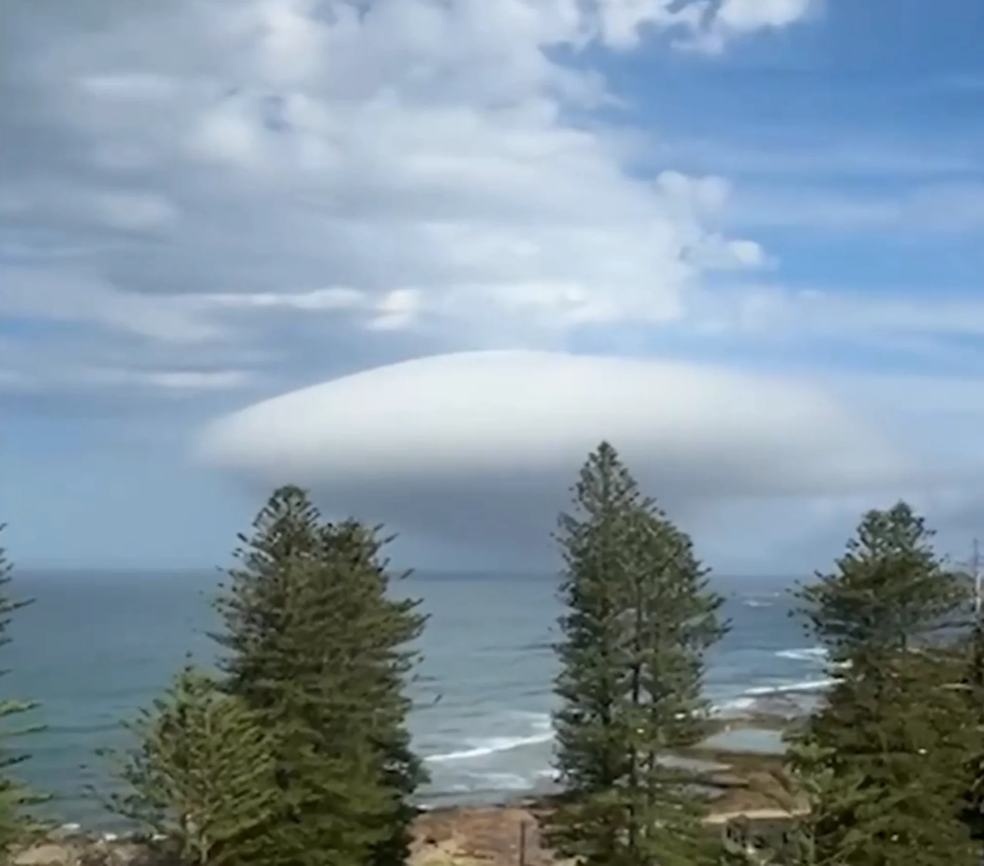
What the heck is going on in Australia? On December 17, viral posts on social media showcased a bizarre, long, tubular cloud hovering over the Pacific Ocean in Cronulla, a coastal suburb of Sydney. Its smooth, otherworldly shape sparked comparisons to a UFO mothership.
While some were quick to float conspiracy theories, an analysis of the atmospheric conditions and satellite imagery debunks any out-of-this-world explanations. The cloud is, in fact, a roll cloud, a rare and fascinating meteorological phenomenon.
DON'T MISS: Weirdest cloud in Canadian history? Here’s the explanation
What’s a roll cloud?
A roll cloud is part of the arcus cloud family, a key clue that sets it apart from the differentiate it from the stationary lenticular clouds associated with mountains.

Roll clouds are highly dynamic, typically formed along advancing weather fronts. On this particular afternoon, a cold front approaching Sydney brought cooler air surging beneath warm, moist summer air near the surface.
The result? A rolling cloud completely detached from the primary cloud layer, seen rolling along the horizon.
The science behind the spectacle
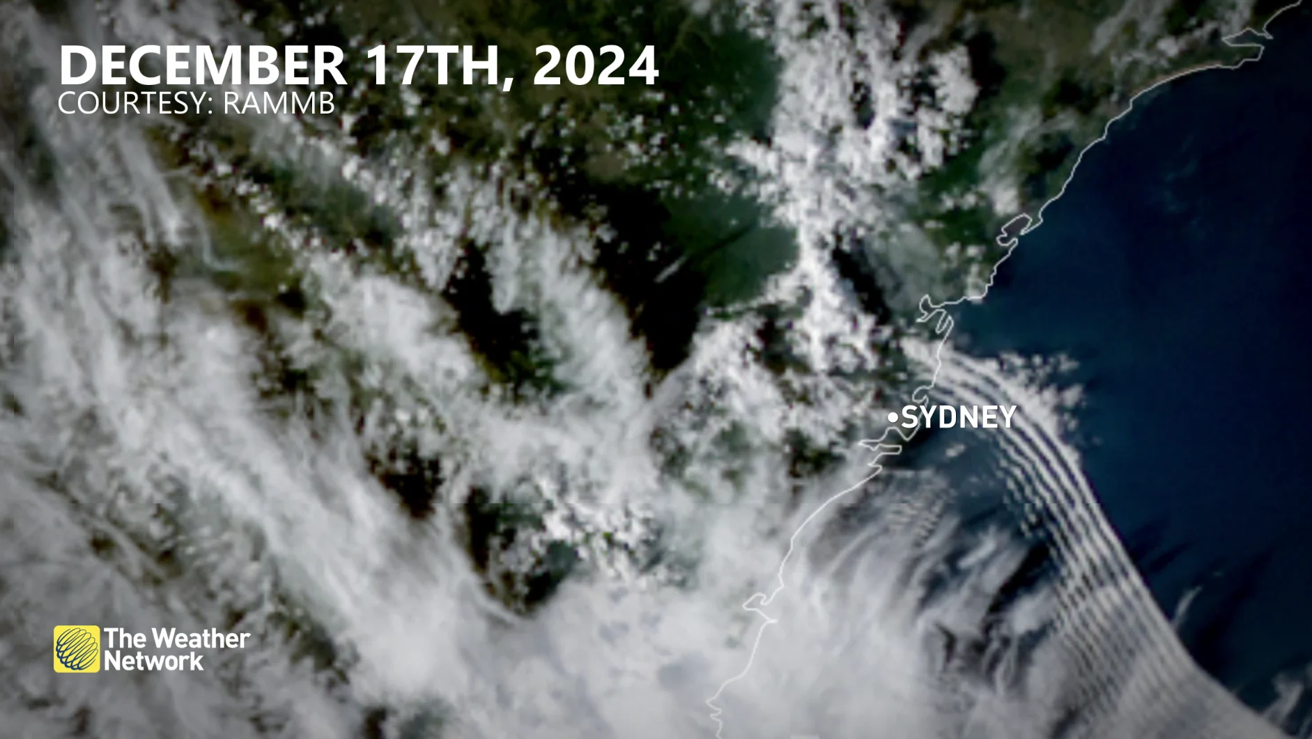
Satellite imagery offered a powerful diagnostic view of the atmosphere, revealing linear wave patterns stretching across Sydney’s coastline.
Sounding data from the same timeframe confirmed the presence of strong mid-level winds, instability, and a temperature inversion—all key ingredients for roll cloud formation.
MUST SEE: A rare overcast sunset painted Canada's sky pink
The cold front acted as the trigger, where cooler air undercuts the warmer air, lifting moisture aloft into a horizontal roll.
Although it wasn’t aliens, the roll cloud still displayed a remarkable display of weather in action–where the science of the skies came alive in a memorable way.
WATCH: Look for these strange cloud patterns next time you look up
Thumbnail image credit to Newsflare/Reuters.