How dynamic and disruptive spring storms roar to life

It takes a powerful jet stream to form some of spring’s strongest storms
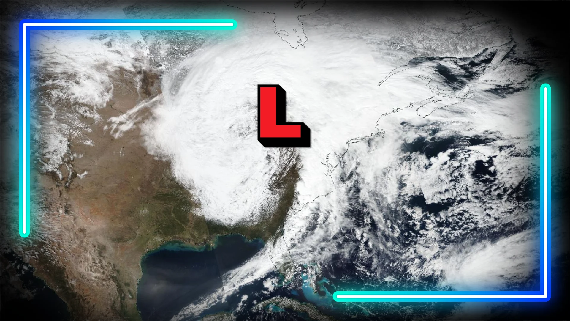
Vivid thundersnow illuminated the skies over Toronto on March 3, 2023, as a powerful early-spring storm system crept north of the border.
Intense dynamics within the system triggered a barrage of severe thunderstorms across the southern states as bands of heavy thundersnow whipped over southern Ontario.
Spring storms are some of the most powerful weather systems we’ll encounter throughout the year. Here’s an inside look at how the season helps generate these impressive feats of nature.
Jet streams drive mammoth spring storm systems
Changing seasons strengthen the jet stream. This fast-moving river of air high above our heads forms as a result of strong temperature gradients between the north and the south.
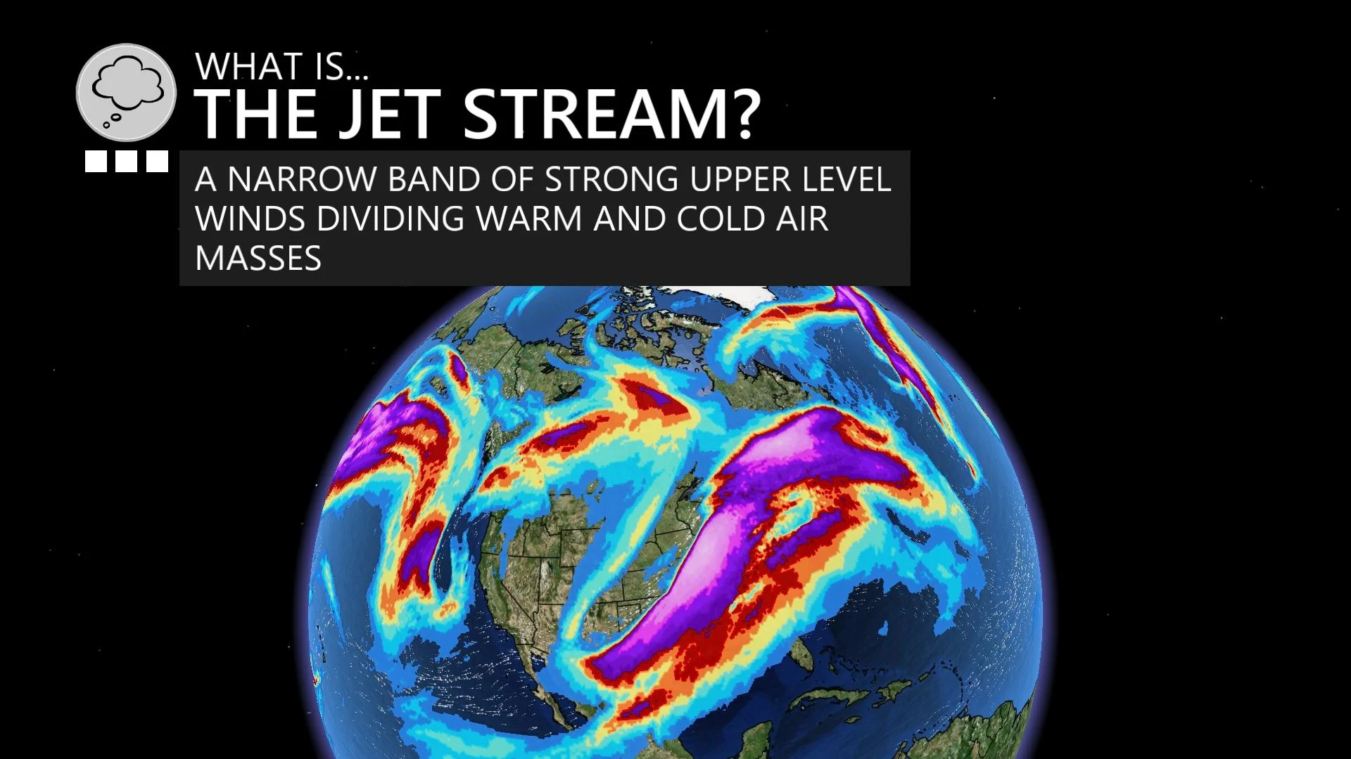
The onset of spring brings beautiful weather to places like Miami, Cancun, and New Orleans, while stubbornly frigid air lingers across much of Canada. This strong temperature gradient enhances the jet stream as it snakes across North America.
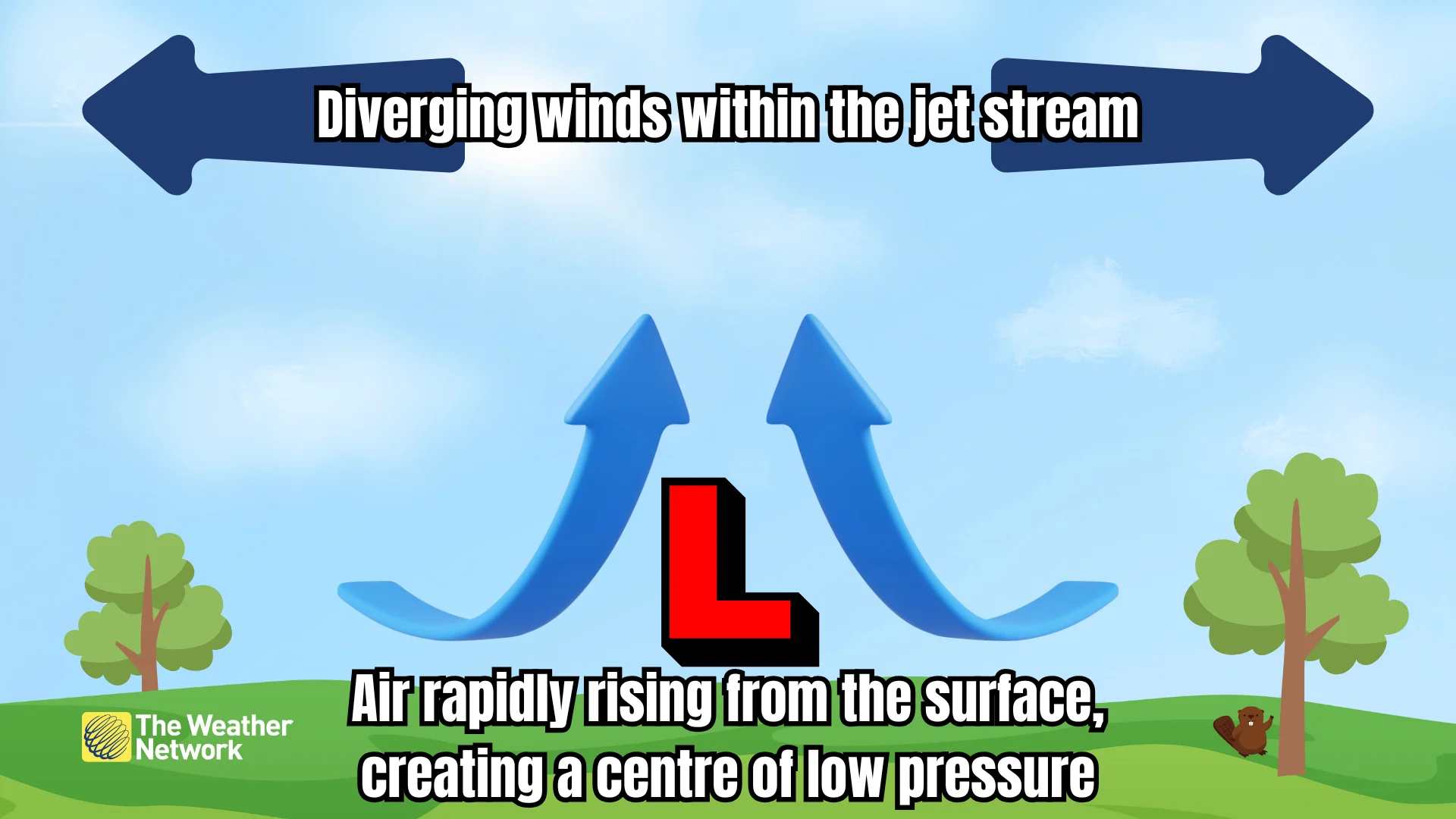
Jet streams drive most of the low-pressure systems we see on an everyday basis. Winds aloft can scream along at several hundred kilometres per hour, crashing together and spreading apart as they enter and exit the jet stream.
RELATED: 'Weather bombs': Explosive storms that create ferocious conditions
Winds spreading apart—called divergence—leaves a void in the upper levels of the atmosphere that air from the surface has to rush upward to replace. This process leaves less air, and lower air pressure, near the ground, which creates a centre of low pressure. Stronger divergence can create a stronger low-pressure system.
This is why we tend to get powerful storm systems—most commonly Colorado lows and Texas lows—during the spring months that can generate the entire spectrum of active weather as they swirl across the landscape.
Snow to the north, storms to the south
A classic springtime low-pressure system will feature a broad blanket of precipitation across the storm thanks to a steady feed of tropical moisture flowing in from the Gulf of Mexico.

Heavy precipitation to the north of the low often falls in the form of snow early in the season, greeting communities from the eastern Prairies to Atlantic Canada with an unwelcome blanket of snow. Freezing rain and ice pellets are common near the transition zone as warm air nudges in from the south.
The southern side of a classic spring storm is full of danger. High instability and ample wind shear allows for the development of widespread severe thunderstorms. These supercell thunderstorms are capable of producing winds in excess of 120 km/h, hailstones the size of baseballs or larger, and some of the strongest tornadoes ever measured.
Spring brought some of history’s most intense storms
The low-pressure system responsible for that memorable thundersnow across the Greater Toronto Area on March 3, 2023, was one of the strongest storms on record for some places south of the border.
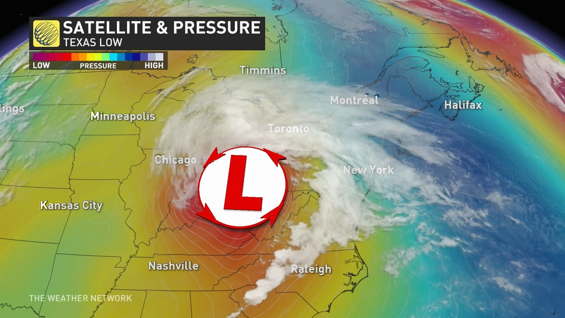
A large swath of Tennessee, Kentucky, and Indiana saw their lowest air pressures ever recorded as that storm rolled overhead, sending pressure readings down to about 975 mb across the region.
The severe thunderstorms these systems are capable of producing are no joke. Some of the worst tornado outbreaks on record unfolded in March and April across the U.S. Deep South, including the “Super Outbreaks” of April 4, 1974 and April 27, 2011.
One historic storm in mid-March 1993, simply known as the “Storm of the Century,” formed in the Gulf of Mexico and rolled up the East Coast. The historic storm saw some of the lowest air pressures and heaviest snows ever observed for parts of the eastern U.S. The impacts didn’t stop at the border—Montreal reportedly saw more than 40 cm of snow from that storm.