How Doppler radar revolutionized weather and saves lives

Weather radar was a military invention that turned into an invaluable tool for saving lives
A tool designed for war became a tool designed to save lives.
Doppler radar is a crown jewel of modern science that helps meteorologists save countless lives every year—and it’s a complex technology we take for granted.
Whether it’s watching a fleeting snow shower or tracking the most intense supercell thunderstorm, we benefit from this remarkable innovation every day if we realize it or not.
DON’T MISS: Brand new satellite begins watching over Canada into the 2030s
War surplus becomes meteorology mainstay
Originally a U.S. Air Force acronym for “radio detection and ranging,” radar became a word of its own as this precious technology nestled itself into everyday life.
Scientists developed radar technology in the early 1900s as a military tool to spot and detect approaching enemy aircraft.

Widely used during World War II, troops quickly realized that their radarscopes weren’t just detecting airplanes—they were also picking up rain and snow.
Surplus radars after the war found new life in research circles as scientists looked for ways to repurpose this valuable technology as a line of defense against our own atmosphere.
Canada’s radar network is 32 sites strong
Meteorologists in the U.S. developed the first widespread weather radar network in the late 1950s.
Radar sites gradually popped up across Canada as meteorologists and researchers utilized the technology to provide advanced warning for population centres.
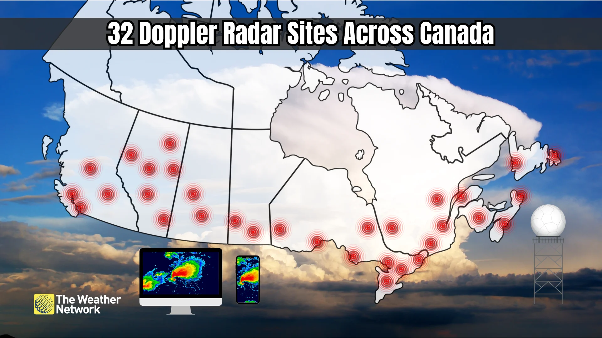
There were 19 weather radar sites across Canada by April 1997 when the Meteorological Service of Canada embarked on the network’s first significant upgrade and expansion. The country’s radar network, newly equipped with Doppler capability, grew to 30 sites by 2002.
Another major overhaul began in October 2017, again upgrading the radar network with more powerful and advanced technology. Environment and Climate Change Canada (ECCC) completed the latest expansion with a current total of 32 radar sites in 2023.
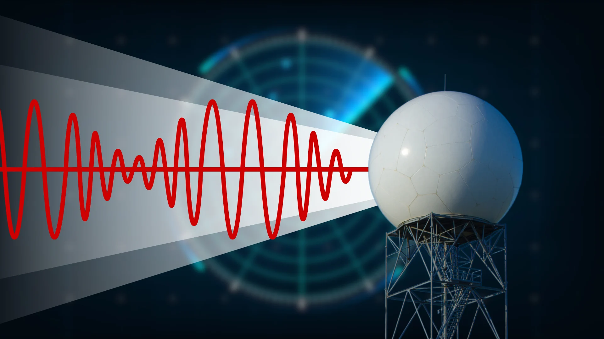
Radar uses microwave energy to detect objects
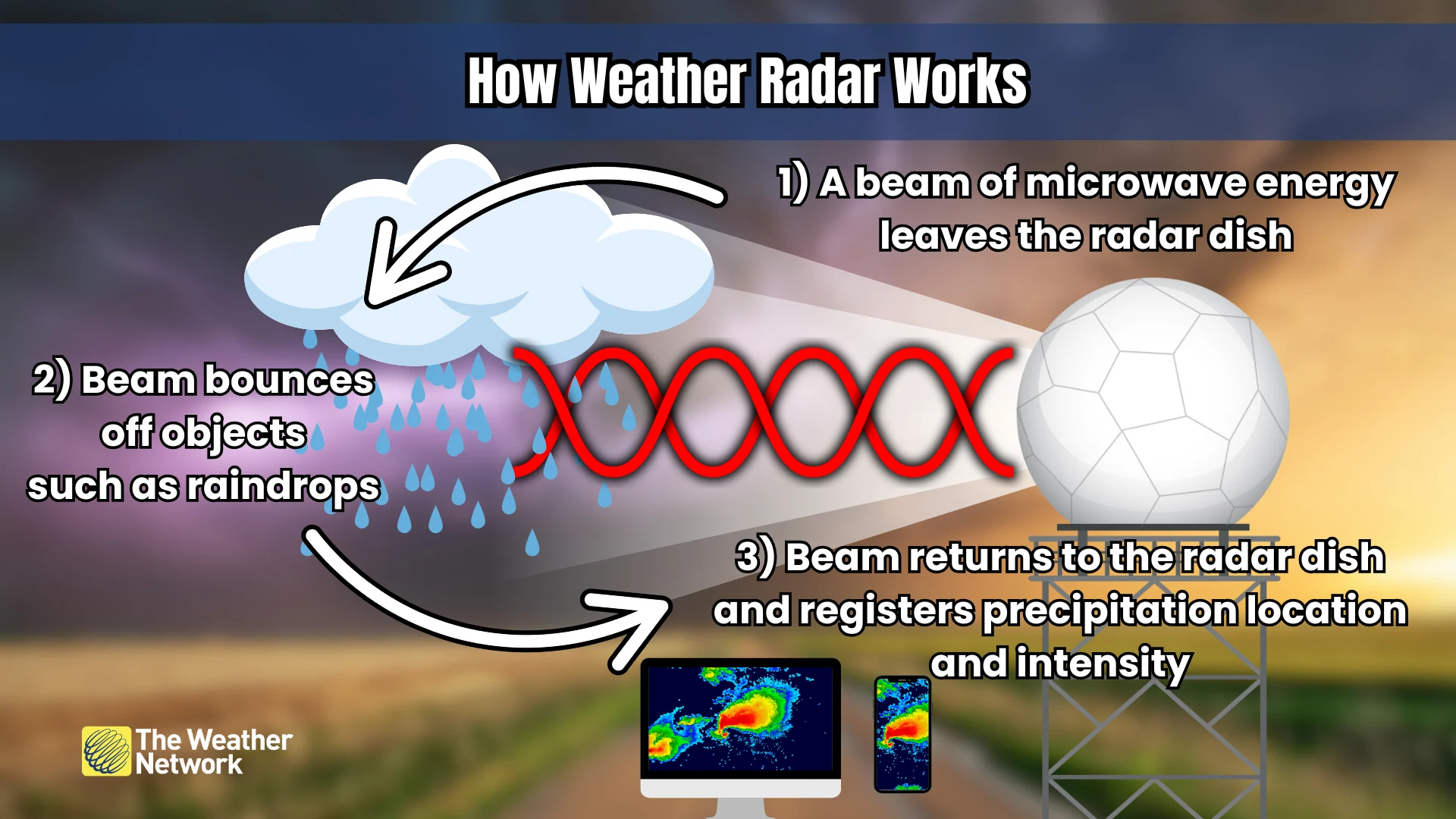
Weather radar consists of a rotating dish that sits atop a tall tower. This dish is protected by a fibreglass radome, which is usually a white sphere that resembles a golf ball.
MUST SEE: The technology that spots hidden tornadoes lurking in storms
The dish sends out a powerful beam of microwave energy into the atmosphere as it rotates. When those microwaves strike an object—such as rain, snow, and hailstones—a tiny bit of the energy reflects off that object and returns to the dish.
The time it takes for the energy to return, as well as the intensity of that return, both help the radar calculate the location and intensity of the precipitation. This produces the rainbow-coloured reflectivity we see on everyday radar imagery.
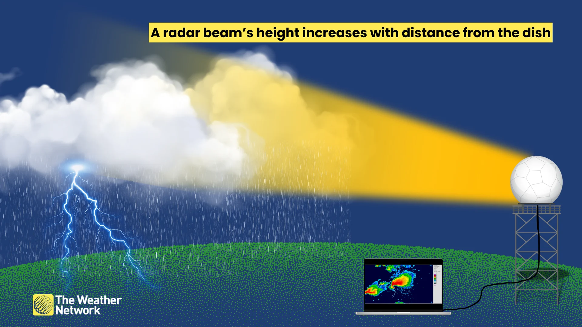
Due to the curvature of the Earth and a slight upward tilt in the dish’s orientation, radar beams gradually climb higher in altitude the farther away from the dish they travel.
Meteorologists program these dishes to gradually increase their tilt with each successive sweep, giving the device a full view of the atmosphere—critical for seeing the internal structure of powerful storms.
Doppler effect changes the game
We can see the location and intensity of a storm. But what about the winds inside? Researchers upgraded radars to utilize the Doppler effect to solve this problem beginning in the late 1980s in the U.S., and in the 1990s across Canada.
The Doppler effect is the change in the frequency of a wavelength as an object moves toward you or away from you. It’s why an ambulance’s siren sounds different when it’s approaching your location than it does when it’s moving away.

Graphic courtesy of the U.S. National Weather Service.
RELATED: How an explosive thunderstorm can burst into the stratosphere
Using this clever bit of physics, radar dishes can detect changes in the frequency of the returning microwave energy to determine the velocity of raindrops, snowflakes, and hailstones—giving us an accurate picture of winds within a storm.
Doppler weather radar enabled meteorologists to spot rotating winds within a thunderstorm, which is a strong precursor to the development of a tornado. This development led to vast improvements in severe thunderstorm and tornado warnings, saving countless lives over the past few decades.
A recent upgrade sniffs out debris
Beginning in the 2010s, radar sites across Canada and the U.S. received their newest upgrade: dual-polarization.
Instead of sending out a single beam of energy, radars now send out two beams simultaneously. This new beam, which resembles a plus sign (+) as it leaves the dish, can determine both the size and the shape of the objects reflecting energy in the atmosphere.
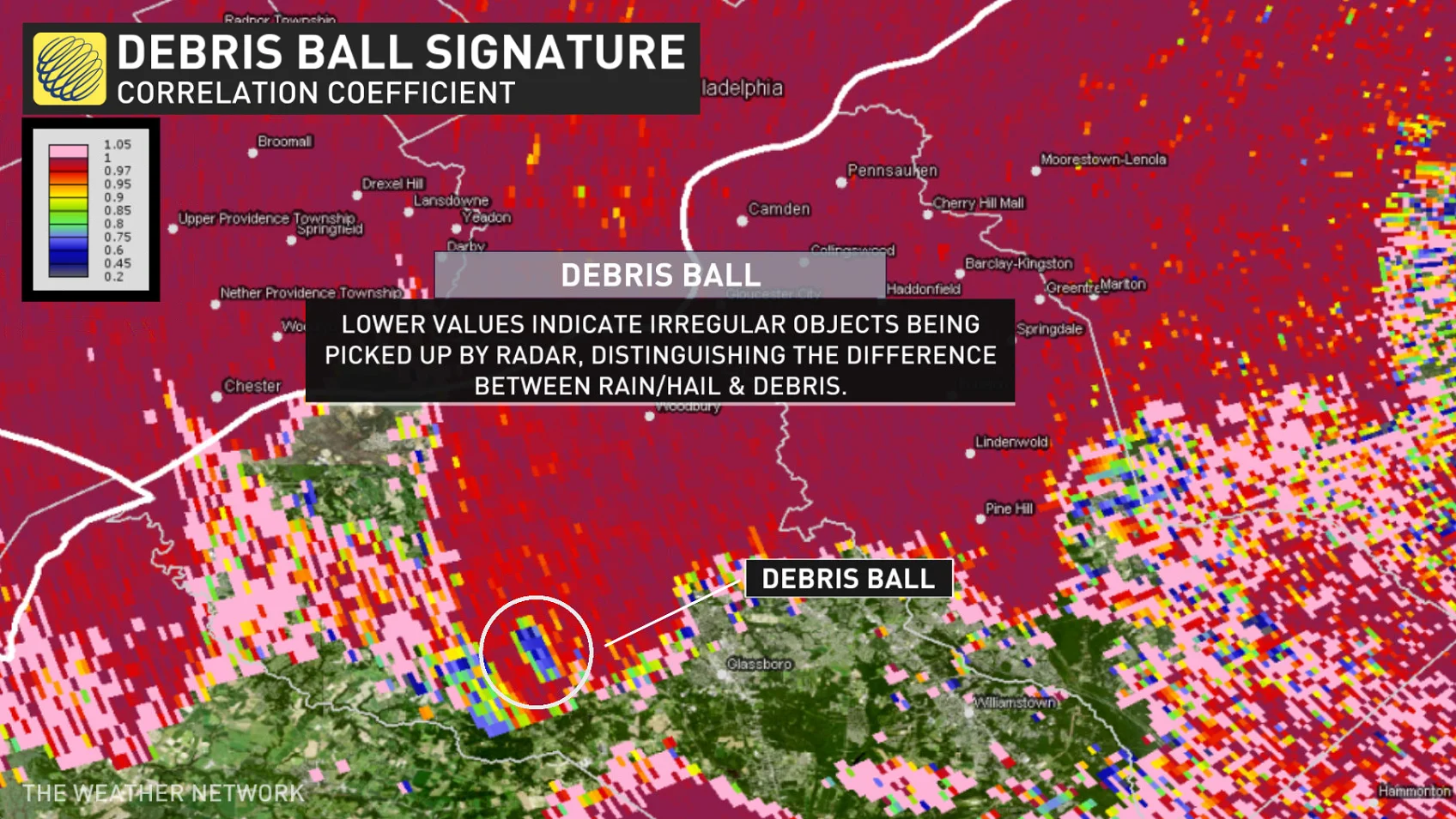
As a result, radar can now discern between raindrops, snowflakes, ice pellets, and hailstones—improving forecasts during winter storms and increasing warning lead time during summertime severe weather outbreaks.
It’s also possible to see tornado debris thanks to dual-polarization, which can help forecasters issue more accurate and timely tornado warnings.