GOES marks 50 breathtaking years of watching Canada’s skies

North America celebrates 50 years of the GOES program this month
This month marks the 50th anniversary of the GOES program, one of meteorology’s most important endeavours.
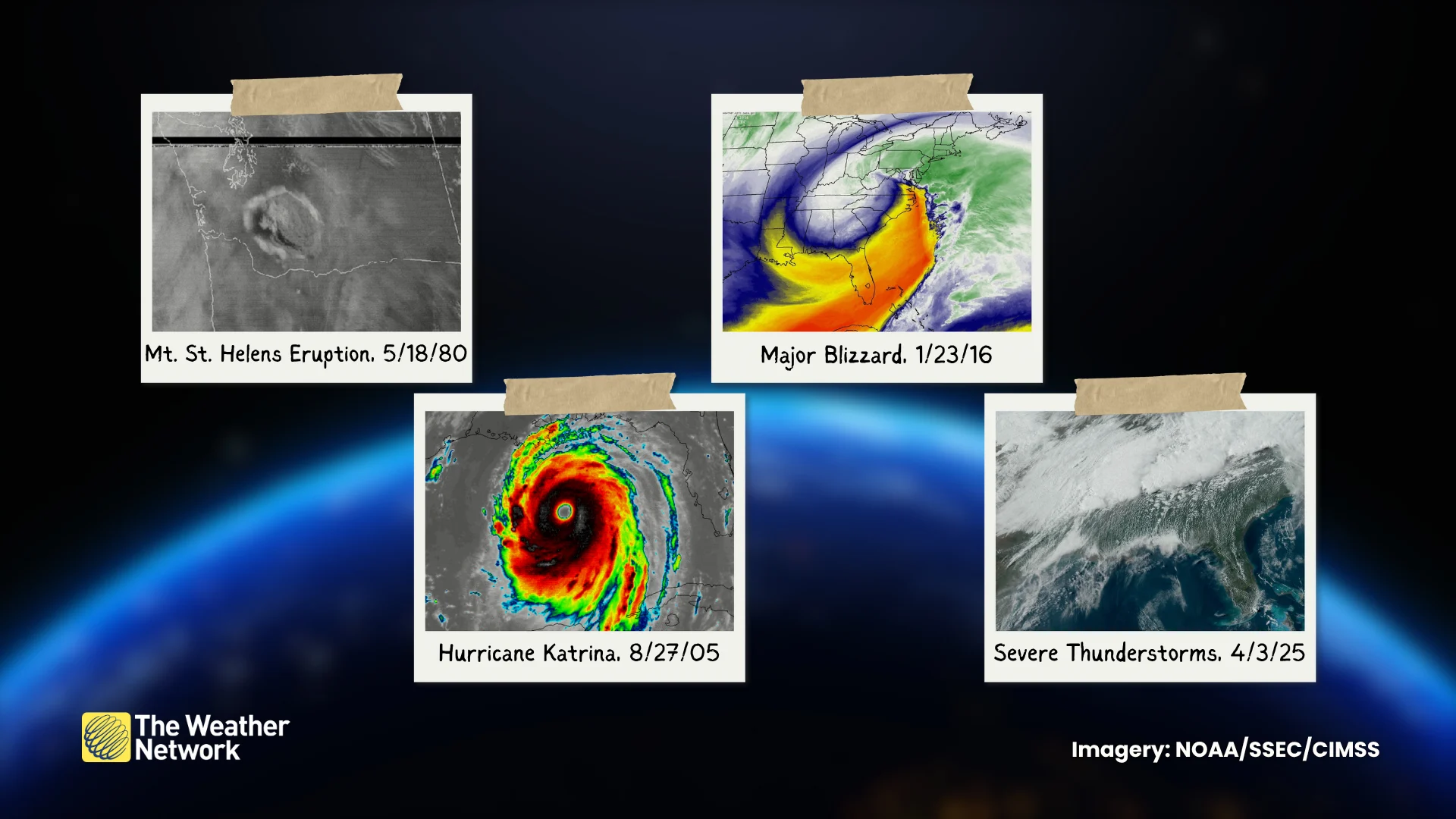
GOES, short for Geostationary Operational Environmental Satellite, is a NOAA-run suite of 19 satellites that have spent five decades monitoring our skies around the clock for thunderstorms, hurricanes, wildfires, and even volcanic eruptions.
The technological advances made over the years are nothing short of stunning. Forecasts and warnings are better today for the program’s success, and they’ll only improve with the next generation of satellites planned for the 2030s and beyond.
DON’T MISS: Brand new satellite begins watching over Canada into the 2030s
Early satellites were rudimentary and low-resolution
The world’s first weather satellite launched a new era when it achieved orbit on April 1, 1960.
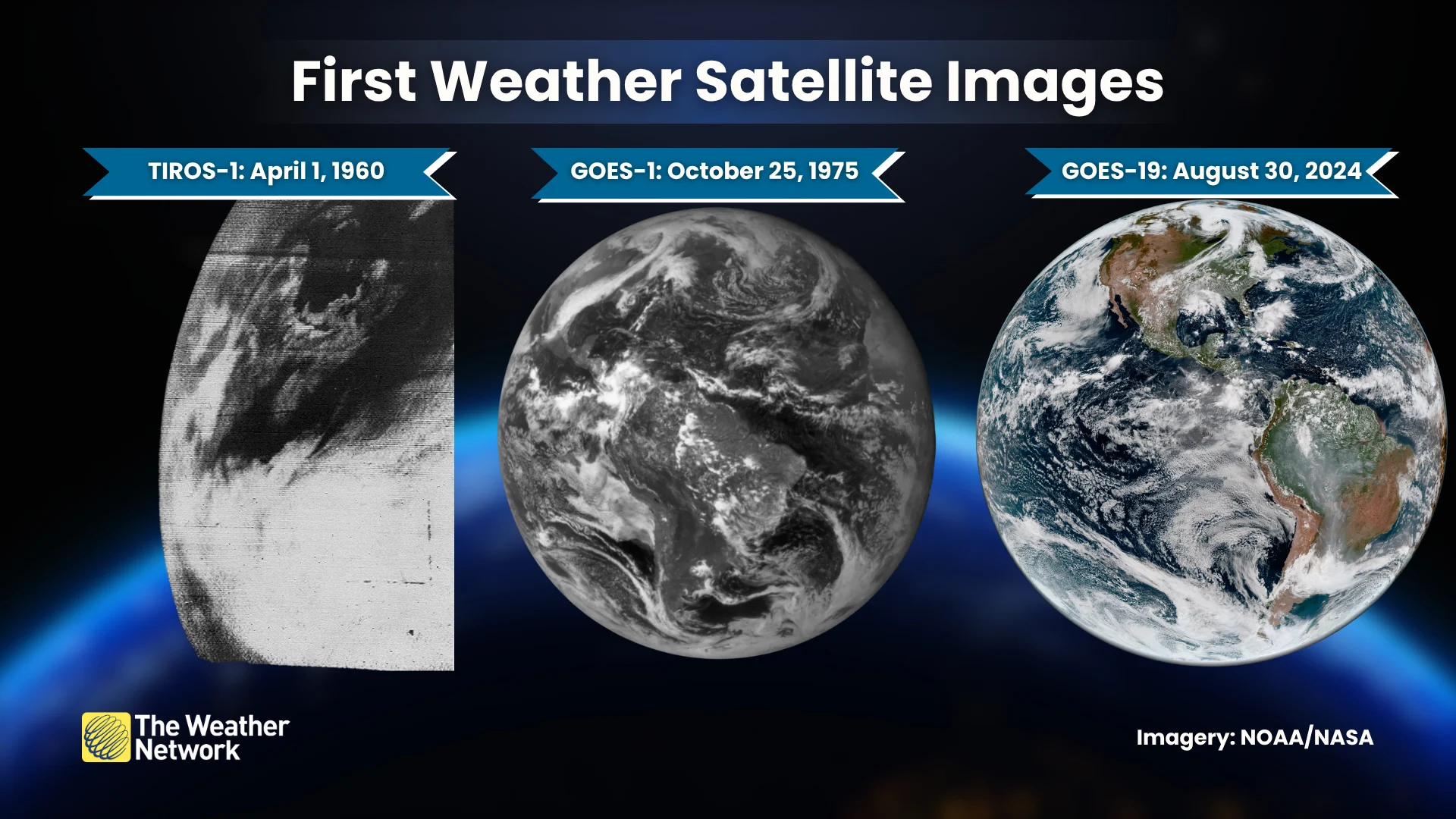
TIROS-1 carried a television camera that sent home fuzzy pictures of our planet. This tremendous accomplishment occurred a full year before the first human flew in space.
Subsequent weather satellites through the early 1970s provided basic visible imagery as they orbited Earth. But inconsistent and low-resolution pictures aren’t ideal for tracking rapidly developing weather events like tornado outbreaks or landfalling hurricanes.
Geostationary orbit changed the game
That’s where geostationary orbit comes in handy. A spacecraft orbiting 35,786 kilometres above the equator will circle the planet at the exact rate Earth rotates on its axis, locking the vehicle over a fixed location on the ground.
Geostationary orbit provides a weather satellite the same view of Earth for its entire lifespan, allowing meteorologists to track weather systems as they happen.
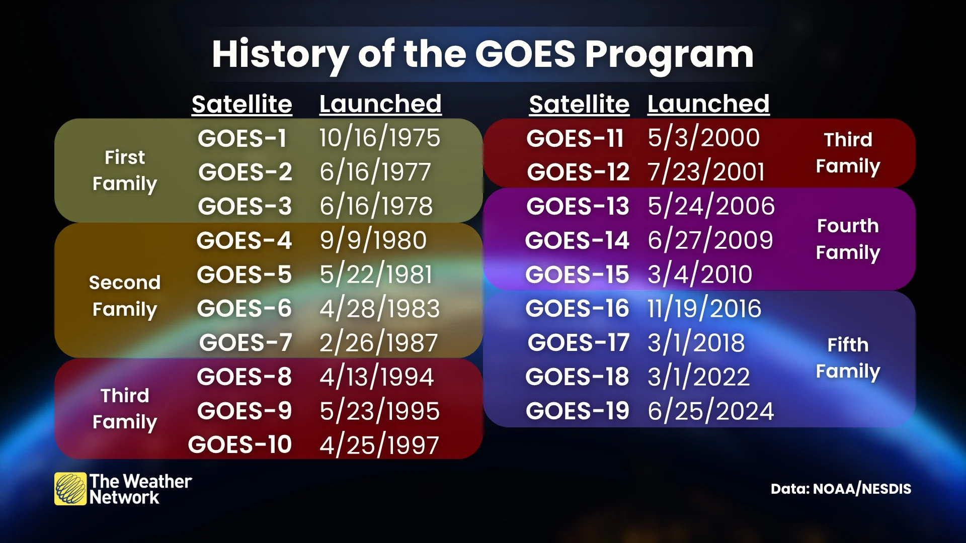
GOES-1 launched on October 16, 1975, inaugurating the GOES program for five decades of rigorous monitoring. The initial satellite collected basic imagery and environmental data.
RELATED: Satellites can 'see' the turbulence that your next flight may hit
Since then, we’ve benefited from five families of GOES satellites, each one more advanced than the last.
GOES 4-7 included the ability to take vertical soundings of the atmosphere, providing important information on temperatures and humidity. Imagery from the first seven GOES satellites was inconsistent due to technical limitations of the vehicles at the time.
GOES 8-12 improved their stabilization and electrical systems, affording each satellite the ability to send home more consistent and reliable imagery.
GOES 13-15 carried upgraded equipment that allowed for more frequent updates. New sensors aboard the satellites enabled experts to monitor space weather and the Sun, including events like solar flares.
Today’s satellites are top-of-the-line technology
The current family of satellites, GOES 16-19, is so advanced that each satellite can snap a high-resolution view of the entire hemisphere every 15 minutes.
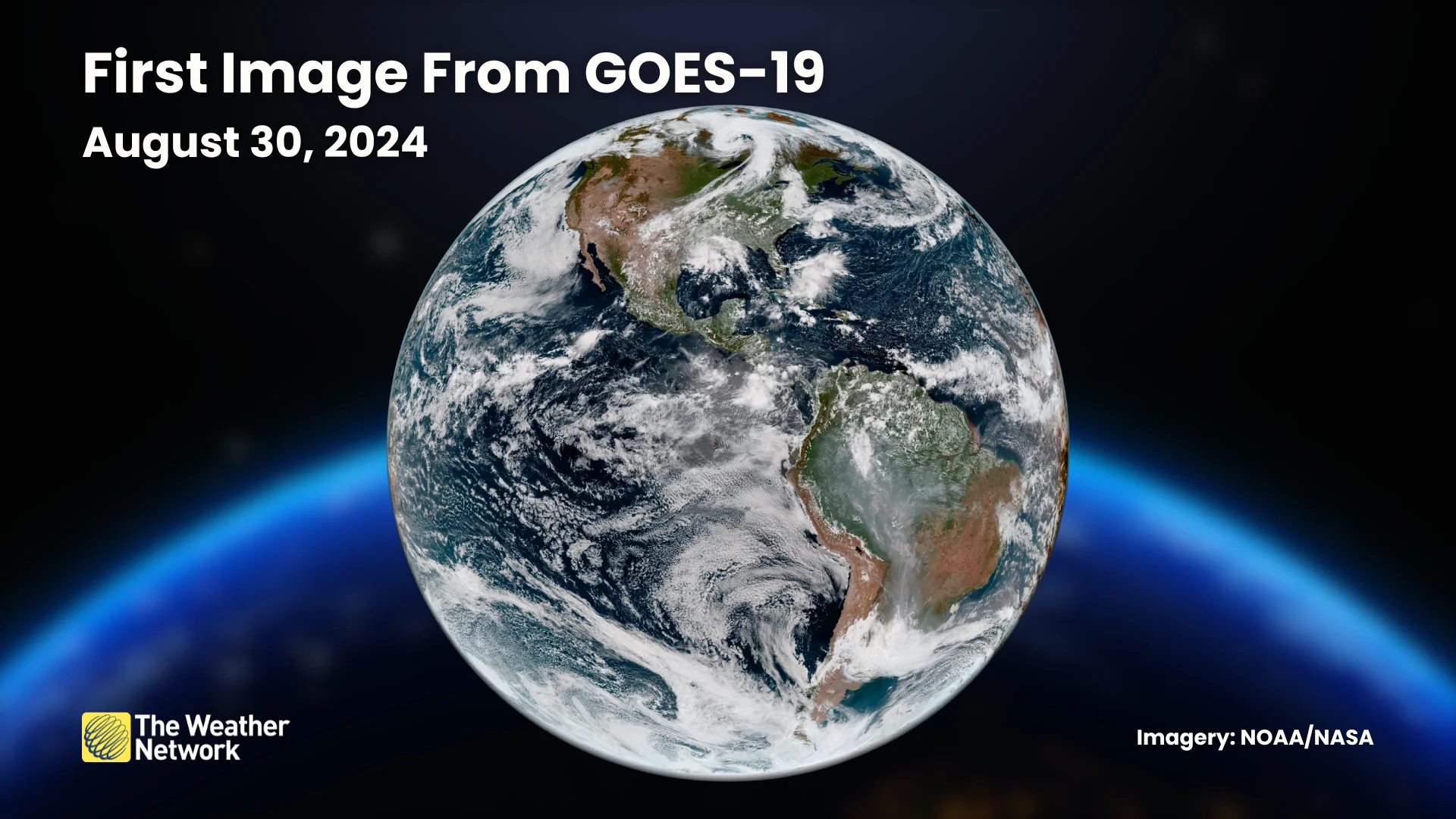
GOES-18 operates as GOES-West, monitoring the Pacific Ocean and western portions of the Americas. GOES-19 serves as GOES-East, watching over the Atlantic Ocean and the eastern Americas.
In addition to the instruments that provide us gorgeous visible and infrared imagery, these satellites carry an array of fantastic equipment designed to provide experts an in-depth understanding of our atmosphere and beyond.

The Global Lightning Mapper (GLM) tracks lightning flashes to help forecasters observe thunderstorms far away from Doppler weather radar sites.
Several sensors also monitor space weather, scoping out the Sun for solar flares and sunspots, as well as looking for changes in Earth’s magnetic field.
Future satellites planned for 2030s and beyond
If the U.S. government follows through with NOAA’s plans and funding, GOES will be replaced by the Geostationary Extended Observations—GeoXO—program by next decade.
Four GeoXO satellites are planned for launch between 2032 and 2043. The program’s first satellite will utilize the same sensors as the current family of GOES vehicles.
Upgraded sensors will fly into orbit beginning with the second GeoXO satellite, which is planned for launch in 2034.
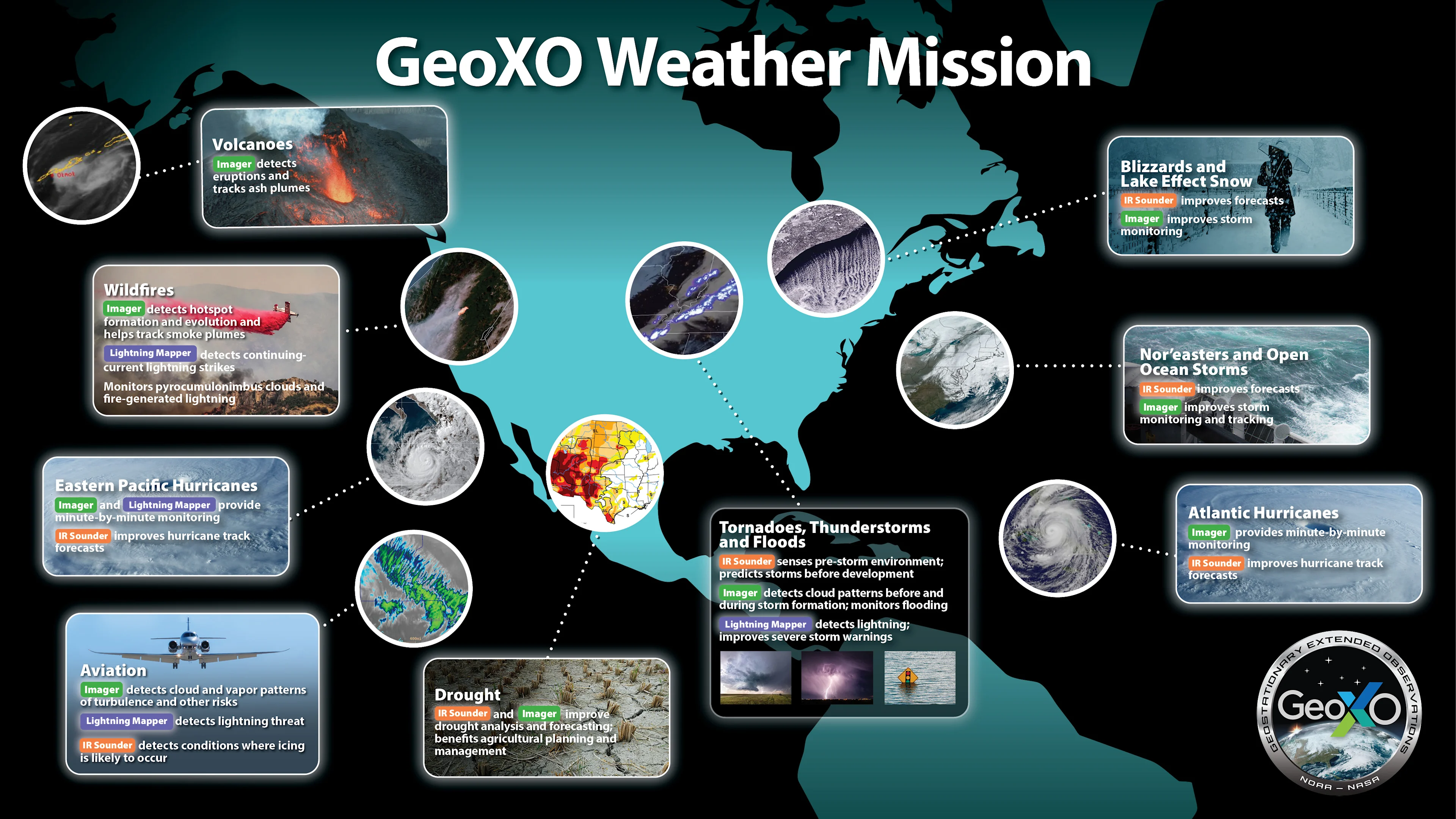
These instruments will include a game-changing atmospheric sounder, which will be able to act like a virtual weather balloon taking regular temperature and humidity readings to improve thunderstorm tracking, hurricane forecasting, and weather model output.
An upgraded imager will take even higher-resolution imagery than we currently enjoy.
The infrared band used for fire detection will increase its resolution from 2 km to 1 km, which will help officials better detect fire ignition and track ongoing blazes.
Visible satellite imagery will see its resolution upgrade from 500 m to 250 m, providing a detailed view of everything from the tiniest showers to the mightiest hurricanes.
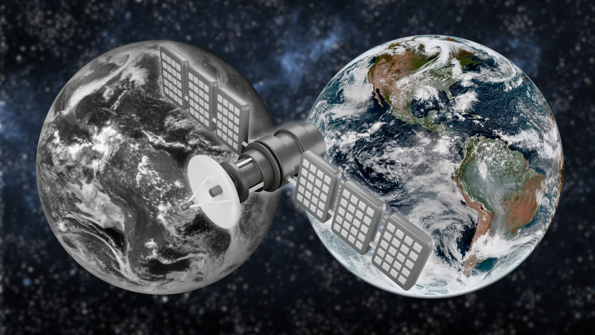
Header image created using graphics and imagery from NOAA and Canva.