Wildfires prompt air quality alerts, evacuations in northwestern Ontario
A number of special air quality statements are in effect across northwestern Ontario, as wildfire activity remains rampant throughout the region.
CHECK OUT: When you can expect your favourite Ontario fruit this summer
Environment and Climate Change Canada issued the statements early Monday morning for well over a dozen communities, including several First Nations:
Big Trout Lake – Kasabonika.
Dryden – Vermilion Bay.
Ear Falls – Perrault Falls – Western Lac Seul.
Fort Frances – Emo – Rainy River.
Kenora – Grassy Narrows – Whitedog.
Pickle Lake – Cat Lake.
Pikangikum – Poplar Hill – MacDowell.
Red Lake – Woodland Caribou Park.
Sachigo Lake – Bearskin Lake.
Sandy Lake – Weagamow Lake – Deer Lake.
Sioux Lookout – Eastern Lac Seul.
Sioux Narrows – Nestor Falls - Morson.
Summer Beaver – Wunnummin Lake – Kingfisher Lake.
Webequie.
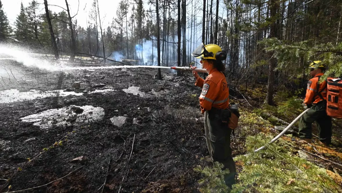
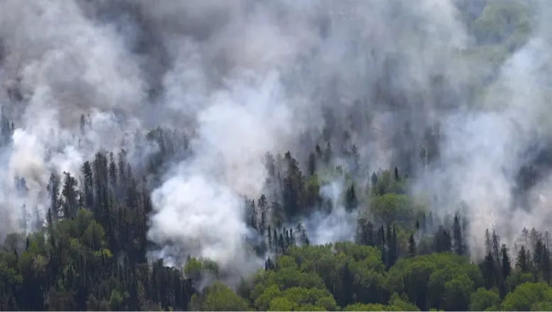
Crews are seen tackling the Kenora 17 wildfire in northwestern Ontario in this photo from May 12. (Ministry of Natural Resources)
"Wildfire smoke is expected to move into the area early this morning and may remain in place for the next several days for some areas," the statements say.
"As smoke levels increase, health risks increase. Limit time outdoors. Consider reducing or rescheduling outdoor sports, activities and events."
Community evacuations are continuing in Deer Lake First Nation and Webequie First Nation due to nearby wildfires.
Meanwhile, members of Wabaseemoong Independent Nations have been under an evacuation order since mid-May.
Webequie First Nation first declared a state of emergency on Thursday. Chief Cornelius Wabasse said high demands for aircraft in other communities affected by wildfires delayed his community's evacuation.
"There is a shortage of planes and also other resources," Wabasse told CBC News in an interview on Monday morning.
He said the first planes were expected to arrive in Webequie on Monday to bring the most vulnerable community members to Barrie, which is about a one-hour drive north of Toronto.
While Nipigon 5 is a few kilometres from the remote Ojibway community, Wabasse said, "the wind has shifted from the south, so it's coming towards the community now."
DON'T MISS: Here's what summer driving can do to your skin
It's been a few years since Webequie First Nation went through a community evacuation, he said, which signifies the need to do more to prepare for emergencies going forward.
"There needs to be a lot of awareness of fires that we have in nearby communities and how we react. I think we just need to be prepared for any disasters in our community."
'Ontario stands with our northern communities'
"Ontario stands with our northern communities and neighbouring provinces as they face the devastating impact of ongoing wildfires," said the province's minister of emergency preparedness and response, Jill Dunlop, in an emailed statement to CBC News on Sunday.
"The Ministry of Emergency Preparedness and Response is actively working with Indigenous leadership, federal and local partners to support evacuation efforts and with the delivery of essential services in northern Ontario."
MUST SEE: Smoke, dust travel thousands of kilometres to collide over Florida
There are 12 active wildfires in northwestern Ontario, including four of note:
Red Lake 12, which is near Deer Lake First Nation, is more than 17,900 hectares large.
Nipigon 5, which is near Webequie First Nation, is more than 7,500 hectares large. It is not under control.
Kenora 20, which is near Ingolf and Wabaseemoong, is more than 35,000 hectares large. It is not under control.
Kenora 14, which is near Wabaseemoong, is more than 1,600 hectares large. It is currently being held.
Restricted fire zones in northwestern Ontario
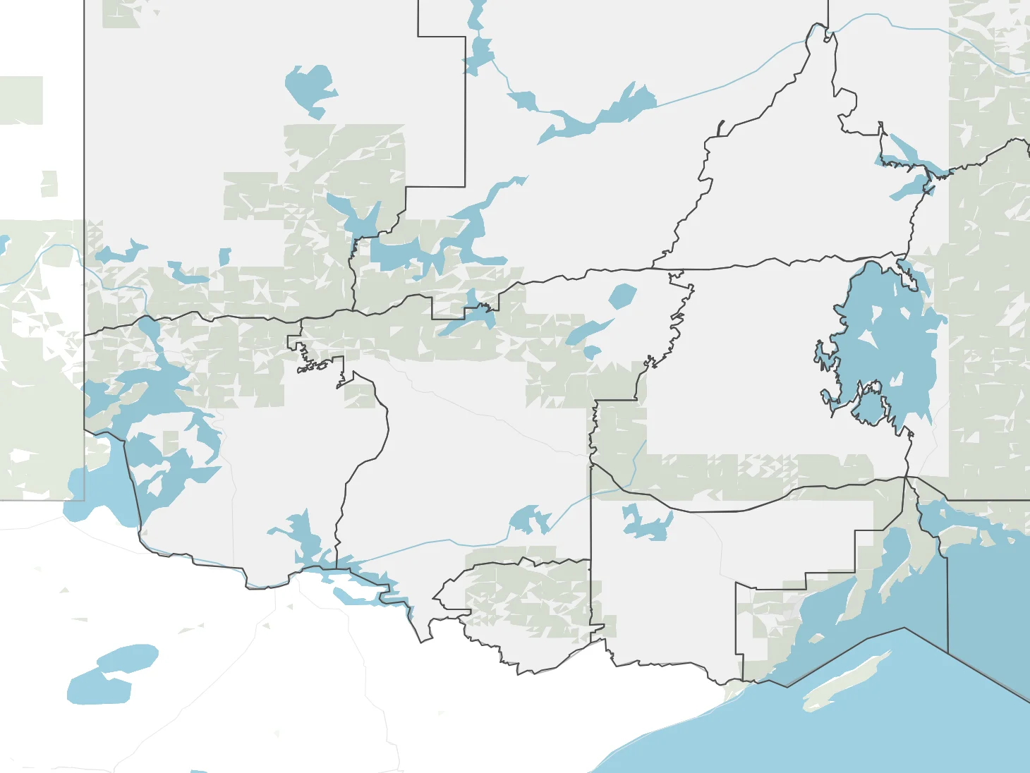
(OpenStreetMap contributor/CBC News)
"The priority of our response is the protection of public safety including the protection of critical infrastructure and property. Efforts have been concentrated on structure protection and crews will be deployed as conditions allow," said minister of natural resources Mike Harris in an emailed statement to CBC News on Sunday.
"Ontario is currently receiving support from our mutual aid partners through the Canadian Interagency Forest Fire Centre. Equipment and personnel from British Columbia, Quebec, Alberta and New Brunswick [have] been deployed."
A restricted fire zone — which means no open air burning is allowed — remains in effect for much of the region.
RELATED: Prolific wildfire smoke continues spreading across Canada, U.S.
Evacuees have been sent to a number of different communities:
Up to 1,300 community members from Deer Lake First Nation are being relocated to Sioux Lookout and the Toronto region.
Up to 400 community members from Webequie First Nation are being sent to Simcoe County; Wabasse said the community is starting with an evacuation of 200 people.
About 450 community members from Wabaseemoong are staying in the Niagara region.
People can view the province's interactive fire map online to track wildfires closest to them.
This article, originally published by CBC News on June 2, 2025, was written by Sarah Law.
Thumbnail courtesy of the Ministry of Natural Resources via CBC News.