Meet the B.C. man winning international awards for his maps
Jeff Clark spends hundreds of hours poring over the minute details of B.C.'s geography to produce a single map.
He describes himself as an "accidental" cartographer after stumbling into the industry back in 2008. But almost two decades later, he's become renowned in the international map-mapping world for his creations.
“I just love doing it, so whether I'm good at it doesn't really matter to me,” Clark said.
He’s made maps of Garibaldi Park, the Salish Sea, the Sea-to-Sky region and Vancouver Island, all out of the basement of his North Vancouver home.

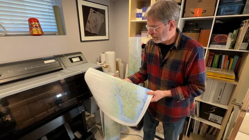
Clark shows population densities on his map by using the colour orange in contrast to the green and blue nature landscapes. (Alanna Kelly/CBC)
A few weekends ago, his Vancouver Island map won first place in the reference category at the CaGIS Map Design Competition, an international contest. In 2024, his Sea-to-Sky map won the same award as well as "best of show."
“I like the process more than I really worry about winning the, you know, the prize,” Clark said.
The maps are formed by him pulling in satellite images and public domain data.
“I've selectively provided you with information that's meaningful to the story, I'm trying to tell you about the beauty of the landscape and how it's connected,” Clark said.

Clark merges public domain and satellite information into three different applications to process the data and start creating his maps. (Alanna Kelly/CBC)
He spends hundreds of hours picking just the essentials to put on the map, such as the 100 largest trees or First Nations territory.
“This is describing the landscape, it’s describing the patterns between the cities and the mountains,” Clark said.
Through his artwork, he hopes people will learn more about where they live.
“I think people tend to forget sometimes how beautiful it is around here."

Using yellow and lavender colours, Jeff Clark highlights the mountains and adds in the essential information he wants to share. (Alanna Kelly/CBC)
When he first started map-making, he made a folding backcountry hiking map.
“I ended up making a map of Garibaldi for the park, and I was like, ‘Wow, this is, this is pretty cool,” Clark said.
Working as a full-time geographic information system (GIS) consultant, he was drawn to tinkering with the maps and layering all the information.
“I'm a little process wired … I’m crunching data for a lot [of it] but there's a design element in here."

In 2008, Jeff Clark made his first waterproof and tear-proof backcountry hiking map of Garibaldi Park. (Alanna Kelly/CBC)
Martin Gamache, the chief cartographer at the National Geographic Society, said there is a big creative element to the profession.
“The art part is what would show our different personalities, and they would all look very different even though we'd be mapping the same place,” Gamache said.
The maps Clark makes are tools for people to connect to where they live, he explained.
“I think if you live in the places where Jeff makes maps, and you want to get to know those places in an intimate way, like you want to connect with a place through the map, his maps are the best for that,” Gamache said.
Tom Patterson, a retired senior cartographer with the U.S. National Park Service, said Clark is one of the best in their field.
“He knows how to lay out geography on a page or on a computer screen and present it in a very eye-pleasing way,” Patterson said.
Much of Clark's success, Patterson said, is due to his level of research.
“He just does a deep dive into the geographical location, he knows it intimately before he starts putting stuff on his map and labels."

Clark focused on mountains and forests in his Garibaldi Lake map. (Alanna Kelly/CBC)
The maps are different from ones on navigation apps or ones created by artificial intelligence because the cartographer decides what they include.
“Instead of getting all this information or select information, he's like telling you the story about all the most beautiful things or the things that he thinks is the story,” Patterson said.
Clark still has many stories to tell and land to cover.
“I'm currently working on the Gulf Islands, and then I'm going to move into the Okanagan,” he said.
This article, written by Alanna Kelly, was originally published for CBC News